
| Memorials | : | 33 |
| Location | : | Duxbury, Plymouth County, USA |
| Coordinate | : | 42.0368300, -70.6742700 |
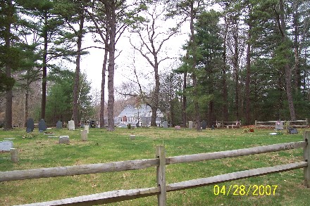
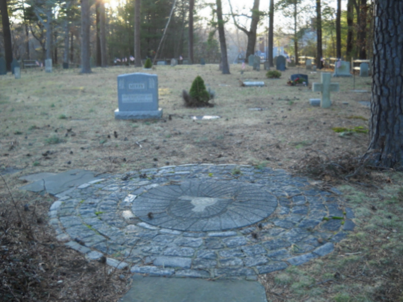
| Description | : | This is a privately-owned cemetery. The oldest gravestone in the cemetery is dated 1820 and belongs to Otis Peterson. The cemetery is open to new burials. The Massachusetts Historical Commission does not refer to this cemetery in MACRIS. This burial place is referenced to in the book "Vital Records of Duxbury, Massachusetts to 1850", Published by the New England Historic Genealogical Society, as G.R.5. This burial place is referenced to in the book "Old Cemeteries of Southeastern Massachusetts" by Charles M Thatcher as "Cemetery in rear of Orthodox Church South Duxbury". This burial place is referenced to in the book "The Mayflower Descendant 1620-1920"... Read More |
frequently asked questions (FAQ):
-
Where is Saint John the Evangelist Episcopal Cemetery?
Saint John the Evangelist Episcopal Cemetery is located at 410 Washington Street Duxbury, Plymouth County ,Massachusetts ,USA.
-
Saint John the Evangelist Episcopal Cemetery cemetery's updated grave count on graveviews.com?
33 memorials
-
Where are the coordinates of the Saint John the Evangelist Episcopal Cemetery?
Latitude: 42.0368300
Longitude: -70.6742700
Nearby Cemetories:
1. Smith Tomb
Duxbury, Plymouth County, USA
Coordinate: 42.0347870, -70.6912280
2. Standish Burial Ground
Duxbury, Plymouth County, USA
Coordinate: 42.0250664, -70.6875076
3. Mayflower Cemetery
Duxbury, Plymouth County, USA
Coordinate: 42.0331001, -70.6952972
4. Watson Cemetery
Plymouth, Plymouth County, USA
Coordinate: 42.0119490, -70.6358560
5. Weston Tomb
Duxbury, Plymouth County, USA
Coordinate: 42.0689160, -70.7191710
6. Dingley Cemetery
Duxbury, Plymouth County, USA
Coordinate: 42.0657997, -70.7272034
7. Old Winslow Burying Ground
Marshfield, Plymouth County, USA
Coordinate: 42.0857000, -70.6808000
8. Baker Cemetery
Marshfield, Plymouth County, USA
Coordinate: 42.0837700, -70.7157200
9. Evergreen Cemetery
Kingston, Plymouth County, USA
Coordinate: 41.9944800, -70.7317400
10. Old Burying Ground
Kingston, Plymouth County, USA
Coordinate: 41.9943800, -70.7321300
11. Chapel Cemetery
Marshfield, Plymouth County, USA
Coordinate: 42.0916214, -70.7090836
12. Cedar Grove Cemetery
Marshfield, Plymouth County, USA
Coordinate: 42.0918045, -70.7086487
13. Ashdod Cemetery
Duxbury, Plymouth County, USA
Coordinate: 42.0670600, -70.7526300
14. Howland Cemetery
Marshfield, Plymouth County, USA
Coordinate: 42.0980500, -70.7146000
15. Saint Joseph Cemetery
Kingston, Plymouth County, USA
Coordinate: 41.9846992, -70.7380981
16. Chapel Burying Ground
Pembroke, Plymouth County, USA
Coordinate: 42.0230600, -70.7715700
17. Christ Episcopal Church Columbarium
Plymouth, Plymouth County, USA
Coordinate: 41.9625100, -70.6737500
18. Pleasant Mountain Pet Rest
Plymouth, Plymouth County, USA
Coordinate: 41.9630360, -70.6918110
19. Sachem Lodge Cemetery
Pembroke, Plymouth County, USA
Coordinate: 42.0577500, -70.7773900
20. Coles Hill Burial Ground
Plymouth, Plymouth County, USA
Coordinate: 41.9573330, -70.6624000
21. Burial Hill
Plymouth, Plymouth County, USA
Coordinate: 41.9559822, -70.6656876
22. Vine Hills Cemetery
Plymouth, Plymouth County, USA
Coordinate: 41.9556200, -70.6792800
23. Church of the Pilgrimage
Plymouth, Plymouth County, USA
Coordinate: 41.9557310, -70.6647230
24. Beth Jacob Cemetery
Plymouth, Plymouth County, USA
Coordinate: 41.9553300, -70.6792600