
| Memorials | : | 0 |
| Location | : | Zander, Manitowoc County, USA |
| Coordinate | : | 44.3024100, -87.7059100 |
| Description | : | Gibson Township, Manitowoc, WI |
frequently asked questions (FAQ):
-
Where is Saint Johns Evangelical Lutheran Cemetery?
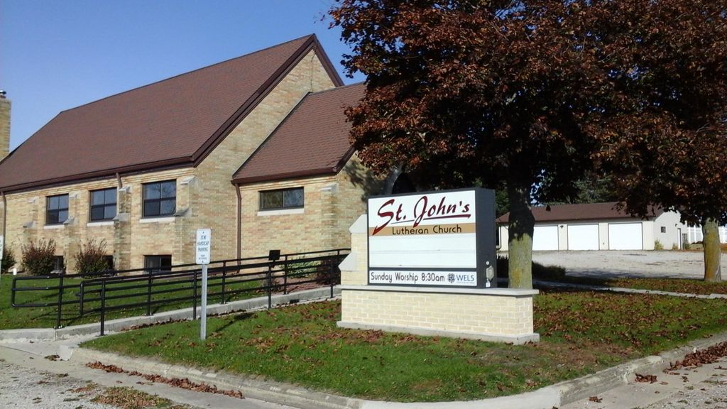
Saint Johns Evangelical Lutheran Cemetery is located at County Highway Q Zander, Manitowoc County ,Wisconsin , 54228USA.
-
Saint Johns Evangelical Lutheran Cemetery cemetery's updated grave count on graveviews.com?
0 memorials
-
Where are the coordinates of the Saint Johns Evangelical Lutheran Cemetery?
Latitude: 44.3024100
Longitude: -87.7059100
Nearby Cemetories:
1. Zander Cemetery
Zander, Manitowoc County, USA
Coordinate: 44.3250760, -87.7057890
2. Larrabee Church Cemetery
Larrabee, Manitowoc County, USA
Coordinate: 44.2697258, -87.7164764
3. Jambo Creek Cemetery
Gibson, Manitowoc County, USA
Coordinate: 44.2710991, -87.6800003
4. Bolt Bohemian Township Cemetery
Bolt, Kewaunee County, USA
Coordinate: 44.3436012, -87.7092972
5. German Methodist Cemetery
Tisch Mills, Manitowoc County, USA
Coordinate: 44.3093987, -87.6331024
6. Saint James Cemetery
Cooperstown, Manitowoc County, USA
Coordinate: 44.3177500, -87.7783400
7. Progressive Farmers Cemetery
Mishicot, Manitowoc County, USA
Coordinate: 44.3200160, -87.6314140
8. Saint Marys Catholic Cemetery
Tisch Mills, Manitowoc County, USA
Coordinate: 44.3205700, -87.6312500
9. Melnik Presbyterian Cemetery
Melnik, Manitowoc County, USA
Coordinate: 44.2470300, -87.7461910
10. Franklin Cemetery
Stangelville, Kewaunee County, USA
Coordinate: 44.3516998, -87.6446991
11. Saint Johns Lutheran Cemetery
Tisch Mills, Manitowoc County, USA
Coordinate: 44.3022003, -87.6081009
12. Mishicot Cemetery
Mishicot, Manitowoc County, USA
Coordinate: 44.2414100, -87.6441800
13. Holy Cross Cemetery
Mishicot, Manitowoc County, USA
Coordinate: 44.2410622, -87.6433716
14. Eastside Cemetery
Cooperstown, Manitowoc County, USA
Coordinate: 44.3269000, -87.8075000
15. Saint Johns Evangelical Lutheran Cemetery
Maribel, Manitowoc County, USA
Coordinate: 44.2702800, -87.8063900
16. Eastside Cemetery
Denmark, Brown County, USA
Coordinate: 44.3591995, -87.7866974
17. Holy Cross Church Cemetery Old
Mishicot, Manitowoc County, USA
Coordinate: 44.2336900, -87.6403400
18. Saxonburg Cemetery
Mishicot, Manitowoc County, USA
Coordinate: 44.2486000, -87.6156006
19. West Danish Cemetery
Denmark, Brown County, USA
Coordinate: 44.3535995, -87.8058014
20. Saint Wenceslaus Cemetery
Cooperstown, Manitowoc County, USA
Coordinate: 44.2514000, -87.8073500
21. Kossuth Cemetery #1
Francis Creek, Manitowoc County, USA
Coordinate: 44.2115260, -87.7359900
22. Saint Lawrence Catholic Cemetery
Stangelville, Kewaunee County, USA
Coordinate: 44.3994000, -87.6864000
23. Saint Joseph Cemetery
Norman, Kewaunee County, USA
Coordinate: 44.3727000, -87.6023000
24. Saint Anne Cemetery
Francis Creek, Manitowoc County, USA
Coordinate: 44.2005100, -87.7219300