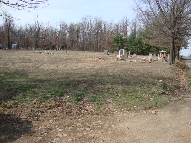
| Memorials | : | 0 |
| Location | : | Verona, Lawrence County, USA |
| Coordinate | : | 36.9625900, -93.7816500 |
| Description | : | AKA: Youngberg Memorial Gardens |
frequently asked questions (FAQ):
-
Where is Saint Johns German Evangelical Cemetery?
Saint Johns German Evangelical Cemetery is located at Verona, Lawrence County ,Missouri ,USA.
-
Saint Johns German Evangelical Cemetery cemetery's updated grave count on graveviews.com?
0 memorials
-
Where are the coordinates of the Saint Johns German Evangelical Cemetery?
Latitude: 36.9625900
Longitude: -93.7816500
Nearby Cemetories:
1. Calvary Cemetery
Verona, Lawrence County, USA
Coordinate: 36.9633300, -93.7839200
2. Spring River Cemetery
Verona, Lawrence County, USA
Coordinate: 36.9418983, -93.7919006
3. Berry Cemetery
Aurora, Lawrence County, USA
Coordinate: 36.9658100, -93.7336750
4. Mount Calvary Cemetery
Aurora, Lawrence County, USA
Coordinate: 36.9552994, -93.7205963
5. Maple Park Cemetery
Aurora, Lawrence County, USA
Coordinate: 36.9530983, -93.7205963
6. Old Aurora City Cemetery
Aurora, Lawrence County, USA
Coordinate: 36.9688492, -93.7179413
7. Lee Cemetery
Verona, Lawrence County, USA
Coordinate: 37.0122340, -93.8247440
8. Verona Amish Cemetery
Verona, Lawrence County, USA
Coordinate: 37.0326000, -93.8122000
9. Samuel Family Graves
Barry County, USA
Coordinate: 36.9249300, -93.7015600
10. Samuel and Catherine Phariss Memorial Cemetery
Aurora, Lawrence County, USA
Coordinate: 36.9899000, -93.6931000
11. Kings Prairie Cemetery
Monett, Barry County, USA
Coordinate: 36.9055200, -93.8459400
12. Zion Cemetery
Mount Vernon, Lawrence County, USA
Coordinate: 37.0402500, -93.7815600
13. Phariss Cemetery
Hoberg, Lawrence County, USA
Coordinate: 37.0329970, -93.8330160
14. Eventide Cemetery
Lawrence County, USA
Coordinate: 36.9418983, -93.8816986
15. Calton Cemetery
Monett, Barry County, USA
Coordinate: 36.8782997, -93.7949982
16. Clay Hill Cemetery
Madry, Barry County, USA
Coordinate: 36.8854000, -93.7330000
17. Anderson Family Cemetery
Lawrence County, USA
Coordinate: 36.9729900, -93.8947600
18. Orange Cemetery
Aurora, Lawrence County, USA
Coordinate: 37.0432800, -93.7170600
19. Spanish Fort Cemetery
Hoberg, Lawrence County, USA
Coordinate: 37.0541992, -93.8311005
20. Buck Prairie Cemetery
Marionville, Lawrence County, USA
Coordinate: 36.9743996, -93.6539001
21. Grammer Cemetery
Marionville, Lawrence County, USA
Coordinate: 37.0167007, -93.6663971
22. McCormick - Saint John's Lutheran Cemetery
Monett, Lawrence County, USA
Coordinate: 36.9361000, -93.9119034
23. Trinity Lutheran Church Cemetery
Freistatt, Lawrence County, USA
Coordinate: 37.0188350, -93.8966440
24. Butler Cemetery
Marionville, Lawrence County, USA
Coordinate: 37.0003014, -93.6536026

