
| Memorials | : | 1 |
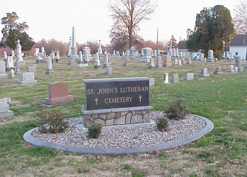
| Location | : | Red Bud, Randolph County, USA |
| Coordinate | : | 38.2080300, -89.9913000 |
| Description | : | Go south in Red Bud, IL on South Main Street (IL-3/Great River Road) turn left onto E S 4th Street. Cemetery is on the right hand side past St. John's Lutheran Church. |
frequently asked questions (FAQ):
-
Where is Saint Johns Lutheran Cemetery?
Saint Johns Lutheran Cemetery is located at Red Bud, Randolph County ,Illinois ,USA.
-
Saint Johns Lutheran Cemetery cemetery's updated grave count on graveviews.com?
1 memorials
-
Where are the coordinates of the Saint Johns Lutheran Cemetery?
Latitude: 38.2080300
Longitude: -89.9913000
Nearby Cemetories:
1. Red Bud City Old Cemetery
Red Bud, Randolph County, USA
Coordinate: 38.2118160, -89.9990240
2. Red Bud City Cemetery
Red Bud, Randolph County, USA
Coordinate: 38.2121360, -89.9823370
3. Klein Cemetery
Red Bud, Randolph County, USA
Coordinate: 38.2136570, -89.9826740
4. Saint Peter Cemetery
Red Bud, Randolph County, USA
Coordinate: 38.2125015, -90.0074997
5. Saint John the Baptist Catholic Cemetery
Red Bud, Randolph County, USA
Coordinate: 38.2119800, -90.0112300
6. Trinity Lutheran Church Cemetery
Red Bud, Randolph County, USA
Coordinate: 38.1821490, -89.9430760
7. Ralls Cemetery
Randolph County, USA
Coordinate: 38.2103004, -89.9281006
8. Saint Marcus Cemetery
Monroe County, USA
Coordinate: 38.2574997, -89.9978027
9. Brickey Cemetery
Monroe County, USA
Coordinate: 38.2358017, -89.9341965
10. Nelson Cemetery
Ruma, Randolph County, USA
Coordinate: 38.1539001, -90.0038986
11. Saint John's Lutheran Church Cemetery
Ruma, Randolph County, USA
Coordinate: 38.1349983, -89.9705963
12. Saint Patricks Parish Cemetery
Ruma, Randolph County, USA
Coordinate: 38.1299120, -90.0095000
13. Ruma Convent Cemetery
Ruma, Randolph County, USA
Coordinate: 38.1289300, -90.0101970
14. Immanuel Cemetery
Monroe County, USA
Coordinate: 38.2839012, -89.9436035
15. Gilbert Cemetery
Ames, Monroe County, USA
Coordinate: 38.1432420, -90.0612330
16. Saint Patrick Cemetery
Tipton, Monroe County, USA
Coordinate: 38.2361040, -90.1026040
17. Hecker City Cemetery
Hecker, Monroe County, USA
Coordinate: 38.3055992, -89.9816971
18. Saint Augustine of Canterbury Catholic Cemetery
Prairie Du Long Township, St. Clair County, USA
Coordinate: 38.3100014, -90.0239029
19. Koch Cemetery
Monroe County, USA
Coordinate: 38.3011017, -89.9227982
20. Stehfest Cemetery
St. Clair County, USA
Coordinate: 38.3155800, -89.9988200
21. Rebenack Cemetery
Monroe County, USA
Coordinate: 38.1652985, -90.1185989
22. Schmoll Cemetery
Baldwin, Randolph County, USA
Coordinate: 38.1660995, -89.8619003
23. Saint Johns Evangelical Lutheran Cemetery
Baldwin, Randolph County, USA
Coordinate: 38.1803017, -89.8514023
24. Hirst Cemetery
St. Clair County, USA
Coordinate: 38.3222008, -89.9843979