
| Memorials | : | 0 |
| Location | : | Oberlin, Decatur County, USA |
| Coordinate | : | 39.8430520, -100.6772920 |
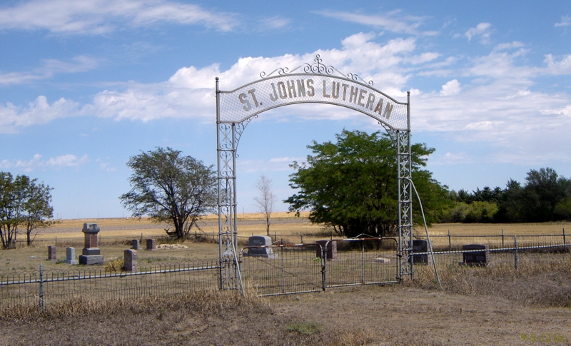
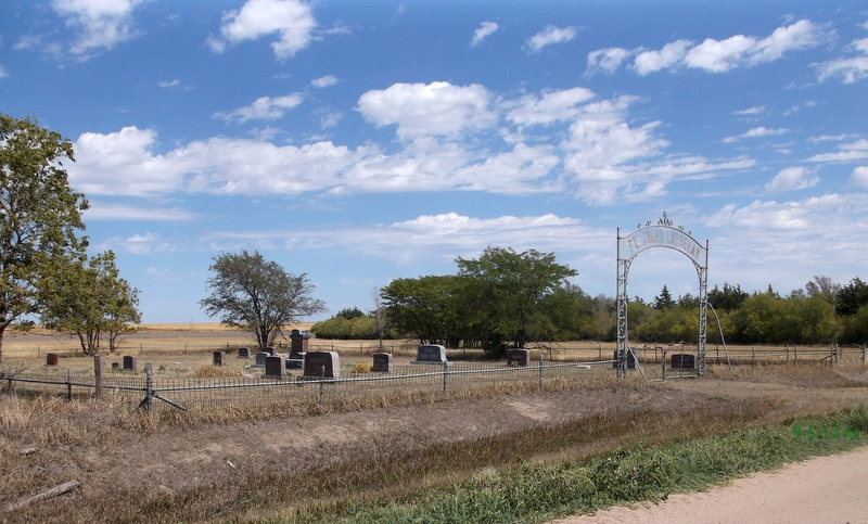
| Description | : | To locate this cemetery, follow the road through Traer south about 5 miles to the dead end and turn right. It's right there on the north side of the road. You may also go south of Herndon about 4 1/2 miles and east 5 miles; or 6 miles west, 1 mile north, and 1 1/2 miles west from the intersection of Highway 36 and 83 at Oberlin. This cemetery is in the SW 1/4 of Section 27. This is not to be confused with the other Saint Johns Lutheran Cemetery known as Old Saint Johns. ... Read More |
frequently asked questions (FAQ):
-
Where is Saint Johns Lutheran Cemetery?
Saint Johns Lutheran Cemetery is located at Section 27 Oberlin, Decatur County ,Kansas ,USA.
-
Saint Johns Lutheran Cemetery cemetery's updated grave count on graveviews.com?
0 memorials
-
Where are the coordinates of the Saint Johns Lutheran Cemetery?
Latitude: 39.8430520
Longitude: -100.6772920
Nearby Cemetories:
1. Traer Lutheran Cemetery
Logan Township, Decatur County, USA
Coordinate: 39.8715400, -100.6839400
2. Saint John's Lutheran Cemetery
Logan Township, Decatur County, USA
Coordinate: 39.8931100, -100.7397900
3. Penn Family Cemetery
Oberlin, Decatur County, USA
Coordinate: 39.8679700, -100.5892500
4. Swedish Lutheran Cemetery
Rawlins County, USA
Coordinate: 39.8135986, -100.7782974
5. Traer Cemetery
Traer, Decatur County, USA
Coordinate: 39.9296989, -100.6457977
6. Evangelical Cemetery
Herndon, Rawlins County, USA
Coordinate: 39.9160995, -100.7577972
7. Swedish Baptist Cemetery
Rawlins County, USA
Coordinate: 39.8217010, -100.8153000
8. Covenant Cemetery
Herndon, Rawlins County, USA
Coordinate: 39.8143997, -100.8244019
9. Saint Marys Cemetery
Herndon, Rawlins County, USA
Coordinate: 39.9160995, -100.7994003
10. Union Cemetery
Herndon, Rawlins County, USA
Coordinate: 39.9255981, -100.7957993
11. Oberlin Cemetery
Oberlin, Decatur County, USA
Coordinate: 39.8266296, -100.5155869
12. Bassettville Cemetery
Oberlin, Decatur County, USA
Coordinate: 39.7064018, -100.7213974
13. Cedar Bluffs Cemetery
Decatur County, USA
Coordinate: 39.9883003, -100.5717010
14. Achilles Cemetery
Achilles, Rawlins County, USA
Coordinate: 39.7117004, -100.8328018
15. Hamper Cemetery
Ludell, Rawlins County, USA
Coordinate: 39.8819008, -100.9075012
16. Lund Church Cemetery
Dresden, Decatur County, USA
Coordinate: 39.6697617, -100.6090775
17. Mennonite Cemetery
Dresden, Decatur County, USA
Coordinate: 39.6725000, -100.5909900
18. Pleasant Prairie Cemetery
Red Willow County, USA
Coordinate: 40.0247002, -100.6097031
19. Rose Hill Cemetery
Ludell, Rawlins County, USA
Coordinate: 39.8400290, -100.9536050
20. Vallonia Cemetery
Oberlin, Decatur County, USA
Coordinate: 39.8792000, -100.4039001
21. Kanona Cemetery
Kanona, Decatur County, USA
Coordinate: 39.8130989, -100.3949966
22. Immanuel Lutheran Cemetery
Ludell, Rawlins County, USA
Coordinate: 39.8610730, -100.9627840
23. Sherman Cemetery
Oberlin, Decatur County, USA
Coordinate: 39.9730450, -100.4411320
24. Trinity Lutheran Cemetery
Ludell, Rawlins County, USA
Coordinate: 39.9230995, -100.9625015