
| Memorials | : | 197 |
| Location | : | Rock Creek, Mitchell County, USA |
| Coordinate | : | 43.3313904, -92.9897232 |
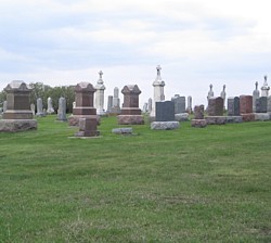
| Description | : | Located four miles east of Grafton; in a corn field on the Reuben Kronemann Farm. About a quarter mile west of the "new" cemetery |
frequently asked questions (FAQ):
-
Where is Saint Johns Lutheran Old Cemetery?
Saint Johns Lutheran Old Cemetery is located at Cameo Avenue Rock Creek, Mitchell County ,Iowa , 50461USA.
-
Saint Johns Lutheran Old Cemetery cemetery's updated grave count on graveviews.com?
197 memorials
-
Where are the coordinates of the Saint Johns Lutheran Old Cemetery?
Latitude: 43.3313904
Longitude: -92.9897232
Nearby Cemetories:
1. Saint Johns Lutheran Cemetery
Rock Creek, Mitchell County, USA
Coordinate: 43.3295560, -92.9849770
2. Riverview Cemetery
Saint Ansgar, Mitchell County, USA
Coordinate: 43.3430328, -92.9220200
3. Blakestad Cemetery
Saint Ansgar, Mitchell County, USA
Coordinate: 43.3711014, -92.9400024
4. Grafton Cemetery
Grafton, Worth County, USA
Coordinate: 43.3252983, -93.0631027
5. Priem Cemetery
Carpenter, Mitchell County, USA
Coordinate: 43.3869019, -92.9747009
6. Emmanuel Lutheran Cemetery
Grafton, Worth County, USA
Coordinate: 43.3300018, -93.0691681
7. Immanuel Lutheran Cemetery
Saint Ansgar, Mitchell County, USA
Coordinate: 43.3717003, -92.9257965
8. McKinley Cemetery
Saint Ansgar, Mitchell County, USA
Coordinate: 43.3906400, -92.9368300
9. First Lutheran Cemetery
Saint Ansgar, Mitchell County, USA
Coordinate: 43.3841705, -92.9194412
10. Saint Ansgar Cemetery
Saint Ansgar, Mitchell County, USA
Coordinate: 43.3777809, -92.9094391
11. Newburg Cemetery
Carpenter, Mitchell County, USA
Coordinate: 43.4143982, -93.0049973
12. Oak Grove Cemetery
Mitchell, Mitchell County, USA
Coordinate: 43.3156013, -92.8707962
13. Deer Creek Lutheran Church Cemetery
Carpenter, Mitchell County, USA
Coordinate: 43.4297218, -93.0236130
14. Ogden Cemetery
Otranto, Mitchell County, USA
Coordinate: 43.4366989, -92.9681015
15. Rock Creek Cemetery
Meroa, Mitchell County, USA
Coordinate: 43.2352791, -92.9225006
16. Freddie Hensel Burial Site
Plymouth Junction, Cerro Gordo County, USA
Coordinate: 43.2827034, -93.1317902
17. West End Cemetery
Meroa, Mitchell County, USA
Coordinate: 43.2216682, -92.9250031
18. Oakwood Cemetery
Plymouth, Cerro Gordo County, USA
Coordinate: 43.2538986, -93.1252975
19. Bohemian Cemetery
Plymouth, Cerro Gordo County, USA
Coordinate: 43.2522011, -93.1252975
20. Osage Cemetery
Osage, Mitchell County, USA
Coordinate: 43.2916700, -92.8201700
21. Saint Peter Cemetery
Toeterville, Mitchell County, USA
Coordinate: 43.4402809, -92.8897171
22. Eden Presbyterian Cemetery
Meroa, Mitchell County, USA
Coordinate: 43.2131004, -92.9103012
23. Rustad Cemetery
Otranto, Mitchell County, USA
Coordinate: 43.4585991, -92.9400024
24. Dudley Cemetery
Dudley (historical), Mitchell County, USA
Coordinate: 43.2252998, -92.8743973