
| Memorials | : | 38 |
| Location | : | Alliance, Stark County, USA |
| Coordinate | : | 40.9015670, -81.0893000 |
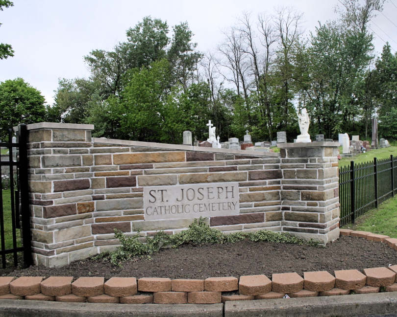
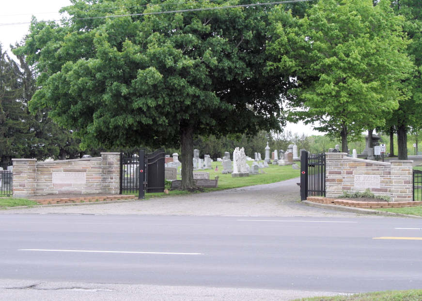
| Description | : | There is no street address for it. All mail goes to the church office. The cemetery is located in the 1300 block of E State St, Alliance OH 44601. The cemetery is located in Osnaburg Township, Stark County, Ohio, and is # 11464 (Saint Joseph Catholic Cemetery / Saint Josephs Cemetery) in “Ohio Cemeteries 1803-2003”, compiled by the Ohio Genealogical Society. The cemetery is registered with the Ohio Division of Real Estate and Professional Licensing (ODRE) as Stump Cemetery with registration license number CBR.0000982491. The U.S. Geological Survey (USGS) Geographic Names Information System (GNIS) feature ID for the cemetery... Read More |
frequently asked questions (FAQ):
-
Where is Saint Joseph Catholic Cemetery?
Saint Joseph Catholic Cemetery is located at East State Street (US 62 / Ohio State Route 173) Alliance, Stark County ,Ohio , 44601USA.
-
Saint Joseph Catholic Cemetery cemetery's updated grave count on graveviews.com?
32 memorials
-
Where are the coordinates of the Saint Joseph Catholic Cemetery?
Latitude: 40.9015670
Longitude: -81.0893000
Nearby Cemetories:
1. Mount Union Cemetery
Alliance, Stark County, USA
Coordinate: 40.8891983, -81.1052017
2. Pentz Cemetery
Knox Township, Columbiana County, USA
Coordinate: 40.8870840, -81.0562440
3. Fairmount Memorial Park
Alliance, Stark County, USA
Coordinate: 40.8755989, -81.1066971
4. Temple Israel Cemetery
Alliance Junction, Mahoning County, USA
Coordinate: 40.9303400, -81.0778700
5. Dutch Church Cemetery
Alliance, Stark County, USA
Coordinate: 40.9305650, -81.1055320
6. Williamsport Cemetery
Alliance, Stark County, USA
Coordinate: 40.9325981, -81.0980988
7. Old Fairmount Cemetery
Stark County, USA
Coordinate: 40.8706017, -81.1053009
8. Alliance City Cemetery
Alliance, Stark County, USA
Coordinate: 40.9309998, -81.1129990
9. West Beech Cemetery
Beechwood, Stark County, USA
Coordinate: 40.8860016, -81.1330032
10. Grandview Cemetery
Sebring, Mahoning County, USA
Coordinate: 40.9042015, -81.0310974
11. Fairmount Grange Cemetery
Alliance, Stark County, USA
Coordinate: 40.8572809, -81.1031532
12. Quaker Hill Cemetery
Sebring, Mahoning County, USA
Coordinate: 40.9158900, -81.0312000
13. Highland Memorial Park
Knox Township, Columbiana County, USA
Coordinate: 40.9010410, -81.0113983
14. Science Hill Cemetery
Alliance, Stark County, USA
Coordinate: 40.9213930, -81.1639020
15. Greenlawn Cemetery
Freeburg, Stark County, USA
Coordinate: 40.8506800, -81.1332290
16. Bethel Church Cemetery
Knox Township, Columbiana County, USA
Coordinate: 40.8727989, -81.0175018
17. Lexington Quaker Cemetery
Lexington, Stark County, USA
Coordinate: 40.9617004, -81.1117020
18. Wood Family Cemetery
Lexington, Stark County, USA
Coordinate: 40.9524870, -81.1407710
19. Presbyterian Cemetery
Homeworth, Columbiana County, USA
Coordinate: 40.8378480, -81.0686890
20. Saint Joseph Cemetery
Maximo, Stark County, USA
Coordinate: 40.8779411, -81.1721878
21. Kaylor Ridge Cemetery
Knox Township, Columbiana County, USA
Coordinate: 40.8374121, -81.0305028
22. Freeburg Cemetery
Freeburg, Stark County, USA
Coordinate: 40.8357201, -81.1452713
23. Reading Cemetery
Homeworth, Columbiana County, USA
Coordinate: 40.8372002, -81.0278015
24. Homeworth Mennonite Cemetery
Homeworth, Columbiana County, USA
Coordinate: 40.8191880, -81.0478080