
| Memorials | : | 84 |
| Location | : | Leitchfield, Grayson County, USA |
| Website | : | www.cemify.com/cem/st-joseph-cemetery |
| Coordinate | : | 37.4896100, -86.2937380 |
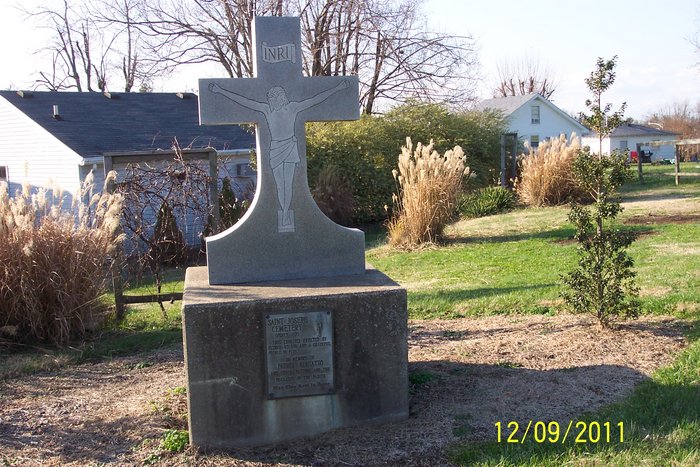
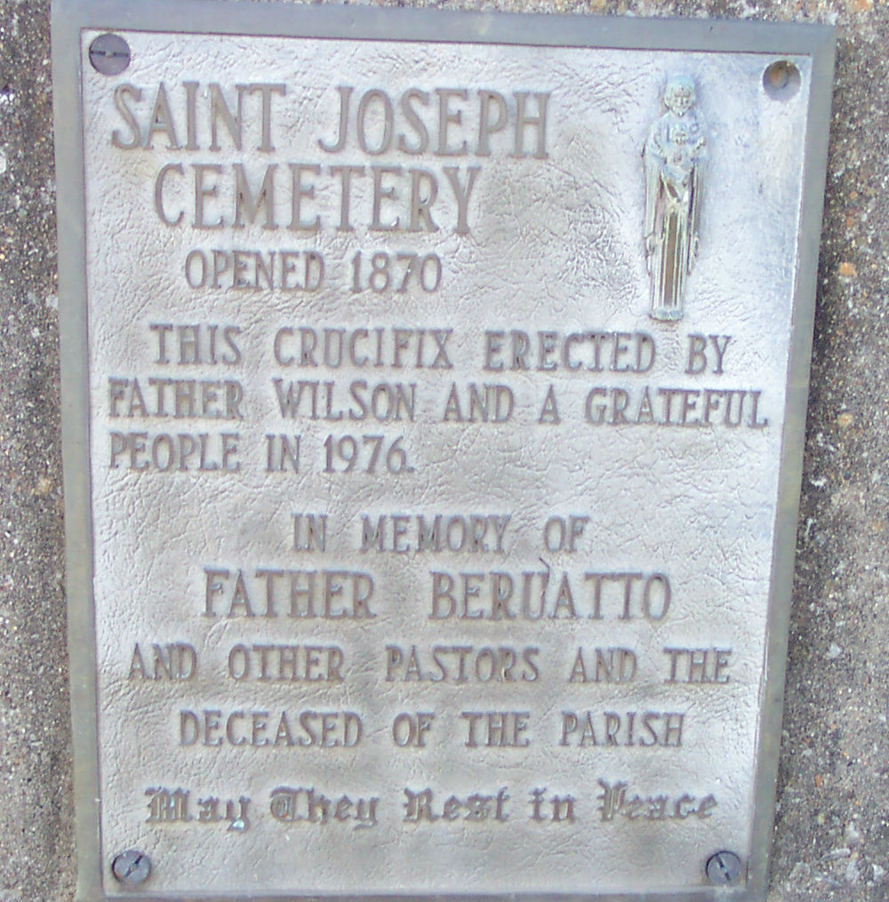
| Description | : | Saint Joseph Catholic Cemetery was founded in 1870. It is owned by Saint Joseph Catholic Church, a parish of the Catholic Diocese of Owensboro, Kentucky. The area was settled by English and Irish Catholics who had migrated to Kentucky from Maryland. Catholics began settling in the area around 1840. Growth in the area was spurred largely by the construction of a railroad through Grayson County that linked Paducah and Elizabethtown. A Catholic school was founded in 1948 with help from the Sisters of Saint Francis from Minnesota. Later the Ursuline Sisters from Mount Saint Joseph took charge of the school.... Read More |
frequently asked questions (FAQ):
-
Where is Saint Joseph Cemetery?
Saint Joseph Cemetery is located at 700 Brandenburg Road Leitchfield, Grayson County ,Kentucky , 42754USA.
-
Saint Joseph Cemetery cemetery's updated grave count on graveviews.com?
78 memorials
-
Where are the coordinates of the Saint Joseph Cemetery?
Latitude: 37.4896100
Longitude: -86.2937380
Nearby Cemetories:
1. Thomas Cemetery
Leitchfield, Grayson County, USA
Coordinate: 37.4825000, -86.2917000
2. Walnut Hill Cemetery
Leitchfield, Grayson County, USA
Coordinate: 37.4878000, -86.3031200
3. Barton Cemetery
Leitchfield, Grayson County, USA
Coordinate: 37.4793940, -86.2967140
4. Broadway Baptist Church Cemetery
Leitchfield, Grayson County, USA
Coordinate: 37.4787645, -86.2973109
5. Woodson Cemetery
Leitchfield, Grayson County, USA
Coordinate: 37.4779000, -86.2995000
6. Fair View Cemetery
Leitchfield, Grayson County, USA
Coordinate: 37.4841995, -86.2771988
7. Leitchfield Memorial Gardens
Leitchfield, Grayson County, USA
Coordinate: 37.5123000, -86.2919000
8. Mount Vernon Church Cemetery
Leitchfield, Grayson County, USA
Coordinate: 37.5133900, -86.2901800
9. Kerr Cemetery
Leitchfield, Grayson County, USA
Coordinate: 37.5144005, -86.2869034
10. Watson Cemetery
Leitchfield, Grayson County, USA
Coordinate: 37.5111008, -86.3242035
11. Beaver Dam Cemetery
Leitchfield, Grayson County, USA
Coordinate: 37.4991740, -86.2485450
12. Bloomington Baptist Church Cemetery
Leitchfield, Grayson County, USA
Coordinate: 37.4553680, -86.2705320
13. Lile Cemetery
Leitchfield, Grayson County, USA
Coordinate: 37.4550864, -86.2694347
14. McClure Cemetery
Leitchfield, Grayson County, USA
Coordinate: 37.4487490, -86.2919170
15. Mulberry Flats Cemetery
Leitchfield, Grayson County, USA
Coordinate: 37.5164870, -86.2508530
16. Richland Cemetery
Grayson County, USA
Coordinate: 37.4596558, -86.3459091
17. Claggett United Baptist Church Cemetery
Leitchfield, Grayson County, USA
Coordinate: 37.4882510, -86.3647650
18. Black Rock Church of Christ Cemetery
Black Rock (Leitchfield), Grayson County, USA
Coordinate: 37.4612630, -86.3552550
19. Kefauver Cemetery
Leitchfield, Grayson County, USA
Coordinate: 37.4771996, -86.3641968
20. Scott Cemetery
Leitchfield, Grayson County, USA
Coordinate: 37.4348570, -86.2720830
21. Hanging Rock Church Cemetery
Leitchfield, Grayson County, USA
Coordinate: 37.5458210, -86.3199690
22. Saint Elizabeth Cemetery
Clarkson, Grayson County, USA
Coordinate: 37.5031013, -86.2193985
23. Saint Augustine Cemetery
Clarkson, Grayson County, USA
Coordinate: 37.4501480, -86.2321580
24. Clarkson Cemetery
Clarkson, Grayson County, USA
Coordinate: 37.4967030, -86.2146150