
| Memorials | : | 4 |
| Location | : | Baldwin, Allegheny County, USA |
| Coordinate | : | 40.3877754, -79.9657059 |
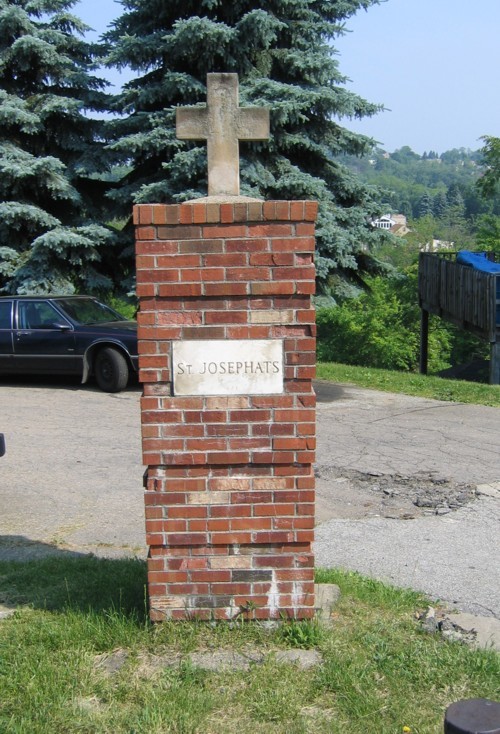
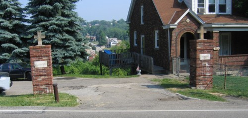
| Description | : | Going out Brownsville Road, turn left onto Churchview Avenue, turn left onto Glass Run Road, St Josephat's Cememtery is on left. Coming from another direction: Going out Carson Street and onto Streets Run Road, turn right on Glass Run Road, St Josephat's Cemetery is on the right before the intersection with Churchview Avenue. (lat= 40.38776 and log= -79.965706) The land for the Cemetery was acquired 1/6/1925 consisting of 15 acres This cemetery is Managed by: Catholic Parish Cemeteries Association 1000 Logue St Pittsburgh PA 15220 Telephone 412-256-9370 [email protected] |
frequently asked questions (FAQ):
-
Where is Saint Josephat's Cemetery?
Saint Josephat's Cemetery is located at 877 Glass Run Road Baldwin, Allegheny County ,Pennsylvania ,USA.
-
Saint Josephat's Cemetery cemetery's updated grave count on graveviews.com?
4 memorials
-
Where are the coordinates of the Saint Josephat's Cemetery?
Latitude: 40.3877754
Longitude: -79.9657059
Nearby Cemetories:
1. Saint John The Baptist Cemetery
Baldwin, Allegheny County, USA
Coordinate: 40.3855940, -79.9670580
2. Saint Paul's Lutheran Cemetery
Baldwin, Allegheny County, USA
Coordinate: 40.3950000, -79.9696000
3. Passionist Cemetery
Allegheny County, USA
Coordinate: 40.3857800, -79.9766900
4. Birmingham Cemetery
Carrick, Allegheny County, USA
Coordinate: 40.3880000, -79.9786000
5. Saint George Cemetery
Carrick, Allegheny County, USA
Coordinate: 40.3809920, -79.9871360
6. Concord Presbyterian Church Cemetery
Carrick, Allegheny County, USA
Coordinate: 40.3966000, -79.9868000
7. Saint Peters Episcopal Church Columbarium
Brentwood, Allegheny County, USA
Coordinate: 40.3671750, -79.9812560
8. Saint Adalbert's Cemetery
Carrick, Allegheny County, USA
Coordinate: 40.3986015, -79.9942017
9. Saint John Vianney Cemetery
Carrick, Allegheny County, USA
Coordinate: 40.4062540, -79.9923990
10. Bingham Street Methodist Episcopal Burying Ground
Mount Oliver, Allegheny County, USA
Coordinate: 40.4130900, -79.9883800
11. First Saint Paul's Evangelical Lutheran Cemetery
Mount Oliver, Allegheny County, USA
Coordinate: 40.4152985, -79.9835968
12. Saint Peters Cemetery
Mount Oliver, Allegheny County, USA
Coordinate: 40.4166985, -79.9813995
13. Saint Michaels Cemetery
Mount Oliver, Allegheny County, USA
Coordinate: 40.4185982, -79.9843979
14. Sunset Hills United Presbyterian Church Memorial G
Mount Lebanon, Allegheny County, USA
Coordinate: 40.3760871, -80.0277895
15. Hungarian Reformed Cemetery
Munhall, Allegheny County, USA
Coordinate: 40.3940000, -79.9018000
16. Saint Sava Cemetery
Bethel Park, Allegheny County, USA
Coordinate: 40.3586006, -80.0183029
17. Saint Mary Magdalene Cemetery
Munhall, Allegheny County, USA
Coordinate: 40.3968000, -79.9007000
18. Saint John's Cathedral Byzantine Catholic Cemetery
Munhall, Allegheny County, USA
Coordinate: 40.3947220, -79.8999939
19. Rowland Family Cemetery
Castle Shannon, Allegheny County, USA
Coordinate: 40.3666240, -80.0260450
20. Homestead Cemetery
Munhall, Allegheny County, USA
Coordinate: 40.3972015, -79.9002991
21. Anne Ashley United Methodist Church Cemetery
Munhall, Allegheny County, USA
Coordinate: 40.3984000, -79.8991000
22. Sacred Heart of Jesus Polish Nat. Catholic Cemeter
Lincoln Park, Allegheny County, USA
Coordinate: 40.3645400, -79.9031200
23. Old Saint Anne Cemetery
Castle Shannon, Allegheny County, USA
Coordinate: 40.3619130, -80.0299580
24. Saint Anne Cemetery
Castle Shannon, Allegheny County, USA
Coordinate: 40.3632900, -80.0312100