| Memorials | : | 0 |
| Location | : | Brooklyn, Kings County (Brooklyn), USA |
| Coordinate | : | 40.6826300, -73.9671300 |
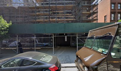
| Description | : | The Episcopal Church of St. Luke and St. Matthew 520 Clinton Avenue (between Fulton St. & Atlantic Ave. Originally constructed as St. Luke’s Protestant Episcopal Church, its congregation was founded in 1841 following the failure of Trinity Church. The building, the largest in the Episcopal Diocese of Long Island, merged with St. Matthew’s Episcopal Church in 1943, and the Church of St. Michael and St. Mark in 1993. Designated a New York City landmark in 1981, it was added to the National Register of Historic Places the following year. The building was damaged by fire in late 2012. The basis for burials... Read More |
frequently asked questions (FAQ):
-
Where is Saint Luke's Episcopal Churchyard?
Saint Luke's Episcopal Churchyard is located at 520 Clinton Avenue Brooklyn, Kings County (Brooklyn) ,New York ,USA.
-
Saint Luke's Episcopal Churchyard cemetery's updated grave count on graveviews.com?
0 memorials
-
Where are the coordinates of the Saint Luke's Episcopal Churchyard?
Latitude: 40.6826300
Longitude: -73.9671300
Nearby Cemetories:
1. Prison Ship Martyrs Monument
Brooklyn, Kings County (Brooklyn), USA
Coordinate: 40.6917992, -73.9754562
2. Fort Greene Cemetery
Fort Greene, Kings County (Brooklyn), USA
Coordinate: 40.6920720, -73.9760380
3. Wallabout Cemetery (Defunct)
Brooklyn, Kings County (Brooklyn), USA
Coordinate: 40.6951680, -73.9755540
4. Maryland Monument
Brooklyn, Kings County (Brooklyn), USA
Coordinate: 40.6661860, -73.9692310
5. Naval Hospital Cemetery
Brooklyn, Kings County (Brooklyn), USA
Coordinate: 40.6992770, -73.9630700
6. Saint James Pro-Cathedral Churchyard
Brooklyn, Kings County (Brooklyn), USA
Coordinate: 40.6969530, -73.9866460
7. Friends Quaker Cemetery
Brooklyn, Kings County (Brooklyn), USA
Coordinate: 40.6593933, -73.9720764
8. Horsfield Graveyard
Brooklyn Heights, Kings County (Brooklyn), USA
Coordinate: 40.7013850, -73.9942910
9. Most Holy Trinity Church and Crypt
Brooklyn, Kings County (Brooklyn), USA
Coordinate: 40.7069000, -73.9443000
10. Old Methodist Burial Grounds
Williamsburg, Kings County (Brooklyn), USA
Coordinate: 40.7125230, -73.9503590
11. Flatbush Reformed Dutch Church Cemetery
Flatbush, Kings County (Brooklyn), USA
Coordinate: 40.6499977, -73.9592285
12. Long Island State Hospital Cemetery
Brooklyn, Kings County (Brooklyn), USA
Coordinate: 40.6574290, -73.9383150
13. Green-Wood Cemetery
Brooklyn, Kings County (Brooklyn), USA
Coordinate: 40.6521988, -73.9910965
14. Kings County Farm Cemetery
Brooklyn, Kings County (Brooklyn), USA
Coordinate: 40.6571990, -73.9334210
15. Memorial Gore
Williamsburg, Kings County (Brooklyn), USA
Coordinate: 40.7148200, -73.9423100
16. Bushwick Dutch Reformed Cemetery
Bushwick, Kings County (Brooklyn), USA
Coordinate: 40.7155960, -73.9426790
17. Methodist Protestant Attorney Street Vaults
New York County (Manhattan), USA
Coordinate: 40.7182010, -73.9848410
18. Oliver Street Baptist Churchyard
Manhattan, New York County (Manhattan), USA
Coordinate: 40.7128470, -73.9977730
19. Forsyth Street Methodist Episcopal Churchyard
New York County (Manhattan), USA
Coordinate: 40.7148070, -73.9942650
20. First Cemetery of Congregation Shearith Israel
Chinatown, New York County (Manhattan), USA
Coordinate: 40.7129211, -73.9985352
21. German Reformed Cemetery
Manhattan, New York County (Manhattan), USA
Coordinate: 40.7152800, -73.9947050
22. Cholera Hospital Burial Ground
Manhattan, New York County (Manhattan), USA
Coordinate: 40.7060510, -74.0093190
23. Methodist Society Cemetery
New York, New York County (Manhattan), USA
Coordinate: 40.7164260, -73.9945290
24. First Moravian Church Fresh Water Burial Ground
Manhattan, New York County (Manhattan), USA
Coordinate: 40.7151210, -73.9985380

