
| Memorials | : | 0 |
| Location | : | Paw Paw, Van Buren County, USA |
| Phone | : | (269) 657-3762 |
| Coordinate | : | 42.2208060, -85.8863340 |
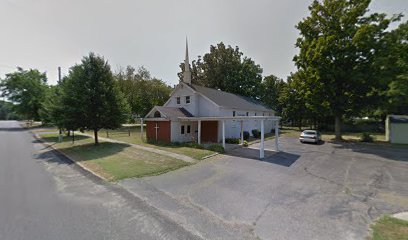
| Description | : | The columbarium is located inside St. Mark’s Episcopal Church, 412 Cedar Street, Paw Paw, MI 49079 A columbarium is one of the unique features of St. Mark's Episcopal Church. It contains the cremains of members who choose to be interred there. The altar in the center of the columbarium was created by Alan Williams and contains panels carved with biblical scenes by Timothy Cavey. |
frequently asked questions (FAQ):
-
Where is Saint Marks Episcopal Church Columbarium?
Saint Marks Episcopal Church Columbarium is located at 412 Cedar Street Paw Paw, Van Buren County ,Michigan , 49079USA.
-
Saint Marks Episcopal Church Columbarium cemetery's updated grave count on graveviews.com?
0 memorials
-
Where are the coordinates of the Saint Marks Episcopal Church Columbarium?
Latitude: 42.2208060
Longitude: -85.8863340
Nearby Cemetories:
1. Pioneer Cemetery
Paw Paw, Van Buren County, USA
Coordinate: 42.2225590, -85.8877020
2. Clapp Cemetery
Paw Paw, Van Buren County, USA
Coordinate: 42.2259120, -85.8977010
3. Saint Marys Cemetery
Paw Paw, Van Buren County, USA
Coordinate: 42.2080994, -85.8852997
4. Bangs Cemetery
Paw Paw, Van Buren County, USA
Coordinate: 42.2207790, -85.8668450
5. Prospect Hill Cemetery
Paw Paw, Van Buren County, USA
Coordinate: 42.2019005, -85.8874969
6. Harwick Cemetery
Mattawan, Van Buren County, USA
Coordinate: 42.2153015, -85.8249969
7. Wildey Cemetery
Paw Paw, Van Buren County, USA
Coordinate: 42.2216988, -85.9567032
8. Austin Cemetery
Paw Paw, Van Buren County, USA
Coordinate: 42.2807103, -85.9010842
9. Almena Cemetery
Paw Paw, Van Buren County, USA
Coordinate: 42.2638809, -85.8241614
10. Oak Grove Cemetery
Lawton, Van Buren County, USA
Coordinate: 42.1707993, -85.8339005
11. Cuddeback Cemetery
Paw Paw, Van Buren County, USA
Coordinate: 42.1753006, -85.9518967
12. Maple Grove Cemetery
Mattawan, Van Buren County, USA
Coordinate: 42.2369003, -85.7917023
13. West Oshtemo Cemetery
Oshtemo, Kalamazoo County, USA
Coordinate: 42.2760000, -85.8040000
14. Chamberlin Cemetery
Lawton, Van Buren County, USA
Coordinate: 42.1349983, -85.8535995
15. Glendale Cemetery
Waverly Township, Van Buren County, USA
Coordinate: 42.2995800, -85.9569600
16. Covey Hill Cemetery
Almena Township, Van Buren County, USA
Coordinate: 42.3170000, -85.8770000
17. Virgo Cemetery
Texas Township, Kalamazoo County, USA
Coordinate: 42.1782990, -85.7643967
18. Hicks Cemetery
Lawrence, Van Buren County, USA
Coordinate: 42.2666700, -86.0127800
19. Prospect Lake Cemetery
Lawrence, Van Buren County, USA
Coordinate: 42.1780000, -86.0210000
20. Pine Grove Cemetery
Van Buren County, USA
Coordinate: 42.3325300, -85.8464800
21. Cole Cemetery
Texas Township, Kalamazoo County, USA
Coordinate: 42.1958240, -85.7314410
22. Lawrence Village Pioneer Cemetery
Lawrence, Van Buren County, USA
Coordinate: 42.2200000, -86.0540000
23. Luv Pet Cemetery
Decatur, Van Buren County, USA
Coordinate: 42.1131350, -85.9750070
24. Robinson Cemetery
Gobles, Van Buren County, USA
Coordinate: 42.3469009, -85.8803024