
| Memorials | : | 0 |
| Location | : | Chestnut, Monroe County, USA |
| Coordinate | : | 31.8098490, -87.2327110 |
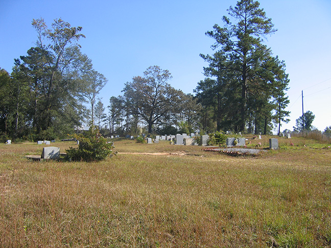
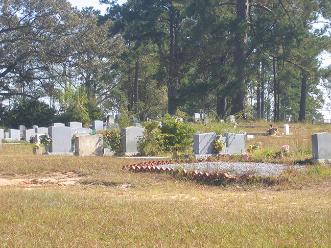
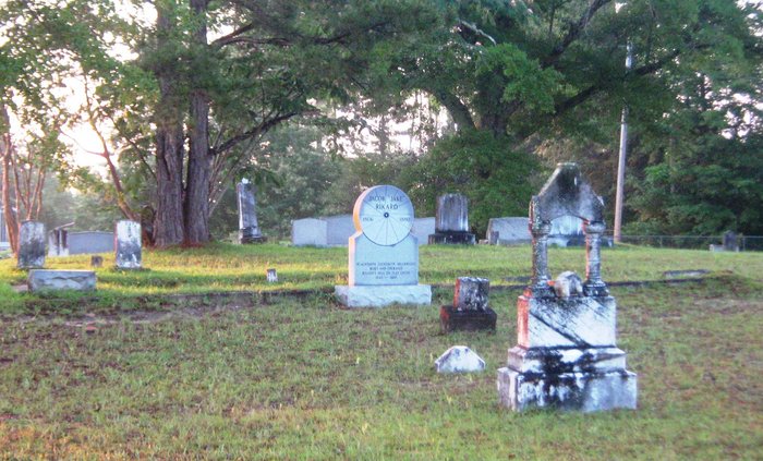
| Description | : | The St. Matthew's Baptist Church and Cemetery are also known as the Chestnut Community Cemetery, Chestnut is a small rural community in the upper portion of Monroe County, Alabama, Plat F-1, Section 26 on the Monroe County map. The community is located near, but north of the historic Rikard's Mill. From Monroeville, travel on Hwy-21 to the town of Beatrice. At the center of Beatrice Township is a junction where Hwy-265 and CR-56 veer to the left. Turn here onto 265/56 and continue northward and follow the signs toward the Rikard's Mill area (approximately... Read More |
frequently asked questions (FAQ):
-
Where is Saint Matthew Baptist Church Cemetery?
Saint Matthew Baptist Church Cemetery is located at Marshall Road Chestnut, Monroe County ,Alabama ,USA.
-
Saint Matthew Baptist Church Cemetery cemetery's updated grave count on graveviews.com?
0 memorials
-
Where are the coordinates of the Saint Matthew Baptist Church Cemetery?
Latitude: 31.8098490
Longitude: -87.2327110
Nearby Cemetories:
1. Buena Vista Cemetery
Monroe County, USA
Coordinate: 31.7947006, -87.2536011
2. Basidonia Cemetery
Monroe County, USA
Coordinate: 31.7875004, -87.2791977
3. Bradley Cemetery
Buena Vista, Monroe County, USA
Coordinate: 31.7875450, -87.2792590
4. Apple Grove Missionary Baptism Church Cemetery
Vredenburgh, Monroe County, USA
Coordinate: 31.8234938, -87.2996277
5. Turkestan Cemetery
Monroe County, USA
Coordinate: 31.7800007, -87.1521988
6. Pineview Cemetery
Pineville, Monroe County, USA
Coordinate: 31.7828007, -87.1500015
7. Bell Cemetery
Vredenburgh, Monroe County, USA
Coordinate: 31.7791400, -87.3150450
8. Enon Baptist Church Cemetery
Fatama, Wilcox County, USA
Coordinate: 31.8864770, -87.2363110
9. First Baptist Church Cemetery
Vredenburgh, Monroe County, USA
Coordinate: 31.8314780, -87.3221820
10. Saint John AME Church Cemetery
Beatrice, Monroe County, USA
Coordinate: 31.7333298, -87.2047195
11. Mount Carmel Cemetery
Wilcox County, USA
Coordinate: 31.8810997, -87.2807999
12. Pineville Methodist Cemetery
Pineville, Monroe County, USA
Coordinate: 31.7427998, -87.1766968
13. Gravel Hill Cemetery
Wilcox County, USA
Coordinate: 31.8817005, -87.2799988
14. Pineville Cemetery
Pineville, Monroe County, USA
Coordinate: 31.7453120, -87.1699150
15. Pineville Baptist Cemetery
Pineville, Monroe County, USA
Coordinate: 31.7432556, -87.1729279
16. New Hope Cemetery
Beatrice, Monroe County, USA
Coordinate: 31.7285520, -87.2607740
17. Stallworth Cemetery
Beatrice, Monroe County, USA
Coordinate: 31.7273250, -87.2001630
18. Sylvester Baptist Church Cemetery
Beatrice, Monroe County, USA
Coordinate: 31.7366000, -87.1631660
19. Shiloh Baptist Church Cemetery
Natchez, Monroe County, USA
Coordinate: 31.7200670, -87.2763680
20. Indian Springs Baptist Cemetery
Beatrice, Monroe County, USA
Coordinate: 31.7917410, -87.1177570
21. Old Zion Missionary Baptist Church Cemetery
Coy, Wilcox County, USA
Coordinate: 31.8608100, -87.3337300
22. Mount Zion Baptist Church Cemetery
Pine Hill, Wilcox County, USA
Coordinate: 31.8607800, -87.3338210
23. Reaves Chapel Memorial Cemetery
Wilcox County, USA
Coordinate: 31.8726080, -87.3315460
24. Dees Cemetery
Wilcox County, USA
Coordinate: 31.8547001, -87.3497009