
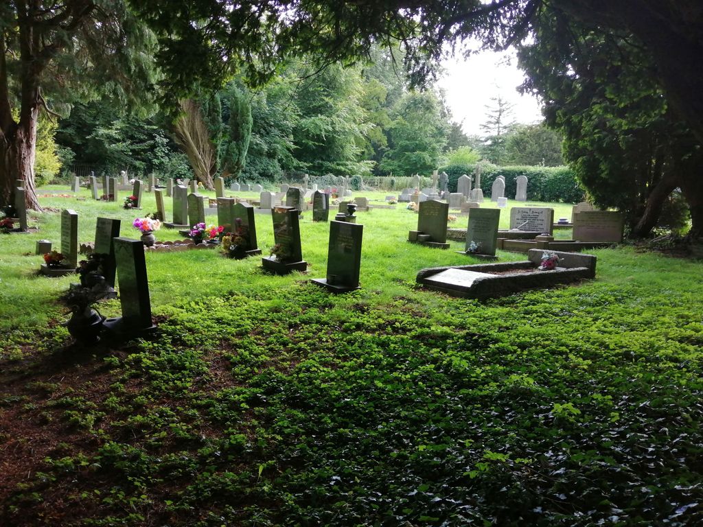
| Memorials | : | 13 |
| Location | : | Brodsworth, Metropolitan Borough of Doncaster, England |
| Coordinate | : | 53.5591500, -1.2365300 |
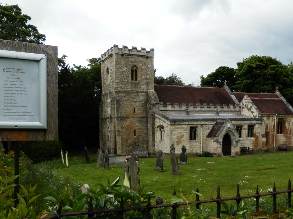
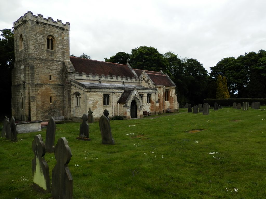
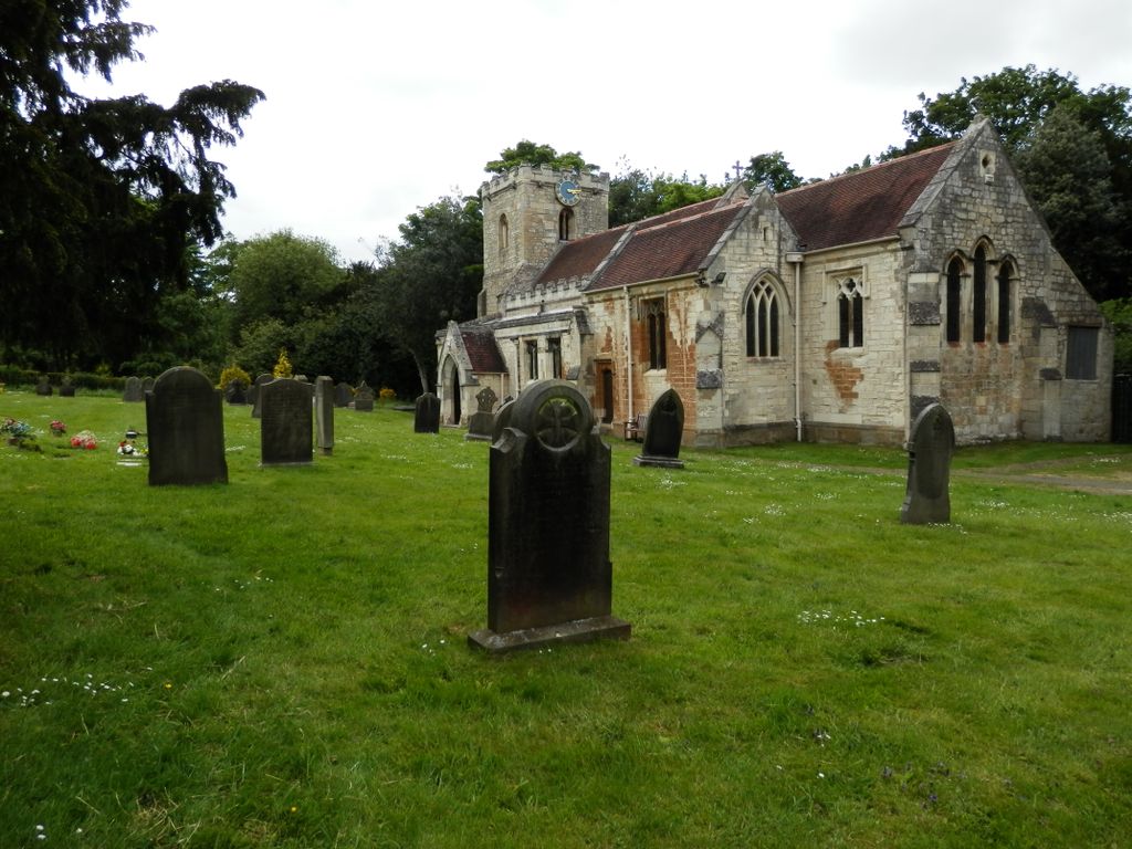
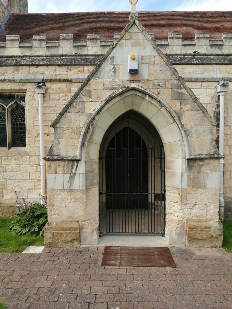
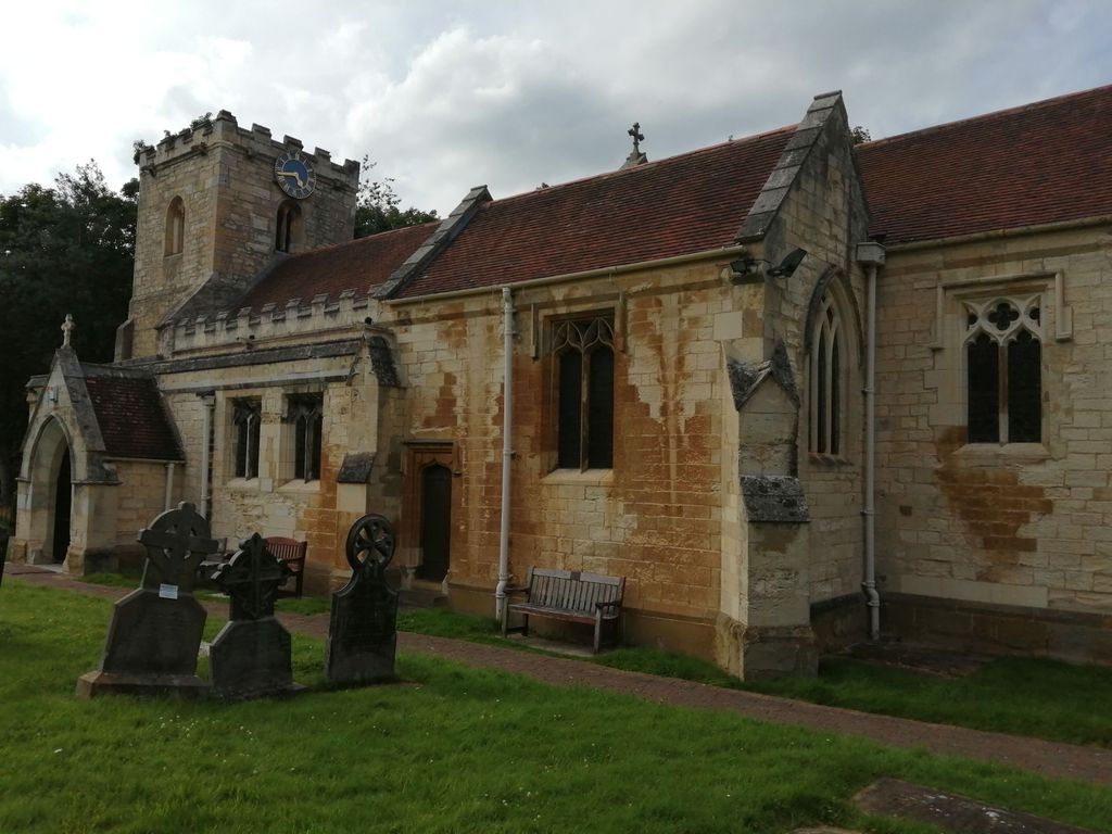
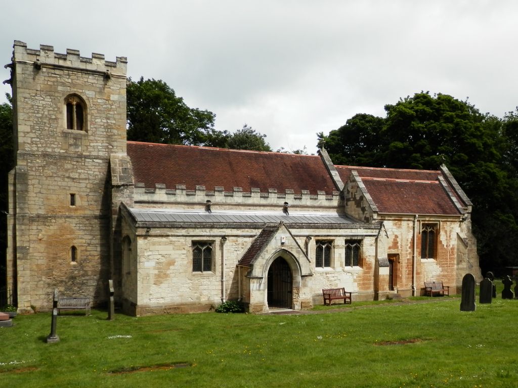
| Description | : | The village is recorded in the Domesday Book of 1086 as ‘Brodesworde’. There was a church here before Domesday, possibly built by the Saxon ‘Alsi’, who was lord of the manor at the time of Edward the Confessor. The present church is largely Norman and originally consisted of a nave and chancel. Later the tower and north aisle were added. The Thellusson family restored and extended the church in the 19th century, adding a south aisle, chapel and porch. The original Brodsworth Hall stood near the church and is known to have been occupied as early as 1665. The Hall is now... Read More |
frequently asked questions (FAQ):
-
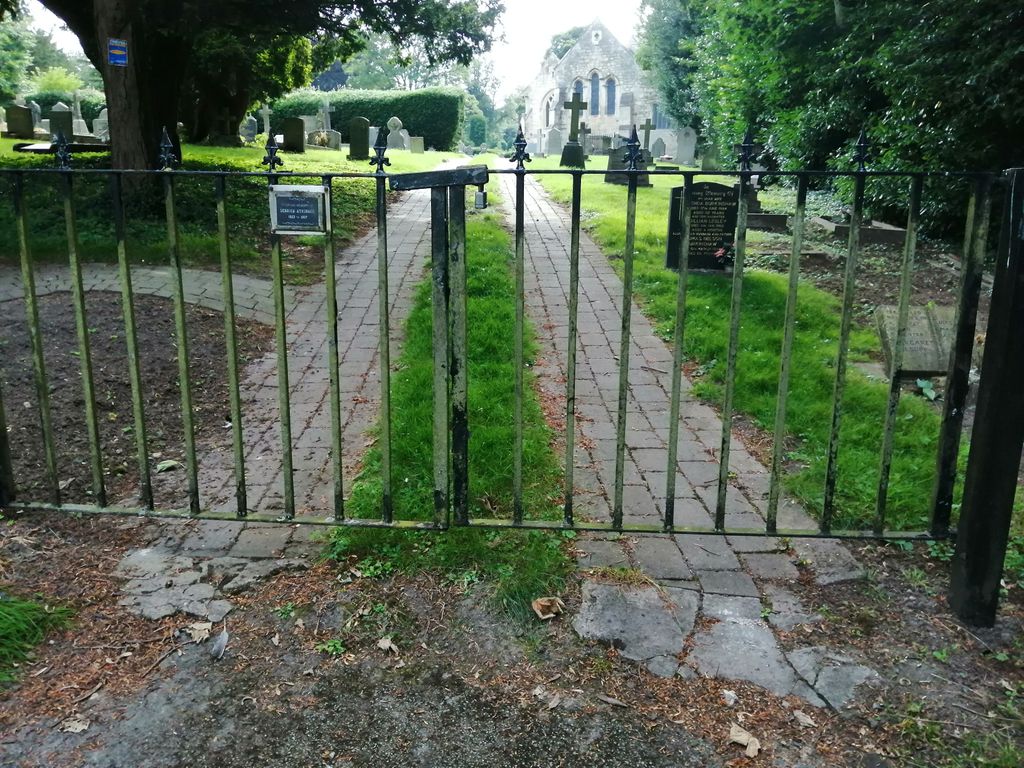
Where is Saint Michael and All Angels Churchyard?
Saint Michael and All Angels Churchyard is located at Brodsworth, Metropolitan Borough of Doncaster ,South Yorkshire ,England.
-
Saint Michael and All Angels Churchyard cemetery's updated grave count on graveviews.com?
13 memorials
-
Where are the coordinates of the Saint Michael and All Angels Churchyard?
Latitude: 53.5591500
Longitude: -1.2365300

Nearby Cemetories:
1. St. Helen's Churchyard
Marr, Metropolitan Borough of Doncaster, England
Coordinate: 53.5421740, -1.2252260
2. All Saints Churchyard
Hooton Pagnell, Metropolitan Borough of Doncaster, England
Coordinate: 53.5660840, -1.2683133
3. Hooton Pagnell New Churchyard
Hooton Pagnell, Metropolitan Borough of Doncaster, England
Coordinate: 53.5625600, -1.2701200
4. St. Wilfrid's Churchyard
Hickleton, Metropolitan Borough of Doncaster, England
Coordinate: 53.5422520, -1.2723760
5. Windmill Balk Lane Cemetery
Adwick le Street, Metropolitan Borough of Doncaster, England
Coordinate: 53.5662610, -1.1913080
6. Red House Cemetery
Brodsworth, Metropolitan Borough of Doncaster, England
Coordinate: 53.5761770, -1.1990350
7. Redhouse Lane Cemetery
Adwick le Street, Metropolitan Borough of Doncaster, England
Coordinate: 53.5762650, -1.1989510
8. Hampole Priory
Hampole, Metropolitan Borough of Doncaster, England
Coordinate: 53.5876700, -1.2373620
9. St. Laurence Churchyard
Adwick le Street, Metropolitan Borough of Doncaster, England
Coordinate: 53.5710200, -1.1846150
10. All Saints Churchyard
Frickley, Metropolitan Borough of Doncaster, England
Coordinate: 53.5652700, -1.2950500
11. St. Peter's Churchyard
Barnburgh, Metropolitan Borough of Doncaster, England
Coordinate: 53.5232810, -1.2710492
12. St. Michael's Churchyard
Skelbrooke, Metropolitan Borough of Doncaster, England
Coordinate: 53.6029400, -1.2293000
13. St. Mary the Virgin Churchyard
South Elmsall, Metropolitan Borough of Wakefield, England
Coordinate: 53.5934950, -1.2861930
14. St. James' Churchyard
High Melton, Metropolitan Borough of Doncaster, England
Coordinate: 53.5106490, -1.2338020
15. St. Helen's Churchyard
Burghwallis, Metropolitan Borough of Doncaster, England
Coordinate: 53.6020620, -1.1899730
16. Moorthorpe Cemetery
Moorthorpe, Metropolitan Borough of Wakefield, England
Coordinate: 53.5938700, -1.3025110
17. St Helen Churchyard
Thurnscoe, Metropolitan Borough of Barnsley, England
Coordinate: 53.5452600, -1.3222850
18. All Saints Churchyard
Owston, Metropolitan Borough of Doncaster, England
Coordinate: 53.5942161, -1.1691935
19. St. Mary's Churchyard
Sprotbrough, Metropolitan Borough of Doncaster, England
Coordinate: 53.5122280, -1.1878590
20. Thurnscoe Cemetery
Thurnscoe, Metropolitan Borough of Barnsley, England
Coordinate: 53.5423000, -1.3248700
21. St. Margaret's Churchyard
North Elmsall, Metropolitan Borough of Wakefield, England
Coordinate: 53.6091690, -1.2810510
22. All Saints Churchyard
South Kirkby, Metropolitan Borough of Wakefield, England
Coordinate: 53.5941350, -1.3170410
23. St. John's Churchyard
Cadeby, Metropolitan Borough of Doncaster, England
Coordinate: 53.4989370, -1.2254130
24. St. John the Baptist Churchyard
Adwick-on-Dearne, Metropolitan Borough of Doncaster, England
Coordinate: 53.5080520, -1.2924120