
| Memorials | : | 0 |
| Location | : | Hinchinbrooke, Monteregie Region, Canada |
| Coordinate | : | 45.0083930, -74.0389910 |
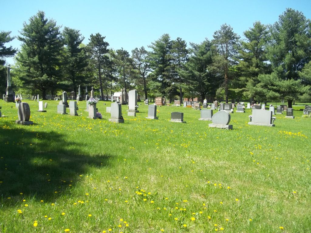
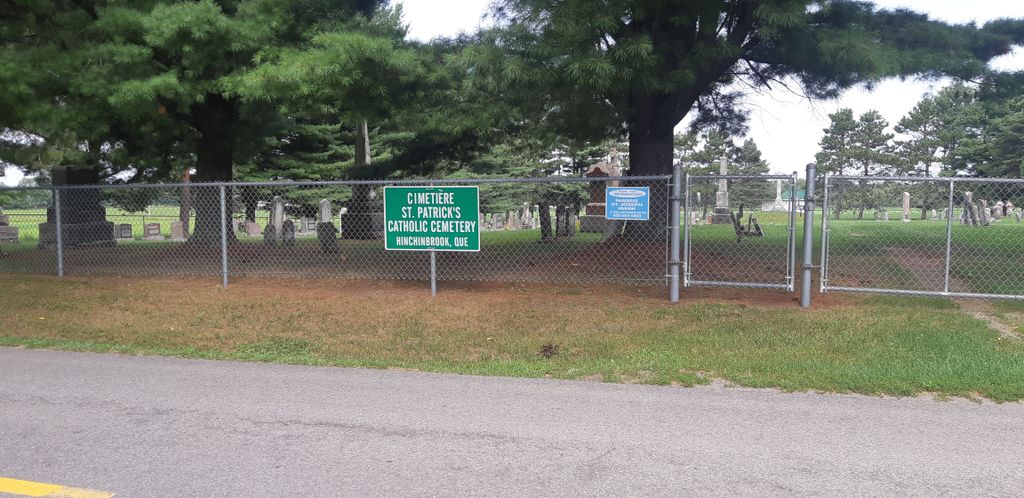
| Description | : | Also known as St. Patrick's Catholic Cemetery or Rockburn Old Catholic Cemetery, this cemetery is located in Hinchinbrooke on the north side of First Concession Road approximately 3 kilometers west of the junction with Rockburn Road. The parish of St. Patrick's was established in 1826, but the parish boundaries changed over time. Indeed, at one time the parish included neighboring areas of the New York State and many headstones in the cemetery and persons listed in the church records are for American citizens. The cemetery originally had a church close by and the most recent church, which burned down in 1929,... Read More |
frequently asked questions (FAQ):
-
Where is Saint Patrice de Hinchinbrooke Catholic Cemetery?
Saint Patrice de Hinchinbrooke Catholic Cemetery is located at 1781 Chemin de la 1 Concession E Hinchinbrooke, Monteregie Region ,Quebec , QC J0S 1E0Canada.
-
Saint Patrice de Hinchinbrooke Catholic Cemetery cemetery's updated grave count on graveviews.com?
0 memorials
-
Where are the coordinates of the Saint Patrice de Hinchinbrooke Catholic Cemetery?
Latitude: 45.0083930
Longitude: -74.0389910


Nearby Cemetories:
1. Hillside Cemetery
Hinchinbrooke, Monteregie Region, Canada
Coordinate: 45.0232610, -74.0527650
2. Earlville Cemetery
Earlville, Franklin County, USA
Coordinate: 44.9738570, -74.0437260
3. Wills Cemetery
Chateaugay, Franklin County, USA
Coordinate: 44.9659900, -74.0492700
4. Saint Pauls Anglican Cemetery
Herdman, Monteregie Region, Canada
Coordinate: 45.0268440, -74.0957430
5. Gore Cemetery
Hinchinbrooke, Monteregie Region, Canada
Coordinate: 45.0489270, -74.0914570
6. Gentle-Welch Cemetery
Franklin, Monteregie Region, Canada
Coordinate: 45.0223120, -73.9622890
7. Christ Church Cemetery
Franklin, Monteregie Region, Canada
Coordinate: 45.0261740, -73.9530760
8. Sandy Knoll Cemetery
Franklin County, USA
Coordinate: 44.9728012, -74.1258011
9. Mitchell Cemetery
Chateaugay, Franklin County, USA
Coordinate: 44.9891800, -74.1435300
10. Hilliker Cemetery
Chateaugay, Franklin County, USA
Coordinate: 44.9332100, -74.0174700
11. Smith-Green Cemetery
Chateaugay, Franklin County, USA
Coordinate: 44.9297470, -74.0414570
12. Powerscourt United Church Cemetery
Powerscourt, Monteregie Region, Canada
Coordinate: 45.0068100, -74.1577900
13. East Side Cemetery
Chateaugay, Franklin County, USA
Coordinate: 44.9267006, -74.0669022
14. Evergreen Cemetery
Chateaugay, Franklin County, USA
Coordinate: 44.9272003, -74.0702972
15. Franklin Centre Cemetery
Franklin, Monteregie Region, Canada
Coordinate: 45.0303500, -73.9187000
16. Brayton Hollow Cemetery
Franklin County, USA
Coordinate: 44.9421997, -74.1219025
17. Immaculate Heart of Mary Cemetery
Churubusco, Clinton County, USA
Coordinate: 44.9568000, -73.9332000
18. Old Immaculate Heart of Mary Cemetery
Churubusco, Clinton County, USA
Coordinate: 44.9543080, -73.9323230
19. Atwater Cemetery
Chateaugay, Franklin County, USA
Coordinate: 44.9371700, -74.1259200
20. Saint Patrick Cemetery
Chateaugay, Franklin County, USA
Coordinate: 44.9219017, -74.0980988
21. Athelstan Presbyterian Cemetery
Athelstan, Monteregie Region, Canada
Coordinate: 45.0378400, -74.1689400
22. North Burke Cemetery
Franklin County, USA
Coordinate: 44.9851500, -74.1737700
23. Dunn Cemetery
Franklin, Monteregie Region, Canada
Coordinate: 45.0392120, -73.8871310
24. Elliott-Rust Cemetery
Chateaugay, Franklin County, USA
Coordinate: 44.9123300, -74.1265000