| Memorials | : | 0 |
| Location | : | Bearden, Okfuskee County, USA |
| Coordinate | : | 35.3338800, -96.3450200 |
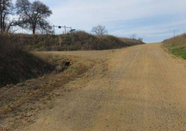
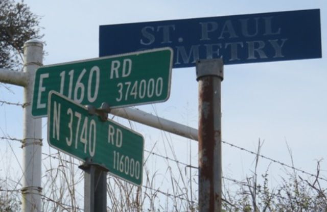
| Description | : | Directions: From Interstate 40 and Highway #48 proceed south on Highway #48 3.6 miles. Right inside the city limits of Bearden there is a sharp right curve that has a dirt road turning left off of the highway. That is county road North 3730. Turn left and curve on North 3730 and follow it one-half block to county road E1150. Turn left (east) on E1150 and go 1 mile to dead end. Turn right (south) on N3740 and go 1 mile to County Road E1160 (also Saint Pauls Cemetery Road). Turn left (east) on E1160... Read More |
frequently asked questions (FAQ):
-
Where is Saint Paul's Cemetery?
Saint Paul's Cemetery is located at Bearden, Okfuskee County ,Oklahoma ,USA.
-
Saint Paul's Cemetery cemetery's updated grave count on graveviews.com?
0 memorials
-
Where are the coordinates of the Saint Paul's Cemetery?
Latitude: 35.3338800
Longitude: -96.3450200
Nearby Cemetories:
1. Bearden Cemetery
Okfuskee County, USA
Coordinate: 35.3644100, -96.3810500
2. Foster Family Cemetery
Okemah, Okfuskee County, USA
Coordinate: 35.3769440, -96.3120750
3. Shiloh Cemetery
Okfuskee County, USA
Coordinate: 35.3258018, -96.2814026
4. High Spring Cemetery
Okfuskee County, USA
Coordinate: 35.3718987, -96.2988968
5. Thlopthlocco Cemetery
Okfuskee County, USA
Coordinate: 35.3174500, -96.2825200
6. Wind Family Cemetery
Okemah, Okfuskee County, USA
Coordinate: 35.3762220, -96.2995700
7. Deere Family Cemetery
Cromwell, Seminole County, USA
Coordinate: 35.3189070, -96.4364430
8. Rock Creek Cemetery
Okfuskee County, USA
Coordinate: 35.3680992, -96.2592010
9. Little Quarsarty Cemetery
Cromwell, Seminole County, USA
Coordinate: 35.3152300, -96.4430310
10. Greenleaf Cemetery
Okemah, Okfuskee County, USA
Coordinate: 35.4174400, -96.3546400
11. Wisner Cemetery
Wetumka, Hughes County, USA
Coordinate: 35.2444000, -96.3343964
12. Sand Creek Cemetery
Seminole County, USA
Coordinate: 35.3911018, -96.4413986
13. Salt Creek Cemetery
Wetumka, Hughes County, USA
Coordinate: 35.2811012, -96.2444000
14. Holahta Cemetery
Okfuskee County, USA
Coordinate: 35.4316200, -96.3679100
15. Butner Cemetery
Hughes County, USA
Coordinate: 35.2677994, -96.4368973
16. Prairie Springs Cemetery
Okemah, Okfuskee County, USA
Coordinate: 35.4354973, -96.3562775
17. Harjo Family Cemetery
Okemah, Okfuskee County, USA
Coordinate: 35.4429300, -96.3392500
18. Ben Johnson Old Home Cemetery
Schoolton, Seminole County, USA
Coordinate: 35.3909630, -96.4646870
19. North Fork Cemetery
Clearview, Okfuskee County, USA
Coordinate: 35.3622017, -96.2099991
20. Jimboy Family Cemetery
Okemah, Okfuskee County, USA
Coordinate: 35.3901700, -96.2234200
21. Highland Cemetery
Okemah, Okfuskee County, USA
Coordinate: 35.4441986, -96.2985992
22. Schoolton Cemetery
Cromwell, Seminole County, USA
Coordinate: 35.4065410, -96.4659690
23. Frank Family Farm Cemetery
Seminole County, USA
Coordinate: 35.4207060, -96.4547250
24. Castle Cemetery
Castle, Okfuskee County, USA
Coordinate: 35.4603004, -96.3874969


