
| Memorials | : | 23 |
| Location | : | Middleburg Heights, Cuyahoga County, USA |
| Coordinate | : | 41.3885994, -81.8432999 |
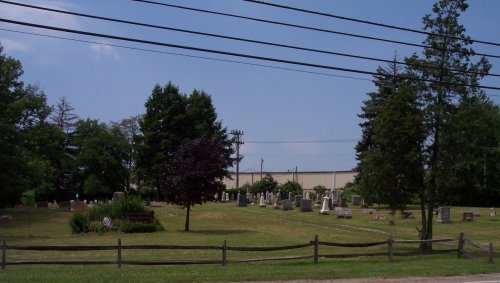
| Description | : | The cemetery is located on the west side of Eastland Road about 300 feet south of its intersection with Sheldon Road. The cemetery is 3 acres in size. The cemetery is located in the City of Middleburg Heights, Cuyahoga County, Ohio, and is # 2619 (Saint Paul Cemetery / Saint Pauls Cemetery) in “Ohio Cemeteries 1803-2003”, compiled by the Ohio Genealogical Society. The U.S. Geological Survey (USGS) Geographic Names Information System (GNIS) feature ID for the cemetery is 1045756 (Saint Pauls Cemetery). |
frequently asked questions (FAQ):
-
Where is Saint Paul Lutheran Church Cemetery?
Saint Paul Lutheran Church Cemetery is located at 6630 Eastland Road Middleburg Heights, Cuyahoga County ,Ohio , 44130USA.
-
Saint Paul Lutheran Church Cemetery cemetery's updated grave count on graveviews.com?
23 memorials
-
Where are the coordinates of the Saint Paul Lutheran Church Cemetery?
Latitude: 41.3885994
Longitude: -81.8432999
Nearby Cemetories:
1. Saint Marys Cemetery
Berea, Cuyahoga County, USA
Coordinate: 41.3782997, -81.8581009
2. Hickcox Park
Middleburg Heights, Cuyahoga County, USA
Coordinate: 41.3745079, -81.8311920
3. Berea United Methodist Church Repository
Berea, Cuyahoga County, USA
Coordinate: 41.3711920, -81.8512490
4. Saint Adalbert Cemetery
Middleburg Heights, Cuyahoga County, USA
Coordinate: 41.3732986, -81.8292007
5. Adams Street Cemetery
Berea, Cuyahoga County, USA
Coordinate: 41.3633003, -81.8482971
6. Woodvale Cemetery
Middleburg Heights, Cuyahoga County, USA
Coordinate: 41.3614006, -81.8244019
7. Fowles Family Cemetery
Middleburg Heights, Cuyahoga County, USA
Coordinate: 41.3592529, -81.8309860
8. Saint Mary of the Falls Cemetery
Berea, Cuyahoga County, USA
Coordinate: 41.3732986, -81.8908005
9. Old Chestnut Grove Cemetery
Olmsted Falls, Cuyahoga County, USA
Coordinate: 41.3796390, -81.8962700
10. Chestnut Grove Cemetery
Olmsted Falls, Cuyahoga County, USA
Coordinate: 41.3767800, -81.8960300
11. Holy Cross Cemetery
Brook Park, Cuyahoga County, USA
Coordinate: 41.4136009, -81.7968979
12. Assumption of Mary Cemetery
Brook Park, Cuyahoga County, USA
Coordinate: 41.4185486, -81.8001099
13. Sunset Memorial Park
North Olmsted, Cuyahoga County, USA
Coordinate: 41.3991780, -81.9039050
14. Saint Patrick Church Cemetery
Cleveland, Cuyahoga County, USA
Coordinate: 41.4341774, -81.8220596
15. Butternut Ridge Cemetery
North Olmsted, Cuyahoga County, USA
Coordinate: 41.4071999, -81.9056015
16. Coe Ridge Cemetery
North Olmsted, Cuyahoga County, USA
Coordinate: 41.4281006, -81.8921967
17. Westview Cemetery
Columbia Township, Lorain County, USA
Coordinate: 41.3487320, -81.9006577
18. Strongsville Baptist Church Cemetery
Strongsville, Cuyahoga County, USA
Coordinate: 41.3296300, -81.8362400
19. Fairview Park Cemetery
Fairview Park, Cuyahoga County, USA
Coordinate: 41.4511986, -81.8361969
20. Gods Acre Cemetery
Cleveland, Cuyahoga County, USA
Coordinate: 41.4314003, -81.7807999
21. Alger Cemetery
Cleveland, Cuyahoga County, USA
Coordinate: 41.4488983, -81.8143997
22. Parma Public Cemetery
Parma, Cuyahoga County, USA
Coordinate: 41.3640480, -81.7584534
23. Parma Heights Cemetery
Parma Heights, Cuyahoga County, USA
Coordinate: 41.3988304, -81.7513504
24. Maple Ridge Cemetery
Westlake, Cuyahoga County, USA
Coordinate: 41.4431000, -81.9028015