
| Memorials | : | 253 |
| Location | : | Baltimore County, USA |
| Coordinate | : | 39.7111500, -76.7898600 |
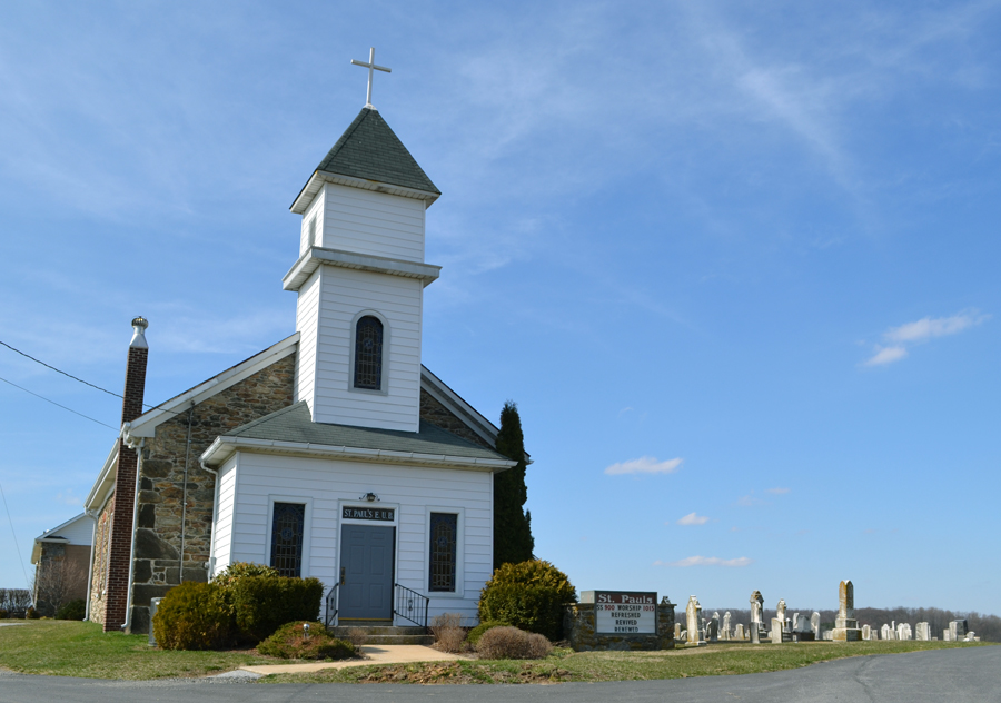
| Description | : | St. Paul's is located at the Mason Dixon Line of Maryland and Pennsylvania, where Baltimore, Carroll & York counties meet. The church was founded in 1848 and enhanced over time. New facilities were added in 1998 which have a breathtaking view of the surrounding valley's sunrises and sunsets. Located in Baltimore County, the cemetery lays right on the line of Baltimore & Caroll Counties, so it's often overlooked in both counties. |
frequently asked questions (FAQ):
-
Where is Saint Pauls Independent Church Cemetery?
Saint Pauls Independent Church Cemetery is located at 5010 St. Pauls Road Baltimore County ,Maryland , 21102USA.
-
Saint Pauls Independent Church Cemetery cemetery's updated grave count on graveviews.com?
0 memorials
-
Where are the coordinates of the Saint Pauls Independent Church Cemetery?
Latitude: 39.7111500
Longitude: -76.7898600
Nearby Cemetories:
1. Shue Family Cemetery
Millers, Carroll County, USA
Coordinate: 39.7167900, -76.7918700
2. Zimmermans Mennonite Cemetery
Manchester, Carroll County, USA
Coordinate: 39.7010200, -76.8076500
3. Mount Tabor Cemetery
Baltimore County, USA
Coordinate: 39.6864400, -76.7769600
4. Hoffman Gunpowder Cemetery
Hoffmanville, Baltimore County, USA
Coordinate: 39.6864400, -76.7769300
5. Hoffmanville Cemetery
Hoffmanville, Baltimore County, USA
Coordinate: 39.6864146, -76.7769192
6. Alesia Free Methodist Church Cemetery
Alesia, Carroll County, USA
Coordinate: 39.6926100, -76.8365200
7. Saint Peters Lutheran Church Cemetery
Hampstead, Carroll County, USA
Coordinate: 39.6693200, -76.7955900
8. Lazarus Union Cemetery
Lineboro, Carroll County, USA
Coordinate: 39.7137135, -76.8485880
9. Bollinger Cemetery
Carroll County, USA
Coordinate: 39.7042007, -76.8506012
10. Stansbury Cemetery
Carroll County, USA
Coordinate: 39.6814003, -76.8550034
11. Saint Johns United Methodist Cemetery
Glenville, York County, USA
Coordinate: 39.7446000, -76.8537000
12. Middletown Cemetery
Freeland, Baltimore County, USA
Coordinate: 39.6769600, -76.7238600
13. Millers United Methodist Church Cemetery
Millers, Carroll County, USA
Coordinate: 39.6699430, -76.8493870
14. Saint Jacobs Stone Church Cemetery
Glenville, York County, USA
Coordinate: 39.7702789, -76.8158264
15. Black Rock Church of the Brethren Cemetery
Brodbecks, York County, USA
Coordinate: 39.7234900, -76.8696000
16. Grave Run Methodist Episcopal Church Cemetery
Baltimore County, USA
Coordinate: 39.6485800, -76.8059800
17. Bowser Cemetery
New Freedom, York County, USA
Coordinate: 39.7393990, -76.7121964
18. Saint Abraham's Lutheran Church Cemetery
Beckleysville, Baltimore County, USA
Coordinate: 39.6448100, -76.7895000
19. New Hope United Church of Christ Cemetery
Glen Rock, York County, USA
Coordinate: 39.7672195, -76.7358322
20. Oakland Methodist Cemetery
Freeland, Baltimore County, USA
Coordinate: 39.7138600, -76.6941200
21. Klinefelter Cemetery
Glen Rock, York County, USA
Coordinate: 39.7721333, -76.7331667
22. New Freedom Cemetery
New Freedom, York County, USA
Coordinate: 39.7383380, -76.6927240
23. Mount Zion United Methodist Church Cemetery
Freeland, Baltimore County, USA
Coordinate: 39.6970870, -76.6867380
24. Manchester Baptist Church Cemetery
Manchester, Carroll County, USA
Coordinate: 39.6856200, -76.8900400