
| Memorials | : | 0 |
| Location | : | Westphalia, Clinton County, USA |
| Coordinate | : | 42.9505997, -84.7388992 |
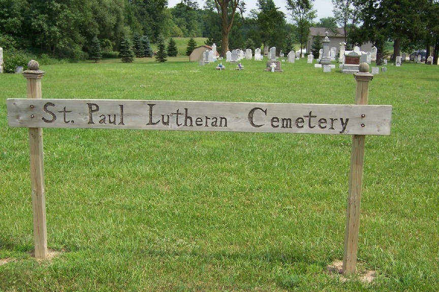
| Description | : | Sexton:Pastor Clark 989-593-2354 The cemetery is located in Dallas Township on the east side of S Wright Road (County Road 543) about 0.5 miles south of its intersection with W Taft Road. The U.S. Geological Survey (USGS) Geographic Names Information System (GNIS) feature ID for the cemetery is 637000 (Saint Paul’s Cemetery / Saint Pauls Cemetery). |
frequently asked questions (FAQ):
-
Where is Saint Pauls Lutheran Cemetery?
Saint Pauls Lutheran Cemetery is located at S Wright Road (County Road 543) Westphalia, Clinton County ,Michigan , 48894USA.
-
Saint Pauls Lutheran Cemetery cemetery's updated grave count on graveviews.com?
0 memorials
-
Where are the coordinates of the Saint Pauls Lutheran Cemetery?
Latitude: 42.9505997
Longitude: -84.7388992
Nearby Cemetories:
1. Oak Ridge Cemetery
Saint Johns, Clinton County, USA
Coordinate: 42.9583015, -84.7043991
2. Boughton Cemetery
Riley, Clinton County, USA
Coordinate: 42.9221992, -84.7052994
3. Saint Peter Lutheran Cemetery
Saint Johns, Clinton County, USA
Coordinate: 42.9230995, -84.7014008
4. Saint Marys Cemetery
Westphalia, Clinton County, USA
Coordinate: 42.9277992, -84.8116989
5. Bray Cemetery
Saint Johns, Clinton County, USA
Coordinate: 42.9594002, -84.6414032
6. Georgia Cemetery
Saint Johns, Clinton County, USA
Coordinate: 42.9439011, -84.6367035
7. Most Holy Trinity Cemetery
Fowler, Clinton County, USA
Coordinate: 43.0158005, -84.7975006
8. Wager Cemetery
Fowler, Clinton County, USA
Coordinate: 43.0321999, -84.7343979
9. Spaulding Cemetery
Pewamo, Ionia County, USA
Coordinate: 42.9693930, -84.8551150
10. Mount Calvary Cemetery
Pewamo, Ionia County, USA
Coordinate: 42.9893990, -84.8480988
11. Pioneer Cemetery
Portland, Ionia County, USA
Coordinate: 42.9431000, -84.8769400
12. Frink Cemetery
Saint Johns, Clinton County, USA
Coordinate: 43.0162970, -84.6313980
13. Pewamo Cemetery
Pewamo, Ionia County, USA
Coordinate: 43.0014000, -84.8632965
14. South Riley Township Cemetery
South Riley, Clinton County, USA
Coordinate: 42.8633003, -84.6414032
15. Beach Cemetery
Maple Rapids, Clinton County, USA
Coordinate: 43.0616989, -84.7003021
16. North Eagle Cemetery
Eagle Township, Clinton County, USA
Coordinate: 42.8396988, -84.7956009
17. East Plains Cemetery
Lebanon Township, Clinton County, USA
Coordinate: 43.0513800, -84.8368400
18. Eddy Family Cemetery
Eagle, Clinton County, USA
Coordinate: 42.8287100, -84.7691800
19. Merrihew Cemetery
Olive Township, Clinton County, USA
Coordinate: 42.9294014, -84.5663986
20. Gardner Cemetery
Bingham Township, Clinton County, USA
Coordinate: 43.0307999, -84.6003036
21. Horrocks Family Farm Cemetery
Lyons, Ionia County, USA
Coordinate: 42.9296950, -84.9169710
22. Wacousta Cemetery
Wacousta, Clinton County, USA
Coordinate: 42.8206980, -84.6963820
23. Alward Cemetery
Olive Township, Clinton County, USA
Coordinate: 42.8925018, -84.5717010
24. Prairie Cemetery
Saint Johns, Clinton County, USA
Coordinate: 43.0456009, -84.6066971