
| Memorials | : | 8 |
| Location | : | Glenmore, Brown County, USA |
| Coordinate | : | 44.4200000, -87.8913890 |
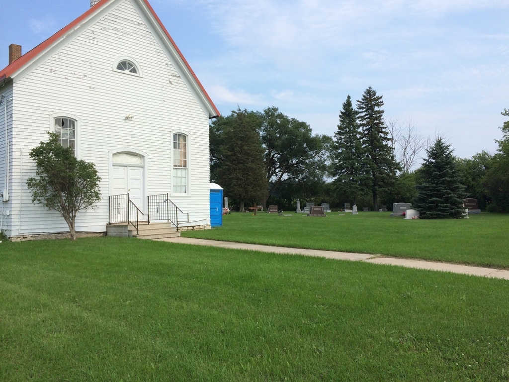
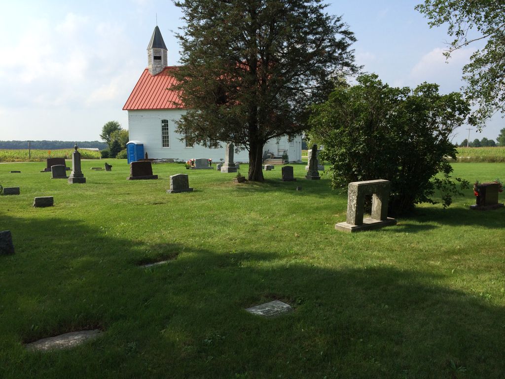
| Description | : | This small cemetery is at the corner of Brown County Highway R, (South of Highway 29) and Trestle Road. 4431 Stagecoach Road, Green Bay, Wisconsin 54311 More records of Saint Pauls Lutheran Cemetery are available with the Bay Area Genealogical Society, of Green Bay, Wisconsin. Between 2000-2012, the church building was owned by a small congregation called the Freedom House of Prayer, that is no longer meeting there. There is a wide time range of interments with births in the early 1800s and a recent burial in March of 2014. The little church building is for sale (August 2014). |
frequently asked questions (FAQ):
-
Where is Saint Pauls Lutheran Cemetery?
Saint Pauls Lutheran Cemetery is located at Glenmore, Brown County ,Wisconsin ,USA.
-
Saint Pauls Lutheran Cemetery cemetery's updated grave count on graveviews.com?
8 memorials
-
Where are the coordinates of the Saint Pauls Lutheran Cemetery?
Latitude: 44.4200000
Longitude: -87.8913890
Nearby Cemetories:
1. Holy Trinity Cemetery
Pine Grove, Brown County, USA
Coordinate: 44.4124200, -87.8808400
2. Our Saviors of Eaton Cemetery
Poland, Brown County, USA
Coordinate: 44.4434000, -87.8681000
3. Bellevue Cemetery
Bellevue, Brown County, USA
Coordinate: 44.4660988, -87.9218979
4. Saints Cyril and Methodius Catholic Cemetery
Poland, Brown County, USA
Coordinate: 44.4440400, -87.8242300
5. Saint Marys Cemetery
Glenmore, Brown County, USA
Coordinate: 44.3725000, -87.9475700
6. Holy Martyrs of Gorcum Cemetery
Preble, Brown County, USA
Coordinate: 44.4866900, -87.9075200
7. Emanuel Lutheran Church Cemetery
Henrysville, Brown County, USA
Coordinate: 44.4432000, -87.7909000
8. Zion Lutheran Cemetery
Glenmore, Brown County, USA
Coordinate: 44.3618140, -87.9599760
9. Immanuel Evangelical Lutheran Church Cemetery
Shirley, Brown County, USA
Coordinate: 44.3575070, -87.9526220
10. All Saints Catholic Church Cemetery
Denmark, Brown County, USA
Coordinate: 44.3492000, -87.8356500
11. Saint Josephs Cemetery
Henrysville, Brown County, USA
Coordinate: 44.4510994, -87.7838974
12. Holy Trinity Catholic Church Cemetery
Denmark, Brown County, USA
Coordinate: 44.3330900, -87.8874100
13. Humboldt Cemetery
Humboldt, Brown County, USA
Coordinate: 44.5014000, -87.8469009
14. West Danish Cemetery
Denmark, Brown County, USA
Coordinate: 44.3535995, -87.8058014
15. Bristol Cemetery
De Pere, Brown County, USA
Coordinate: 44.4149430, -88.0215805
16. Saint Marys Cemetery
Humboldt, Brown County, USA
Coordinate: 44.5016022, -87.8222275
17. Eastside Cemetery
Denmark, Brown County, USA
Coordinate: 44.3591995, -87.7866974
18. Rovnost National Cemetery
Denmark, Brown County, USA
Coordinate: 44.3276100, -87.8518500
19. Chauncey Aldrich Memorial Cemetery
Green Bay, Brown County, USA
Coordinate: 44.5165220, -87.9218240
20. Saint Annes Memorial Garden
De Pere, Brown County, USA
Coordinate: 44.4401100, -88.0370000
21. Potters Field Cemetery
Green Bay, Brown County, USA
Coordinate: 44.5242004, -87.9269028
22. Saint Anna Christian Catholic Cemetery
Montpelier, Kewaunee County, USA
Coordinate: 44.4282990, -87.7375031
23. Eastside Cemetery
Cooperstown, Manitowoc County, USA
Coordinate: 44.3269000, -87.8075000
24. Saint Hubert Cemetery
Sugar Bush, Brown County, USA
Coordinate: 44.5018997, -87.7825012