
| Memorials | : | 3 |
| Location | : | Milverton, Perth County, Canada |
| Coordinate | : | 43.5692860, -80.9189270 |
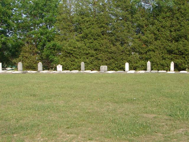
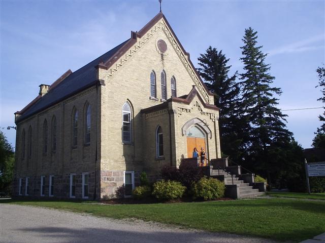
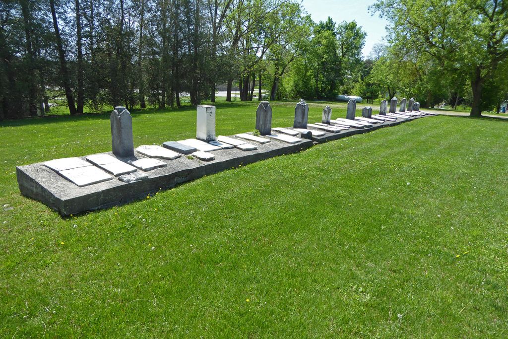
| Description | : | By 1858 Methodists in the area had established a place for worship, Saint Paul's Methodist Church, with a cemetery on the site beside it. The early Presbyterians also held services in the church. In 1874 the Wesleyan Methodists, Primitive Methodists, Methodist New Connection and Methodist Episcopal all joined to form one Methodist Church. In 1928 at the time of Church Union, the name was changed to Saint Paul's United Church. In 1970 the church was sold to the Milverton Conservative Mennonite Congregation but care of the adjoining cemetery remained in the hands of the United Church. In 1978 the surviving... Read More |
frequently asked questions (FAQ):
-
Where is Saint Pauls United Cemetery?
Saint Pauls United Cemetery is located at Milverton, Perth County ,Ontario ,Canada.
-
Saint Pauls United Cemetery cemetery's updated grave count on graveviews.com?
3 memorials
-
Where are the coordinates of the Saint Pauls United Cemetery?
Latitude: 43.5692860
Longitude: -80.9189270
Nearby Cemetories:
1. Saint Peter's Lutheran Cemetery
Milverton, Perth County, Canada
Coordinate: 43.5702820, -80.9203890
2. Greenwood Cemetery
Milverton, Perth County, Canada
Coordinate: 43.5650940, -80.9123535
3. Morningview Amish Mennonite Cemetery
Perth County, Canada
Coordinate: 43.5941920, -80.9250350
4. Gravelridge Cemetery
Milverton, Perth County, Canada
Coordinate: 43.5548930, -80.9645820
5. 7th Line Amish Mennonite Cemetery
Mornington Township, Perth County, Canada
Coordinate: 43.6062202, -80.9167938
6. Poole West Amish Mennonite Cemetery
Poole, Perth County, Canada
Coordinate: 43.5366783, -80.8865128
7. Trinity Anglican Cemetery
North Perth, Perth County, Canada
Coordinate: 43.6039670, -80.9508960
8. Saint John's Lutheran Cemetery
Poole, Perth County, Canada
Coordinate: 43.5321884, -80.8743515
9. Poole Mennonite Cemetery
Poole, Perth County, Canada
Coordinate: 43.5352974, -80.8661575
10. Riverdale Mennonite Cemetery
Millbank, Perth County, Canada
Coordinate: 43.5757904, -80.8431549
11. Knox Wesley United Cemetery
Millbank, Perth County, Canada
Coordinate: 43.5742510, -80.8427670
12. Grace Anglican Cemetery
Millbank, Perth County, Canada
Coordinate: 43.5697300, -80.8324200
13. Millbank Old Methodist Cemetery
Millbank, Perth County, Canada
Coordinate: 43.5702140, -80.8322070
14. Bethel Conservative Mennonite Cemetery
Millbank, Perth County, Canada
Coordinate: 43.5678520, -80.8234787
15. Donegal Cemetery
Donegal, Perth County, Canada
Coordinate: 43.6362610, -80.9748154
16. Riser Reschly Burial Plot
Kingwood, Waterloo Regional Municipality, Canada
Coordinate: 43.5146675, -80.8403397
17. Kingwood Cemetery
Kingwood, Waterloo Regional Municipality, Canada
Coordinate: 43.5143509, -80.8399429
18. 7th Line Amish Mennonite Cemetery
Wellesley Township, Waterloo Regional Municipality, Canada
Coordinate: 43.5560112, -80.8073654
19. Saint Paul's Lutheran Cemetery
Moserville, Perth County, Canada
Coordinate: 43.4962692, -80.9707794
20. North Mornington Presbyterian Cemetery
Perth East Township, Perth County, Canada
Coordinate: 43.6480000, -80.8864200
21. Faith Mennonite Cemetery
Kingwood, Waterloo Regional Municipality, Canada
Coordinate: 43.5096950, -80.8329780
22. Carthage Methodist Pioneer Memorial Cemetery
Carthage, Perth County, Canada
Coordinate: 43.6457200, -80.8619000
23. Fair Haven Mennonite Cemetery
Fernbank, Perth County, Canada
Coordinate: 43.6124030, -80.8082200
24. Klearview Mennonite Cemetery
Carthage, Perth County, Canada
Coordinate: 43.6428150, -80.8364370