
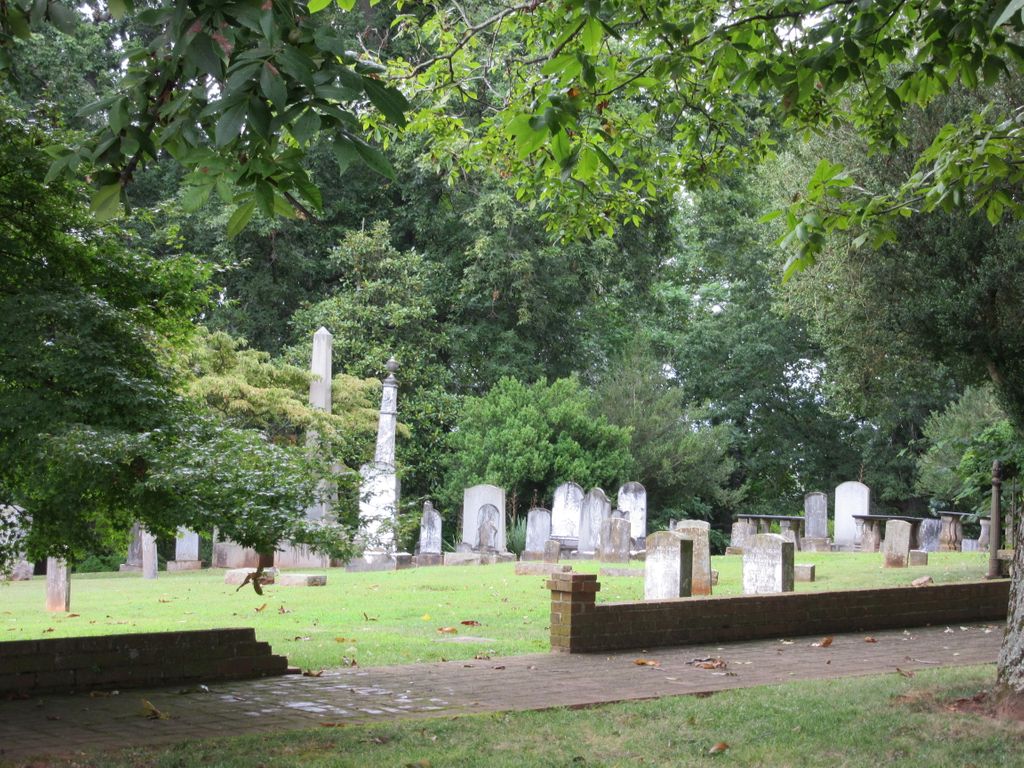
| Memorials | : | 5 |
| Location | : | Forest, Bedford County, USA |
| Coordinate | : | 37.3781090, -79.3083115 |
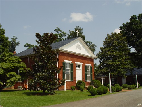
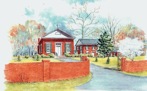
| Description | : | ROUTE 221 South toward Bedford. RIGHT at Intersection of 221 and PERROWVILLE Road. Saint Stephen's is located on the right just past Jefferson Forest High School & stadium parking lot. Saint Stephen's Episcopal Church was established by the Rev'd Nicholas Hamner Cobbs (later Bishop of Alabama) in 1824. The first building was completed in 1825 on land given by Anne Irvine Moseley, the mother of Elizabeth Moseley Radford. Mrs. Moseley had purchased part of the Poplar Forest tract from Martha Jefferson Randolph, the oldest daughter of Thomas Jefferson, who had given the land to his daughter for her dowry in 1790.... Read More |
frequently asked questions (FAQ):
-
Where is Saint Stephens Episcopal Church Cemetery?
Saint Stephens Episcopal Church Cemetery is located at 1695 Perrowville Road Forest, Bedford County ,Virginia , 24511USA.
-
Saint Stephens Episcopal Church Cemetery cemetery's updated grave count on graveviews.com?
5 memorials
-
Where are the coordinates of the Saint Stephens Episcopal Church Cemetery?
Latitude: 37.3781090
Longitude: -79.3083115

Nearby Cemetories:
1. Forest Baptist Church Cemetery
Forest, Bedford County, USA
Coordinate: 37.3629950, -79.2824940
2. Berkeley Cemetery
Forest, Bedford County, USA
Coordinate: 37.3984090, -79.3394340
3. Forest Level Baptist Church Cemetery
Forest, Bedford County, USA
Coordinate: 37.3525887, -79.2804108
4. Virginia Memorial Park
Forest, Bedford County, USA
Coordinate: 37.3788986, -79.3535995
5. Saint Paul Baptist Church Cemetery
Forest, Bedford County, USA
Coordinate: 37.3372470, -79.3167330
6. Elk Hill
Bedford County, USA
Coordinate: 37.4090150, -79.3435220
7. Altha Grove Baptist Church Cemetery
Forest, Bedford County, USA
Coordinate: 37.4254187, -79.3066951
8. Mount Carmel United Methodist Church
Forest, Bedford County, USA
Coordinate: 37.4199530, -79.3448120
9. Harris Family Cemetery
Forest, Bedford County, USA
Coordinate: 37.3921005, -79.3733642
10. Norwood Cemetery
Forest, Bedford County, USA
Coordinate: 37.3924799, -79.3736252
11. Massie Family Cemetery
Goode, Bedford County, USA
Coordinate: 37.3809720, -79.3793540
12. North Bedford Baptist Church Cemetery
Forest, Bedford County, USA
Coordinate: 37.4342440, -79.3187270
13. Ivy Chapel Cemetery
Coffee, Bedford County, USA
Coordinate: 37.4337233, -79.3235184
14. Pleasant View Baptist Church Cemetery
Forest, Bedford County, USA
Coordinate: 37.3905000, -79.2376660
15. Leftwich, Tolley and Scott Cemetery
Forest, Bedford County, USA
Coordinate: 37.3201410, -79.2958400
16. Mount Cifax Cemetery
Bellevue, Bedford County, USA
Coordinate: 37.3842720, -79.3853040
17. McDaniel Cemetery
Boonsboro, Bedford County, USA
Coordinate: 37.4380000, -79.2892000
18. Lockewood Cemetery
Lynchburg, Lynchburg City, USA
Coordinate: 37.3531080, -79.2369200
19. Terrace View Church Cemetery
Forest, Bedford County, USA
Coordinate: 37.3274155, -79.3588333
20. Leftwich Family Cemetery
Forest, Bedford County, USA
Coordinate: 37.3128970, -79.3178770
21. Anderson Family Cemetery
Goode, Bedford County, USA
Coordinate: 37.3897000, -79.3904500
22. Oakland United Methodist Church Cemetery
Goode, Bedford County, USA
Coordinate: 37.3650920, -79.3924227
23. Timberlake United Methodist Church Columbarium
Rustburg, Campbell County, USA
Coordinate: 37.3273730, -79.2502560
24. First Baptist Church of Goode Cemetery
Goode, Bedford County, USA
Coordinate: 37.3561429, -79.3905772