| Memorials | : | 1 |
| Location | : | Saint Thomas, Franklin County, USA |
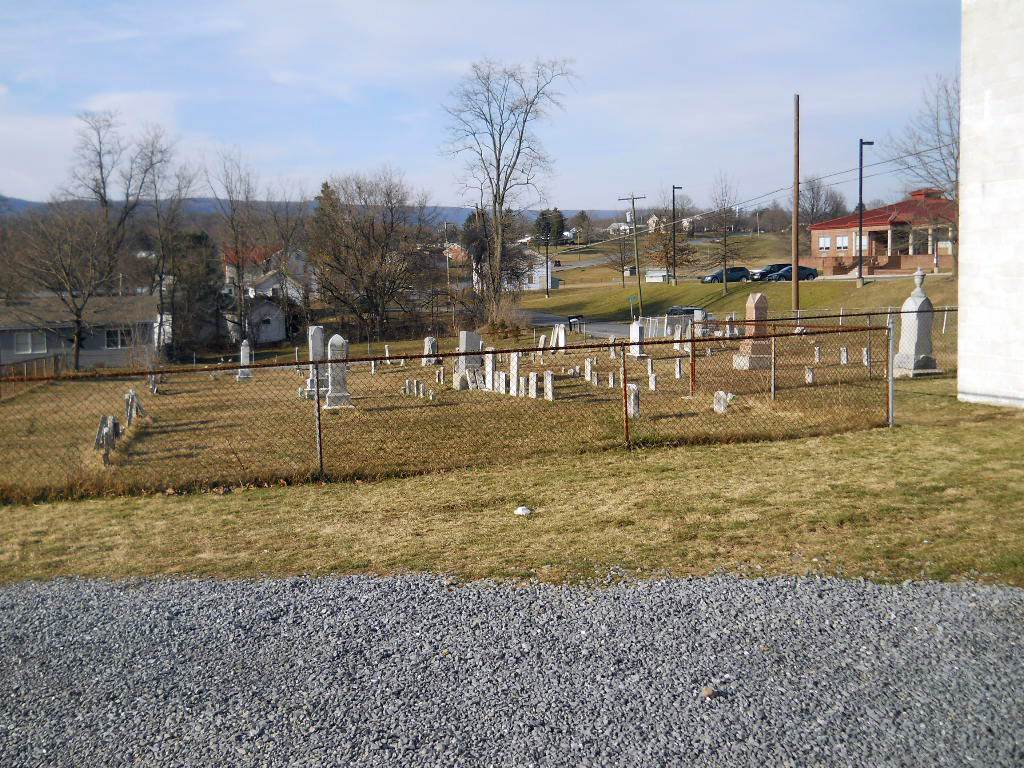
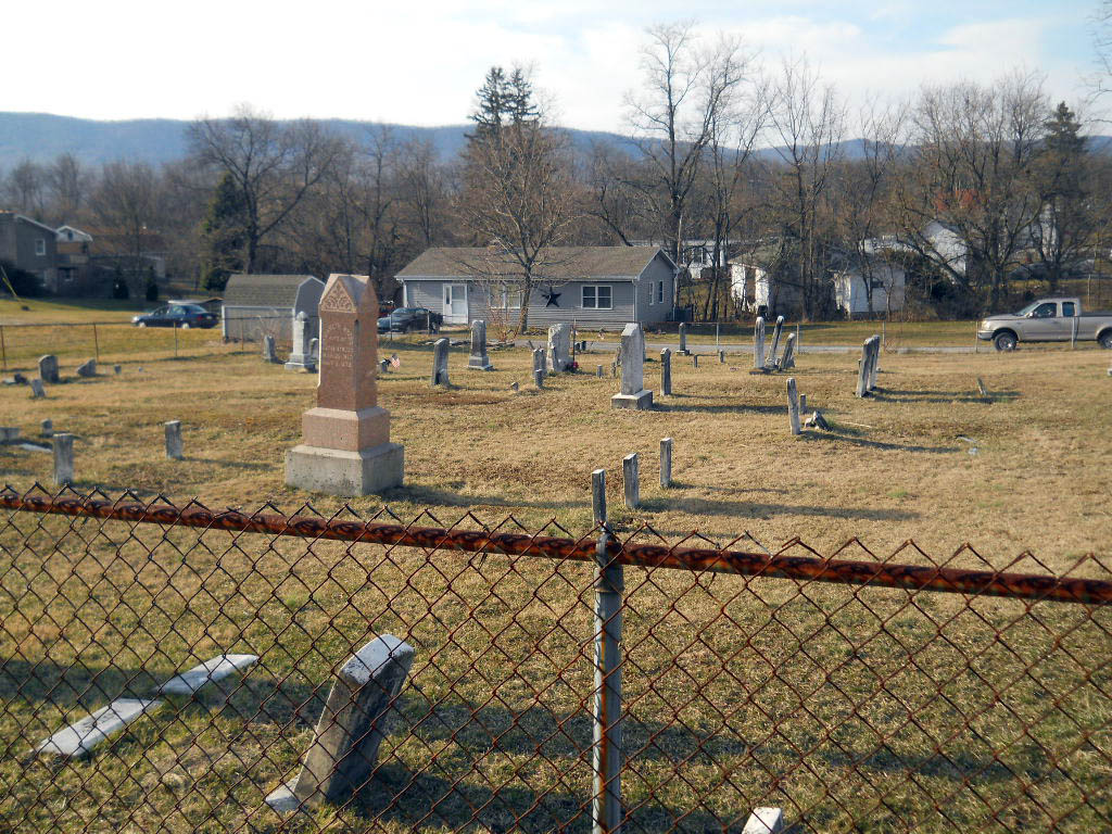
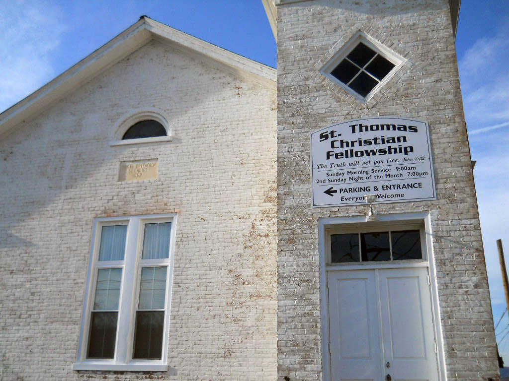
| Description | : | The cemetery is behind what used to be the St. Thomas United Brethern Church. As of Oct 2013, the building is a community fellowship center. The cemetery is small,fenced in,but accessible and is behind the building. To get to the cemetery from the Chambersburg town square, travel west on Rte. 30 into the village of St. Thomas. At the center of St. Thomas, turn right. The cemetery is a short distance on the left. |
frequently asked questions (FAQ):
-
Where is Saint Thomas United Brethren Church?
Saint Thomas United Brethren Church is located at Saint Thomas, Franklin County, USA.
-
Saint Thomas United Brethren Church cemetery's updated grave count on graveviews.com?
1 memorials
Nearby Cemetories:
1. Amberson Union Cemetery
Amberson, Franklin County, USA
Coordinate: 39.8698570, -77.6753380
2. Piper Burial Ground
Amberson, Franklin County, USA
Coordinate: 39.9417000, -77.6644000
3. Stake Cemetery
Amberson, Franklin County, USA
Coordinate: 39.9567000, -77.6453000
4. Cedar Valley Mennonite Church Cemetery
Franklin County, USA
Coordinate: 39.9380860, -77.6748680
5. Center Methodist Church Cemetery
Franklin County, USA
Coordinate: 39.9459000, -77.7463000
6. Air Hill Cemetery
Chambersburg, Franklin County, USA
Coordinate: 39.9589729, -77.7540283
7. Besore Cemetery
Chambersburg, Franklin County, USA
Coordinate: 39.9994300, -77.6247400
8. Bethel Church Cemetery
Chambersburg, Franklin County, USA
Coordinate: 39.9825000, -77.7144000
9. Boyer Cemetery
Chambersburg, Franklin County, USA
Coordinate: 39.9410670, -77.6615500
10. Brechbill Cemetery
Chambersburg, Franklin County, USA
Coordinate: 39.9155000, -77.6244000
11. Brinzer-Brainer Cemetery
Chambersburg, Franklin County, USA
Coordinate: 39.8671500, -77.5821800
12. Browns Mill Old Baptist Brethren Church Cemetery
Chambersburg, Franklin County, USA
Coordinate: 39.9349823, -77.6633301
13. Calvary Mennonite Church Cemetery
Chambersburg, Franklin County, USA
Coordinate: 39.8698570, -77.6753380
14. Cedar Grove Cemetery
Chambersburg, Franklin County, USA
Coordinate: 39.9417000, -77.6644000
15. Chambersburg Mennonite Cemetery
Chambersburg, Franklin County, USA
Coordinate: 39.9567000, -77.6453000
16. Corpus Christi Cemetery
Chambersburg, Franklin County, USA
Coordinate: 39.9380860, -77.6748680
17. Crider Family Farm Cemetery
Chambersburg, Franklin County, USA
Coordinate: 39.9459000, -77.7463000
18. Criders Cemetery
Chambersburg, Franklin County, USA
Coordinate: 39.9589729, -77.7540283
19. Culbertson Mennonite Church Cemetery
Chambersburg, Franklin County, USA
Coordinate: 39.9994300, -77.6247400
20. Emanuel's Liberal United Brethren Church Cemetery
Chambersburg, Franklin County, USA
Coordinate: 39.9825000, -77.7144000
21. Falling Spring Presbyterian Church Cemetery
Chambersburg, Franklin County, USA
Coordinate: 39.9410670, -77.6615500
22. Falling Spring Reformed Mennonite Cemetery
Chambersburg, Franklin County, USA
Coordinate: 39.9155000, -77.6244000
23. Fetterhoff Chapel Cemetery
Chambersburg, Franklin County, USA
Coordinate: 39.8671500, -77.5821800
24. First Evangelical Lutheran Church Cemetery
Chambersburg, Franklin County, USA
Coordinate: 39.9349823, -77.6633301


