
| Memorials | : | 0 |
| Location | : | Perkinsville, Steuben County, USA |
| Coordinate | : | 42.5093500, -77.6317100 |
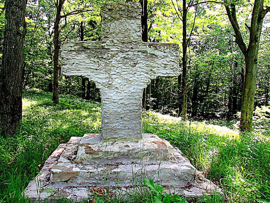
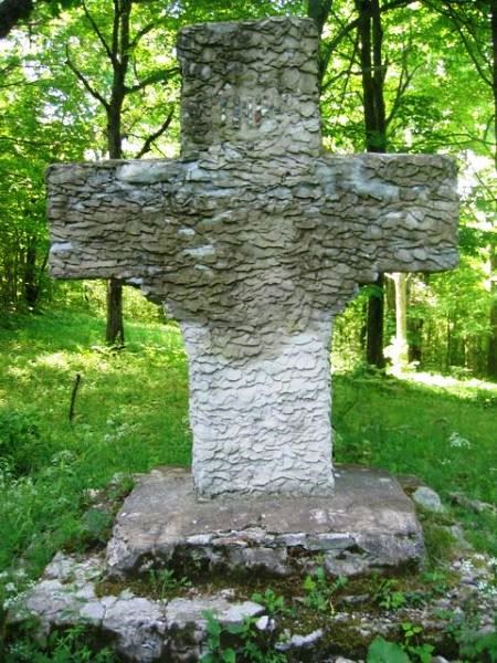
| Description | : | History of the Sandy Hill Church Cemetery compiled from a March 2, 1951 article in the Genesee Country Express by Mrs. Earl C. Armstrong. High on Sandy Hill, overlooking Perkinsville, Wayland, Dansville, and Rogersville, German immigrants completed in 1836 a simple log church, surrounded by a graveyard, and marked by a large wooden cross. It has been called the pioneer church of Steuben County and for a while was the only place of worship for Protestants and Catholics alike for miles around. The earliest recorded burials date to about 1840, however there may have been burials there from the... Read More |
frequently asked questions (FAQ):
-
Where is Sandy Hill Church Cemetery?
Sandy Hill Church Cemetery is located at Acomb Road near Recktenwald Road Perkinsville, Steuben County ,New York ,USA.
-
Sandy Hill Church Cemetery cemetery's updated grave count on graveviews.com?
0 memorials
-
Where are the coordinates of the Sandy Hill Church Cemetery?
Latitude: 42.5093500
Longitude: -77.6317100
Nearby Cemetories:
1. Saint Peter's Cemetery
Perkinsville, Steuben County, USA
Coordinate: 42.5285988, -77.6256027
2. Greenlawn Cemetery
Dansville, Steuben County, USA
Coordinate: 42.5197400, -77.6716800
3. Sacred Heart Cemetery
Perkinsville, Steuben County, USA
Coordinate: 42.5411800, -77.6266930
4. Rogersville Forest Lawn Cemetery
Dansville, Steuben County, USA
Coordinate: 42.4735985, -77.6605988
5. Holy Cross Cemetery
Dansville, Livingston County, USA
Coordinate: 42.5433006, -77.6769028
6. North Loon Lake Cemetery
Wayland, Steuben County, USA
Coordinate: 42.5050880, -77.5665250
7. Lakeside Cemetery
Wayland, Steuben County, USA
Coordinate: 42.4895810, -77.5716990
8. Green Mount Cemetery
Dansville, Livingston County, USA
Coordinate: 42.5430984, -77.6813965
9. Bluff Point Cemetery
Dansville, Steuben County, USA
Coordinate: 42.5044360, -77.6989940
10. East Wayland Cemetery
Wayland, Steuben County, USA
Coordinate: 42.5349998, -77.5691986
11. Old Saint Joseph's Cemetery
Wayland, Steuben County, USA
Coordinate: 42.5594800, -77.6075600
12. North Oak Hill Cemetery
South Dansville, Steuben County, USA
Coordinate: 42.4703200, -77.6832500
13. Saint Joseph's Cemetery
Wayland, Steuben County, USA
Coordinate: 42.5625200, -77.6044980
14. Beachville Cemetery
Beachville, Steuben County, USA
Coordinate: 42.4516983, -77.6250000
15. Old Cemetery
Wayland, Steuben County, USA
Coordinate: 42.5671330, -77.5946220
16. Old Dansville Village Cemetery
Dansville, Livingston County, USA
Coordinate: 42.5570950, -77.6942610
17. Wayland Village Cemetery
Wayland, Steuben County, USA
Coordinate: 42.5723280, -77.5901780
18. Kidd - Fronk Cemetery
Dansville, Livingston County, USA
Coordinate: 42.5730553, -77.6724854
19. Haight Cemetery
Cohocton, Steuben County, USA
Coordinate: 42.5155830, -77.5347020
20. Poag's Hole Cemetery
South Dansville, Steuben County, USA
Coordinate: 42.4946310, -77.7287860
21. Pleasant Valley West Cemetery
Livingston County, USA
Coordinate: 42.5911789, -77.6376953
22. South Oak Hill Cemetery
South Dansville, Steuben County, USA
Coordinate: 42.4366989, -77.6847000
23. Doty's Corners Cemetery
South Dansville, Steuben County, USA
Coordinate: 42.4614601, -77.7282715
24. Saint Paul's New Lutheran Cemetery
Cohocton, Steuben County, USA
Coordinate: 42.5153740, -77.5148060