
| Memorials | : | 0 |
| Location | : | Hickory Flat, Benton County, USA |
| Coordinate | : | 34.7230988, -89.1430969 |
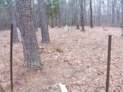
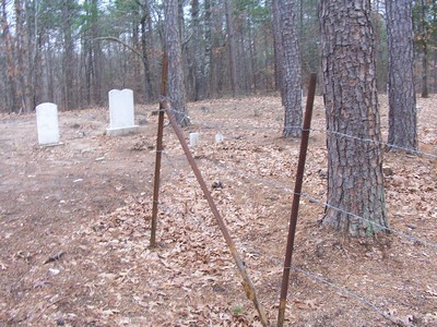
| Description | : | From Bethel Church on Pine Grove Road, go South by Southwest for .6 of a mile. Turn right onto a dirt logging road and go .45 of a mile to the cemetery. The logging road is West of Bethel Rd. and Hudspeth Rd. The Selph-Collins Graveyard is near Pine Grove Baptist Church off Highway 5 between Hickory Flat and Ashland, about 1/2 mile off Pine Grove Rd, between Pine Grove Baptist Church and Bethel Methodist Church. An old logging road leads almost right to the cemetery. It now sits in a forest that is extremely overgrown with trees, grass... Read More |
frequently asked questions (FAQ):
-
Where is Selph-Collins Graveyard?
Selph-Collins Graveyard is located at Hickory Flat, Benton County ,Mississippi ,USA.
-
Selph-Collins Graveyard cemetery's updated grave count on graveviews.com?
0 memorials
-
Where are the coordinates of the Selph-Collins Graveyard?
Latitude: 34.7230988
Longitude: -89.1430969
Nearby Cemetories:
1. Bethel United Methodist Cemetery
Hickory Flat, Benton County, USA
Coordinate: 34.7211609, -89.1367569
2. Hudspeth Cemetery
Benton County, USA
Coordinate: 34.7324982, -89.1622009
3. Duncan Cemetery
Benton County, USA
Coordinate: 34.7308311, -89.1072235
4. Pine Grove Cemetery
Pine Grove, Benton County, USA
Coordinate: 34.7064018, -89.1755981
5. Renick
Ashland, Benton County, USA
Coordinate: 34.7124100, -89.0947037
6. Bains Chapel Cemetery
Ashland, Benton County, USA
Coordinate: 34.7505280, -89.1806133
7. Simpson Cemetery
Ashland, Benton County, USA
Coordinate: 34.7640495, -89.1311569
8. Elliott Cemetery
Benton County, USA
Coordinate: 34.7122002, -89.1956024
9. Old Beech Hill Church of Christ Cemetery
Benton County, USA
Coordinate: 34.7459717, -89.0966034
10. McDonald Cemetery #3
Benton County, USA
Coordinate: 34.7646200, -89.1698670
11. Beech Hill Church of Christ Cemetery
Ashland, Benton County, USA
Coordinate: 34.7503014, -89.0947037
12. Minter Cemetery
Tippah County, USA
Coordinate: 34.7268982, -89.0832977
13. Curtis Creek Cemetery
Benton County, USA
Coordinate: 34.7682991, -89.1066971
14. Daniel Cemetery
Tippah County, USA
Coordinate: 34.7066994, -89.0780029
15. Rainey Cemetery
Ashland, Benton County, USA
Coordinate: 34.7700100, -89.1041100
16. Bluff Springs Cemetery
Ashland, Benton County, USA
Coordinate: 34.7722015, -89.1849976
17. Pleasant Hill Cemetery
Ashland, Benton County, USA
Coordinate: 34.7844009, -89.1577988
18. Ayers Cemetery
Benton County, USA
Coordinate: 34.7602997, -89.2058029
19. Jordan Cemetery
Benton County, USA
Coordinate: 34.7661018, -89.2003021
20. Shelby Creek Cemetery
Tippah County, USA
Coordinate: 34.7710991, -89.0877991
21. Smith Cemetery
Blue Mountain, Tippah County, USA
Coordinate: 34.7066193, -89.0611115
22. Smith Cemetery
Blue Mountain, Tippah County, USA
Coordinate: 34.6980705, -89.0585938
23. Whittentown Baptist Church Cemetery
Whitten Town, Tippah County, USA
Coordinate: 34.7780991, -89.0789032
24. Flat Rock Cemetery
Hickory Flat, Benton County, USA
Coordinate: 34.6563988, -89.0975037