
| Memorials | : | 233 |
| Location | : | Shelbina, Shelby County, USA |
| Coordinate | : | 39.6920000, -92.0500000 |
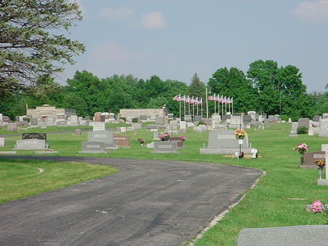
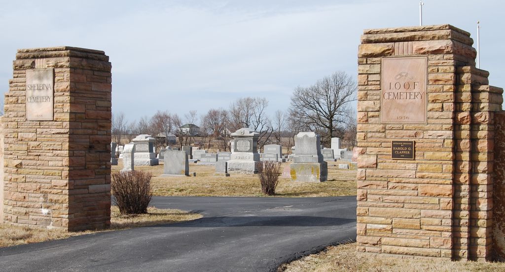
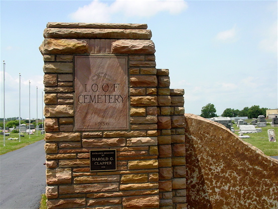
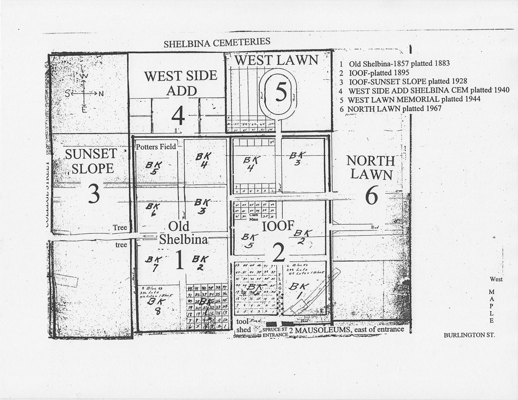
| Description | : | Shelbina Cemetery consists of six sections (originally six legally distinct cemeteries): 1. Old Shelbina, platted 1883, earliest grave 1857 2. Shelbina I.O.O.F., platted 1895 3. Sunset Slope, platted 1928 4. West Side Addition, platted 1940 5. West Lawn Memorial, platted 1944 6. North Lawn, platted 1967 The Shelby County Historical Society ([email protected]) has block and lot information about everyone known to be buried here. |
frequently asked questions (FAQ):
-
Where is Shelbina Cemetery?
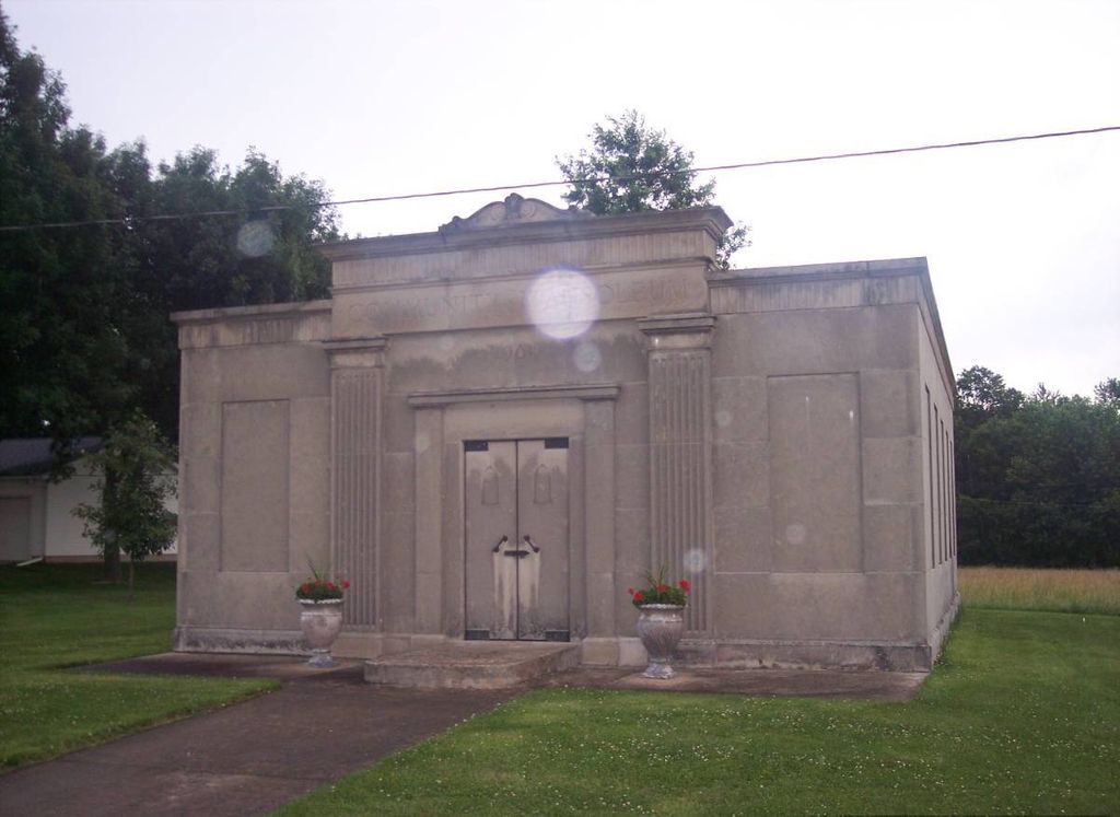
Shelbina Cemetery is located at West Spruce Street Shelbina, Shelby County ,Missouri ,USA.
-
Shelbina Cemetery cemetery's updated grave count on graveviews.com?
216 memorials
-
Where are the coordinates of the Shelbina Cemetery?
Latitude: 39.6920000
Longitude: -92.0500000
Nearby Cemetories:
1. Shelbina Mausoleum No 1 1956
Shelbina, Shelby County, USA
Coordinate: 39.6928200, -92.0482200
2. Shelbina Mausoleum No 2 1961
Shelbina, Shelby County, USA
Coordinate: 39.6930200, -92.0481800
3. Saint Marys Cemetery
Shelbina, Shelby County, USA
Coordinate: 39.6833000, -92.0366974
4. Smith Cemetery
Shelby County, USA
Coordinate: 39.7299995, -92.0550003
5. Roff Cemetery
Shelbina, Shelby County, USA
Coordinate: 39.7379885, -92.0390284
6. Wood Cemetery
Shelby County, USA
Coordinate: 39.7406006, -92.0950012
7. Crooked Creek Cemetery
Paris, Monroe County, USA
Coordinate: 39.6237984, -92.0579987
8. Crooked Creek African American Cemetery
Paris, Monroe County, USA
Coordinate: 39.6173990, -92.0509360
9. Gilchrist Cemetery
Shelbina, Shelby County, USA
Coordinate: 39.7483531, -91.9854958
10. Eaton Cemetery
Shelbyville, Shelby County, USA
Coordinate: 39.7621994, -92.0044022
11. Oakridge Baptist Church Cemetery
Lentner, Shelby County, USA
Coordinate: 39.6739900, -92.1567200
12. Greenwood Cemetery
Monroe County, USA
Coordinate: 39.6203003, -91.9927979
13. Spencer Chapel Cemetery
Monroe County, USA
Coordinate: 39.6175003, -92.1063995
14. Bacon Chapel Cemetery
Shelbyville, Shelby County, USA
Coordinate: 39.7511487, -92.1368436
15. Collins Cemetery
Monroe County, USA
Coordinate: 39.6164017, -91.9766998
16. Fairview Cemetery
Shelby County, USA
Coordinate: 39.7818985, -91.9760971
17. Kendall Mount Olive Cemetery
Shelby County, USA
Coordinate: 39.7167900, -91.9150900
18. Shelby Memorial Cemetery
Shelbyville, Shelby County, USA
Coordinate: 39.8046330, -92.0448310
19. Shelbyville Mausoleum
Shelbyville, Shelby County, USA
Coordinate: 39.8048900, -92.0462300
20. Oak Dale Cemetery
Shelby County, USA
Coordinate: 39.7620700, -91.9336900
21. Hiles Cemetery
Shelbyville, Shelby County, USA
Coordinate: 39.8058014, -92.0691986
22. Shelbyville Masonic Cemetery
Shelbyville, Shelby County, USA
Coordinate: 39.8081100, -92.0465600
23. Ellis Cemetery
North Fork, Monroe County, USA
Coordinate: 39.6159910, -91.9270720
24. Worland-Jarboe Cemetery
Monroe County, USA
Coordinate: 39.6100197, -91.9299011