
| Memorials | : | 8 |
| Location | : | Sherburne, Chenango County, USA |
| Coordinate | : | 42.6944008, -75.5322037 |
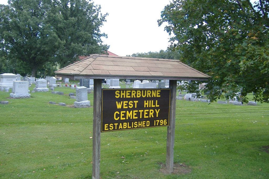
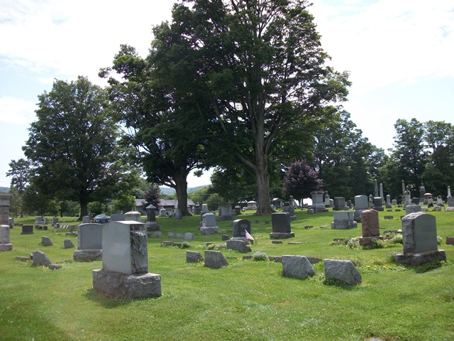
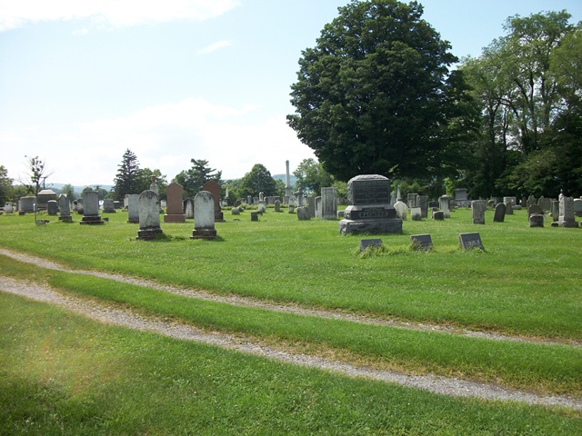
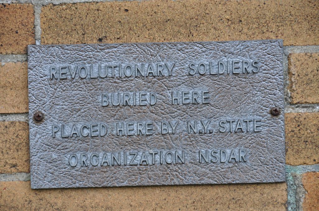
| Description | : | West Hill Cemetery is a historic cemetery at Sherburne in Chenango County, New York. The cemetery contains approximately 4,683 burials, two thirds of which predate 1950. The earliest burial dates to 1803. The cemetery includes a small, one story brick chapel built in 1905.[2] It was added to the National Register of Historic Places in 2006. - "National Register Information System". National Register of Historic Places. National Park Service. 2009-03-13 |
frequently asked questions (FAQ):
-
Where is Sherburne West Hill Cemetery?
Sherburne West Hill Cemetery is located at 2597 State Highway 80 Sherburne, Chenango County ,New York , 13460USA.
-
Sherburne West Hill Cemetery cemetery's updated grave count on graveviews.com?
8 memorials
-
Where are the coordinates of the Sherburne West Hill Cemetery?
Latitude: 42.6944008
Longitude: -75.5322037


Nearby Cemetories:
1. Sherburne Quarter Cemetery
Sherburne, Chenango County, USA
Coordinate: 42.6927986, -75.5074997
2. Smyrna East Cemetery
Smyrna, Chenango County, USA
Coordinate: 42.6880000, -75.5652000
3. Ramer Family Cemetery
Earlville, Madison County, USA
Coordinate: 42.7229500, -75.5338530
4. Saint Malachy Cemetery
Sherburne, Chenango County, USA
Coordinate: 42.6880550, -75.4927770
5. Christ Church Cemetery
Sherburne, Chenango County, USA
Coordinate: 42.6796188, -75.4956970
6. First Settlers Cemetery
Smyrna, Chenango County, USA
Coordinate: 42.6828600, -75.5724000
7. Willcox Cemetery
Smyrna, Chenango County, USA
Coordinate: 42.7213900, -75.5549500
8. Smyrna West Cemetery
Smyrna, Chenango County, USA
Coordinate: 42.6868000, -75.5749100
9. Reynolds Cemetery
Smyrna, Chenango County, USA
Coordinate: 42.6679700, -75.5635800
10. Quaker Cemetery
Smyrna, Chenango County, USA
Coordinate: 42.6785500, -75.5750400
11. Stover Cemetery
Smyrna, Chenango County, USA
Coordinate: 42.6557999, -75.5702972
12. Earlville Cemetery
Earlville, Madison County, USA
Coordinate: 42.7419853, -75.5448151
13. Mount Pleasant Cemetery (Defunct)
Earlville, Madison County, USA
Coordinate: 42.7431160, -75.5415900
14. Harrisville Cemetery
Sherburne, Chenango County, USA
Coordinate: 42.6803500, -75.4650200
15. East Hill Cemetery
Sherburne, Chenango County, USA
Coordinate: 42.6913986, -75.4542007
16. Card Farm Cemetery
Lebanon, Madison County, USA
Coordinate: 42.7422530, -75.5968490
17. Kendricks Road Cemetery
Sherburne, Chenango County, USA
Coordinate: 42.6679410, -75.4428260
18. North Norwich Cemetery
North Norwich, Chenango County, USA
Coordinate: 42.6191660, -75.5191660
19. Poolville Cemetery
Poolville, Madison County, USA
Coordinate: 42.7683029, -75.5058060
20. Ferris Cemetery
Smyrna, Chenango County, USA
Coordinate: 42.6871400, -75.6366200
21. Brown Cemetery
Plymouth, Chenango County, USA
Coordinate: 42.6333300, -75.5962400
22. Stone Family Cemetery
Hamilton, Madison County, USA
Coordinate: 42.7479424, -75.6135683
23. Cox Cemetery
Plymouth, Chenango County, USA
Coordinate: 42.6341200, -75.6055700
24. Ramsdale Cemetery
Sherburne, Chenango County, USA
Coordinate: 42.7401060, -75.4399770