
| Memorials | : | 0 |
| Location | : | Andalusia, Covington County, USA |
| Coordinate | : | 31.1152650, -86.4853300 |
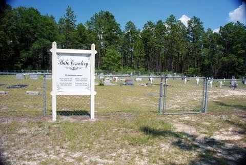
| Description | : | Location: Shiloh Cemetery Location: T2N-R16E-S30. Take Hwy. 55 South out of Andalusia, AL. Go 13-14 miles and turn right on Hwy. 24. Go about 1 1/4 miles, then turn right on dirt road. Go about 1 1/2 miles. Cemetery will be on the right. Compiled by Gerald & Joan Hidle 1996. |
frequently asked questions (FAQ):
-
Where is Shiloh Cemetery?
Shiloh Cemetery is located at Andalusia, Covington County ,Alabama ,USA.
-
Shiloh Cemetery cemetery's updated grave count on graveviews.com?
0 memorials
-
Where are the coordinates of the Shiloh Cemetery?
Latitude: 31.1152650
Longitude: -86.4853300


Nearby Cemetories:
1. Red Oak Baptist Church Cemetery
Red Oak, Covington County, USA
Coordinate: 31.1399994, -86.4608002
2. North Creek Cemetery
Red Oak, Covington County, USA
Coordinate: 31.0949993, -86.4278030
3. Liberty Hill Assembly of God Cemetery
Florala, Covington County, USA
Coordinate: 31.0783005, -86.4366989
4. Shady Hill Cemetery
Covington County, USA
Coordinate: 31.1517260, -86.5384050
5. Zion Rock Cemetery
Beda, Covington County, USA
Coordinate: 31.0806007, -86.5524979
6. Judson Baptist Church Cemetery
Covington County, USA
Coordinate: 31.1980991, -86.4505997
7. Lewis Cemetery
Covington County, USA
Coordinate: 31.0265950, -86.5125690
8. Enon Baptist Church Cemetery
Andalusia, Covington County, USA
Coordinate: 31.1714001, -86.3925018
9. Beda Cemetery
Beda, Covington County, USA
Coordinate: 31.0513992, -86.5828018
10. Damascus Baptist Church Cemetery
Florala, Covington County, USA
Coordinate: 31.0167007, -86.4297028
11. Carolina Baptist Church Cemetery
Covington County, USA
Coordinate: 31.2238846, -86.5098648
12. Pleasant Home Baptist Cemetery
Covington County, USA
Coordinate: 31.1597004, -86.6063995
13. Hopewell United Methodist Church Cemetery
Florala, Covington County, USA
Coordinate: 31.0020020, -86.5075720
14. Mount Hermon AOG Cemetery
Florala, Covington County, USA
Coordinate: 31.0128590, -86.5644080
15. Ebenezer Cemetery
Laurel Hill, Okaloosa County, USA
Coordinate: 30.9911480, -86.5133209
16. Christian Home United Methodist Church Cemetery
Lockhart, Covington County, USA
Coordinate: 31.0043300, -86.4118500
17. Newell Cemetery
Covington County, USA
Coordinate: 30.9958000, -86.5607986
18. Five Run Cemetery
Libertyville, Covington County, USA
Coordinate: 31.2454700, -86.4300000
19. Wing Cemetery at Wayside Church
Wing, Covington County, USA
Coordinate: 31.0249996, -86.6102982
20. New Travelers Rest Church Cemetery
Laurel Hill, Okaloosa County, USA
Coordinate: 30.9734592, -86.4941788
21. Cedar Grove Cemetery
Laurel Hill, Okaloosa County, USA
Coordinate: 30.9719009, -86.4997025
22. Old Ebenezer Cemetery
Laurel Hill, Okaloosa County, USA
Coordinate: 30.9741993, -86.5271988
23. Salem Baptist Church Cemetery
Covington County, USA
Coordinate: 31.2525005, -86.5498962
24. Lockhart Cemetery
Lockhart, Covington County, USA
Coordinate: 31.0058002, -86.3638992