
| Memorials | : | 0 |
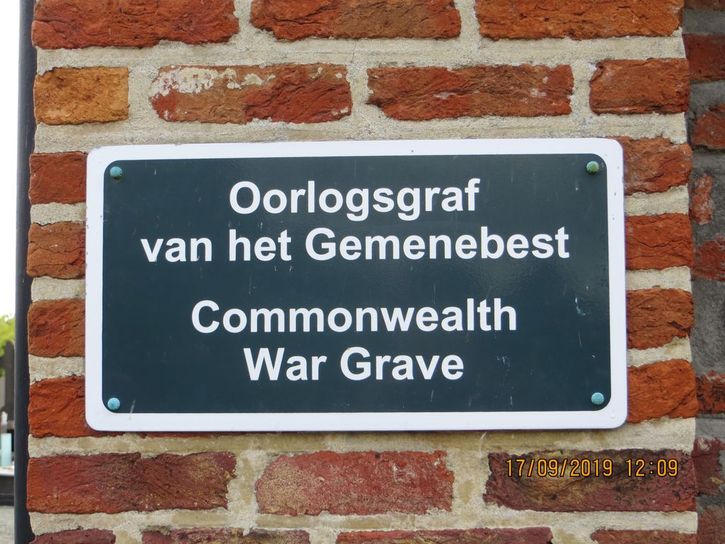
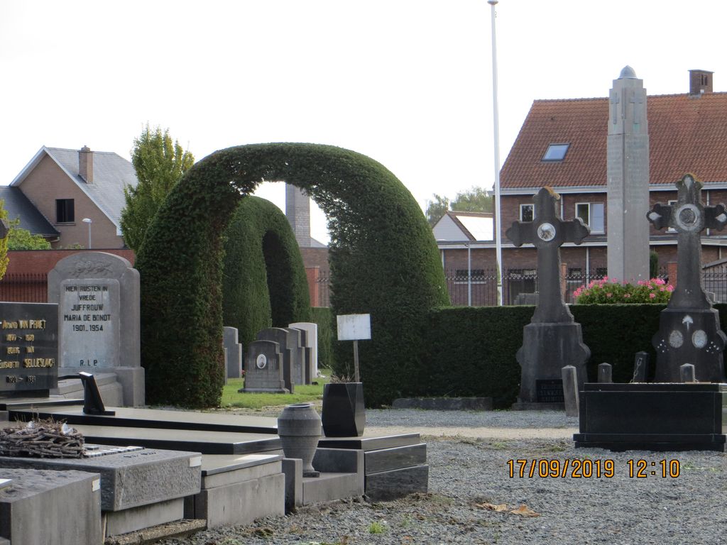
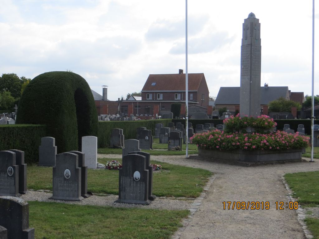
| Location | : | Sint-Amands, Arrondissement Mechelen, Belgium |
| Coordinate | : | 51.0513800, 4.2012800 |
| Description | : | Location Information: The village of Sint-Amands is located north-east of the town of Dendemonde off the N17 which runs between Dendermonde and Willebroek. From Dendermonde follow the N17 direction Willebroek past the river Schelde and over the railway, the road bears left here and after a short distance the turning for Sind-Amands is on the left. Turn left and follow the road onto the village, cross the railway and take the first turning on the left called Leerlooierslaan. The cemetery is at the end of this road on the right. Turn right at the end and the main entrance is... Read More |
frequently asked questions (FAQ):
-
Where is Sint-Amands Communal Cemetery?
Sint-Amands Communal Cemetery is located at Sint-Amands, Arrondissement Mechelen ,Antwerp (Antwerpen) ,Belgium.
-
Sint-Amands Communal Cemetery cemetery's updated grave count on graveviews.com?
0 memorials
-
Where are the coordinates of the Sint-Amands Communal Cemetery?
Latitude: 51.0513800
Longitude: 4.2012800

Nearby Cemetories:
1. Emile Verhaeren Gravesite
Sint-Amands, Arrondissement Mechelen, Belgium
Coordinate: 51.0571200, 4.2009000
2. Baasrode Communal Cemetery
Dendermonde, Arrondissement Dendermonde, Belgium
Coordinate: 51.0371190, 4.1566650
3. Liezele Communal Cemetery
Liezele, Arrondissement Mechelen, Belgium
Coordinate: 51.0602656, 4.2759863
4. Buggenhout communal cemetery
Buggenhout, Arrondissement Dendermonde, Belgium
Coordinate: 51.0010419, 4.1990175
5. Hamme Communal Cemetery
Hamme, Arrondissement Dendermonde, Belgium
Coordinate: 51.0945100, 4.1483300
6. Puurs Communal Cemetery
Puurs, Arrondissement Mechelen, Belgium
Coordinate: 51.0744800, 4.2837100
7. Opstal Communal Cemetery
Buggenhout, Arrondissement Dendermonde, Belgium
Coordinate: 50.9971600, 4.1741900
8. Begraafplaats Grembergen
Dendermonde, Arrondissement Dendermonde, Belgium
Coordinate: 51.0555956, 4.1039628
9. Sint-Gillis Cemetery
Dendermonde, Arrondissement Dendermonde, Belgium
Coordinate: 51.0168906, 4.1150475
10. Kerkhof Tielrode
Arrondissement Sint-Niklaas, Belgium
Coordinate: 51.1143270, 4.1682140
11. Hingene Kerkhof
Hingene, Arrondissement Mechelen, Belgium
Coordinate: 51.1033800, 4.2689700
12. Lebbeke Communal Cemetery
Lebbeke, Arrondissement Dendermonde, Belgium
Coordinate: 50.9983400, 4.1343500
13. Hamme-Zogge Communal Cemetery
Hamme, Arrondissement Dendermonde, Belgium
Coordinate: 51.0764100, 4.0983900
14. Kerkhof Elversele
Arrondissement Sint-Niklaas, Belgium
Coordinate: 51.1157710, 4.1382890
15. St. Lambertus Kerk met ommuurd kerkhof
Eikevliet, Arrondissement Mechelen, Belgium
Coordinate: 51.0920702, 4.3050615
16. Breendonk Communal Cemetery
Breendonk, Arrondissement Mechelen, Belgium
Coordinate: 51.0447158, 4.3274857
17. Temse Cemetery
Temse, Arrondissement Sint-Niklaas, Belgium
Coordinate: 51.1320300, 4.2145490
18. Dendermonde Communal Cemetery and Extension
Dendermonde, Arrondissement Dendermonde, Belgium
Coordinate: 51.0271310, 4.0710140
19. Denderbelle Communal Cemetery
Lebbeke, Arrondissement Dendermonde, Belgium
Coordinate: 51.0026840, 4.0851120
20. Steendorp Cemetery
Temse, Arrondissement Sint-Niklaas, Belgium
Coordinate: 51.1292900, 4.2674800
21. Waasmunster Communal Cemetery
Waasmunster, Arrondissement Dendermonde, Belgium
Coordinate: 51.1042900, 4.0846100
22. Sint Niklaas Heimolen Cemetery
Sint-Niklaas, Arrondissement Sint-Niklaas, Belgium
Coordinate: 51.1326160, 4.1375760
23. Willebroek Communal Cemetery
Willebroek, Arrondissement Mechelen, Belgium
Coordinate: 51.0589300, 4.3448600
24. Appels Churchyard
Dendermonde, Arrondissement Dendermonde, Belgium
Coordinate: 51.0289660, 4.0543200