
| Memorials | : | 0 |
| Location | : | Strusshamn, Askøy kommune, Norway |
| Coordinate | : | 60.4066076, 5.1896775 |
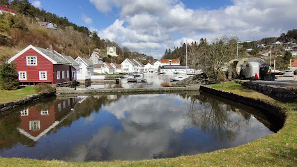
| Description | : | Skjenefloren cemetery came into use around 1950, it was thus Strusshamn Church 5. cemetery. The first church in Askøy was built in Strusshamn in 1741, and from then on people were buried at the associated cemetery - Østre. It is then the oldest cemetery in Strusshamn. Then the Kolera cemetery was put into use in 1849. Then came Jacob's, and then Futebø - it is in an extension of the Kolera cemetery. In the 1950s Skjenefloren came; It was subsequently expanded in the 1960s. The new square was named Strusshamn cemetery. The first two churches in Strusshamn burned... Read More |
frequently asked questions (FAQ):
-
Where is Skjenefloren kirkegård - Strusshamn?
Skjenefloren kirkegård - Strusshamn is located at Strusshamnvegen Strusshamn, Askøy kommune ,Hordaland fylke , 5302Norway.
-
Skjenefloren kirkegård - Strusshamn cemetery's updated grave count on graveviews.com?
0 memorials
-
Where are the coordinates of the Skjenefloren kirkegård - Strusshamn?
Latitude: 60.4066076
Longitude: 5.1896775
Nearby Cemetories:
1. Loddefjord Cemetery
Bergen, Bergen kommune, Norway
Coordinate: 60.3694950, 5.2311200
2. Gravdalspollen
Bergen, Bergen kommune, Norway
Coordinate: 60.3834900, 5.2696620
3. Tveit Cemetery
Tveitevag, Askøy kommune, Norway
Coordinate: 60.4541900, 5.1318300
4. Biskophavn
Bergen, Bergen kommune, Norway
Coordinate: 60.4246390, 5.2979610
5. Fjell Cemetery
Brattholmen, Fjell kommune, Norway
Coordinate: 60.3494608, 5.1559349
6. Bergen Nykirkegaarden
Bergen, Bergen kommune, Norway
Coordinate: 60.3972290, 5.3129590
7. Christ Church (Defunct)
Bergen, Bergen kommune, Norway
Coordinate: 60.4002420, 5.3169850
8. Mariakirken Church Cemetery
Bergen, Bergen kommune, Norway
Coordinate: 60.3989490, 5.3230140
9. Korskirkegården
Bergen, Bergen kommune, Norway
Coordinate: 60.3948930, 5.3277450
10. Bergen Domkirkegaarden
Bergen, Bergen kommune, Norway
Coordinate: 60.3938890, 5.3305560
11. St. Jakob Cemetery
Bergen, Bergen kommune, Norway
Coordinate: 60.3909130, 5.3358110
12. Assistentkirkegaarden
Bergen, Bergen kommune, Norway
Coordinate: 60.3903630, 5.3360020
13. Fyllingsdalen Cemetery
Bergen, Bergen kommune, Norway
Coordinate: 60.3529000, 5.2958100
14. Bergen-Solheim German WAR Cemetery
Bergen, Bergen kommune, Norway
Coordinate: 60.3722720, 5.3387260
15. Solheim Cemetery
Bergen, Bergen kommune, Norway
Coordinate: 60.3692520, 5.3394670
16. Møllendal Church Cemetery
Bergen, Bergen kommune, Norway
Coordinate: 60.3773130, 5.3529970
17. Aarstad Nye
Bergen, Bergen kommune, Norway
Coordinate: 60.3776560, 5.3584790
18. Storetveit
Bergen, Bergen kommune, Norway
Coordinate: 60.3517580, 5.3441870
19. Åsane gamle kirke
Bergen, Bergen kommune, Norway
Coordinate: 60.4748430, 5.3267720
20. Salhus kirkegård
Salhus, Bergen kommune, Norway
Coordinate: 60.5031600, 5.2630100
21. Landro Cemetery
Landro, Fjell kommune, Norway
Coordinate: 60.4193190, 4.9731260
22. Ovsttun Cemetery
Bergen, Bergen kommune, Norway
Coordinate: 60.3116610, 5.3624390
23. Meland Old Cemetery
Frekhaug, Meland kommune, Norway
Coordinate: 60.5400310, 5.1878380
24. Mjeldheim Cemetery
Indre Arna, Bergen kommune, Norway
Coordinate: 60.4133800, 5.4676300