
| Memorials | : | 0 |
| Location | : | Smithtown, Mobile County, USA |
| Coordinate | : | 30.8614290, -88.2070040 |
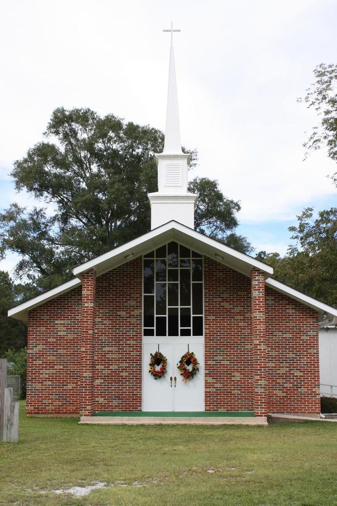
| Description | : | SMITHTOWN BAPTIST CHURCH Establish in 1892 in the home of one Henry Williams, this land having been homesteaded by him in 1836. He and his son-in-law, Warren Smith brought in their first minister, one Barry Byrd. The first church was built in 1900. The charter members were the wife and son of Richard Albert Smith, these being Sarah Mariah Smith, Warren Smith (son), and his wife Annie L. Smith. The Smithtown was named for these Pioneer foundering leaders and others. James Williams homesteaded N.W. 1/4 of S. W. 1/4 Section 20 T.S.2.5 & 2 W Smithtown June 18, 1831. |
frequently asked questions (FAQ):
-
Where is Smithtown Baptist Church Cemetery?
Smithtown Baptist Church Cemetery is located at Smithtown, Mobile County ,Alabama ,USA.
-
Smithtown Baptist Church Cemetery cemetery's updated grave count on graveviews.com?
0 memorials
-
Where are the coordinates of the Smithtown Baptist Church Cemetery?
Latitude: 30.8614290
Longitude: -88.2070040

Nearby Cemetories:
1. Oak Grove Cemetery
Mobile County, USA
Coordinate: 30.8590010, -88.1852690
2. Mauvilla Cemetery
Mauvilla, Mobile County, USA
Coordinate: 30.8409860, -88.1913970
3. Mauvilla Cemetery
Mauvilla, Mobile County, USA
Coordinate: 30.8519001, -88.1667023
4. Mount Olive Cemetery
Mauvilla, Mobile County, USA
Coordinate: 30.8347140, -88.1787340
5. Kushla Assembly Of God Cemetery
Kushla, Mobile County, USA
Coordinate: 30.8282240, -88.1749770
6. Powell Cemetery
Mauvilla, Mobile County, USA
Coordinate: 30.8309270, -88.2426140
7. Williams Cemetery
Chunchula, Mobile County, USA
Coordinate: 30.9086800, -88.2003000
8. Magee Farm Cemetery
Kushla, Mobile County, USA
Coordinate: 30.8210040, -88.1623760
9. Valhalla Memorial Gardens
Semmes, Mobile County, USA
Coordinate: 30.8089008, -88.2450027
10. Starlight Full Gospel Church Cemetery
Chunchula, Mobile County, USA
Coordinate: 30.9268030, -88.2124190
11. Miller Cemetery
Semmes, Mobile County, USA
Coordinate: 30.8034790, -88.2506800
12. Powell Town Cemetery
Semmes, Mobile County, USA
Coordinate: 30.8090980, -88.2634000
13. Georgetown United Methodist Church Cemetery
Chunchula, Mobile County, USA
Coordinate: 30.9147434, -88.2749329
14. Forest Lawn Memorial Gardens
Saraland, Mobile County, USA
Coordinate: 30.8971996, -88.1231003
15. Indian Springs Cemetery
Indian Springs, Mobile County, USA
Coordinate: 30.7782993, -88.1889038
16. Lott Cemetery
Georgetown, Mobile County, USA
Coordinate: 30.9197500, -88.2898900
17. Vickers Cemetery
Wilmer, Mobile County, USA
Coordinate: 30.8276900, -88.3101400
18. Byrd Memorial Cemetery
Mobile County, USA
Coordinate: 30.9424992, -88.2806015
19. Semmes First Baptist Church Cemetery
Semmes, Mobile County, USA
Coordinate: 30.7663994, -88.2608032
20. Crawford United Methodist Church Cemetery
Crawford, Mobile County, USA
Coordinate: 30.7559270, -88.2164550
21. Camellia Missionary Baptist Church Cemetery
Semmes, Mobile County, USA
Coordinate: 30.7863590, -88.2951420
22. Saraland Cemetery
Saraland, Mobile County, USA
Coordinate: 30.8206005, -88.0919037
23. Strange Cemetery
Saraland, Mobile County, USA
Coordinate: 30.8257170, -88.0837040
24. Bear Fork Road Cemetery
Mobile, Mobile County, USA
Coordinate: 30.7490300, -88.1844300