
| Memorials | : | 19 |
| Location | : | Sodaville, Mineral County, USA |
| Coordinate | : | 38.3434000, -118.1078000 |
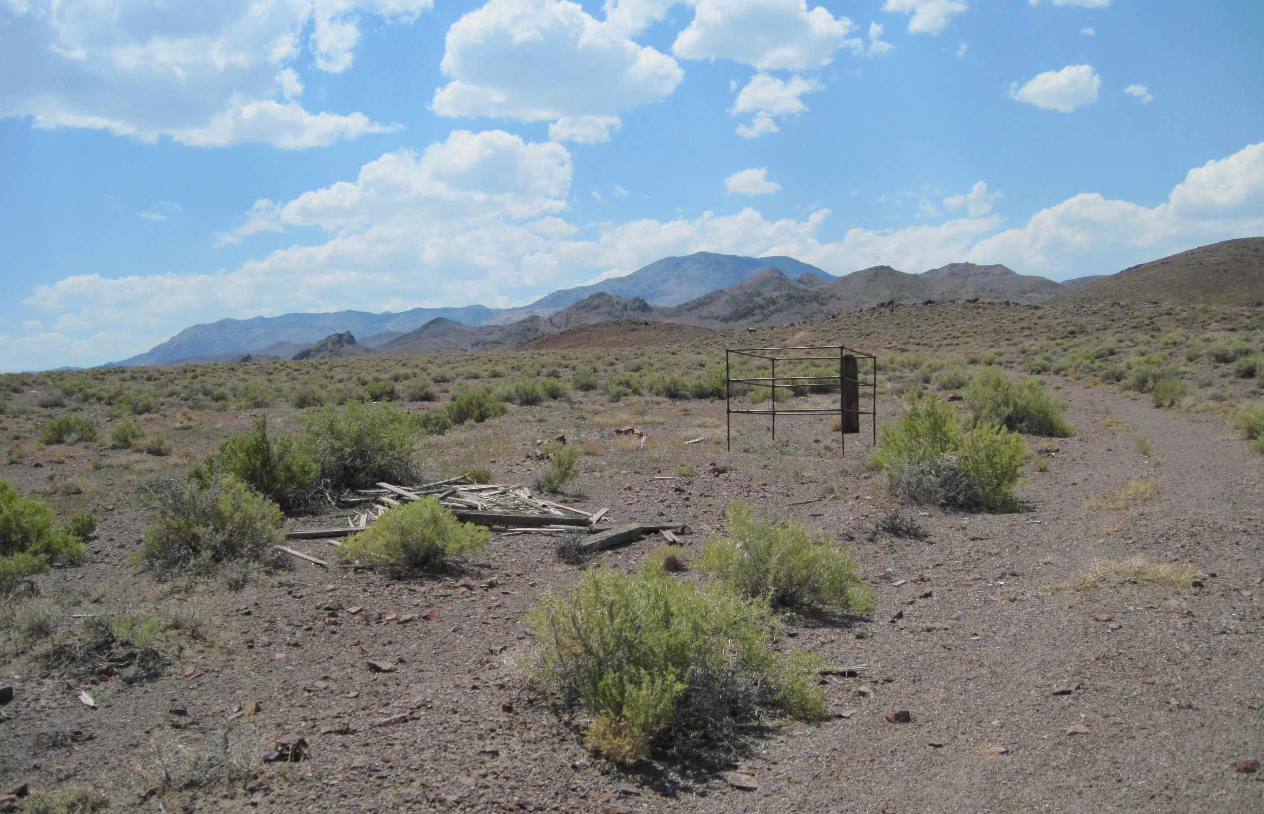
| Description | : | Up to thirty scattered, unreadable, graves scattered in this area. Graves date from 1880 to 1915. Two graves have metal pipe framework. History: The owner of the Sodaville water rights demanded too much money from the railroad. The railroad decided to drill their own wells north of here which later became the town of Mina. Sodaville then went into decline. An old borax plant is nearby and the silver mill ruins are across the road hidden from the highway. Cemetery is on PRIVATE PROPERTY and you should ask permission before going to this area or you will be... Read More |
frequently asked questions (FAQ):
-
Where is Sodaville Cemetery?
Sodaville Cemetery is located at Sodaville, Mineral County ,Nevada ,USA.
-
Sodaville Cemetery cemetery's updated grave count on graveviews.com?
19 memorials
-
Where are the coordinates of the Sodaville Cemetery?
Latitude: 38.3434000
Longitude: -118.1078000
Nearby Cemetories:
1. Mina Cemetery
Mina, Mineral County, USA
Coordinate: 38.3961000, -118.1162000
2. New Boston Gravesite
Mina, Mineral County, USA
Coordinate: 38.4279000, -118.1440600
3. Belleville Cemetery
Candelaria Junction, Mineral County, USA
Coordinate: 38.2145500, -118.1737100
4. Luning Cemetery
Luning, Mineral County, USA
Coordinate: 38.5017891, -118.1787796
5. Tomlin Gravesite
Luning, Mineral County, USA
Coordinate: 38.5045319, -118.1808319
6. Galloway Memorial
Hawthorne, Mineral County, USA
Coordinate: 38.4049600, -118.3176000
7. Candelaria Cemetery
Candelaria Junction, Mineral County, USA
Coordinate: 38.1591988, -118.0841980
8. Marietta Cemetery
Marietta, Mineral County, USA
Coordinate: 38.2447014, -118.3405991
9. Columbus Cemetery
Columbus, Esmeralda County, USA
Coordinate: 38.1128900, -118.0223700
10. Badger Bill Gravesite
Hawthorne, Mineral County, USA
Coordinate: 38.4546000, -118.4032800
11. Chinese Gravesite
Hawthorne, Mineral County, USA
Coordinate: 38.5479813, -118.4238892
12. Gilbert Cemetery
Millers, Esmeralda County, USA
Coordinate: 38.1960400, -117.6967700
13. Chinese Cemetery
Hawthorne, Mineral County, USA
Coordinate: 38.5334300, -118.6144800
14. Hawthorne Cemetery
Hawthorne, Mineral County, USA
Coordinate: 38.5340004, -118.6253967
15. Poinsettia Burial Ground
Hawthorne, Mineral County, USA
Coordinate: 38.7787400, -118.2624100
16. Millers Cemetery #1
Millers, Esmeralda County, USA
Coordinate: 38.1234300, -117.4558600
17. Millers Cemetery #2
Millers, Esmeralda County, USA
Coordinate: 38.1237500, -117.4524100
18. Montgomery City Burial Site
Benton, Mono County, USA
Coordinate: 37.8286110, -118.4308330
19. Downeyville Road Gravesite
Nye County, USA
Coordinate: 38.9107880, -117.9080540
20. Fish Lake Valley Cemetery
Dyer, Esmeralda County, USA
Coordinate: 37.7490005, -118.0404968
21. Virginia Mahon Gravesite
Walker Lake, Mineral County, USA
Coordinate: 38.6531300, -118.7615500
22. Aurora Cemetery
Mineral County, USA
Coordinate: 38.2913300, -118.9014300
23. Benton Hot Springs Cemetery
Benton Hot Springs, Mono County, USA
Coordinate: 37.8029430, -118.5298200
24. Nine Mile Ranch Cemetery
Fletcher, Mineral County, USA
Coordinate: 38.3841200, -118.9369800