| Memorials | : | 0 |
| Location | : | Pitcher, Chenango County, USA |
| Coordinate | : | 42.5797005, -75.8210983 |
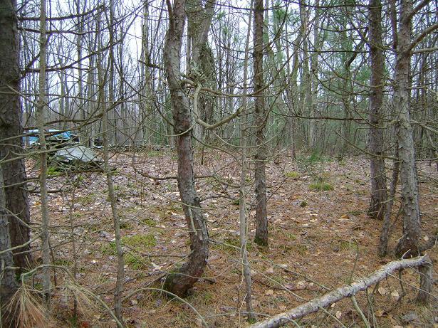
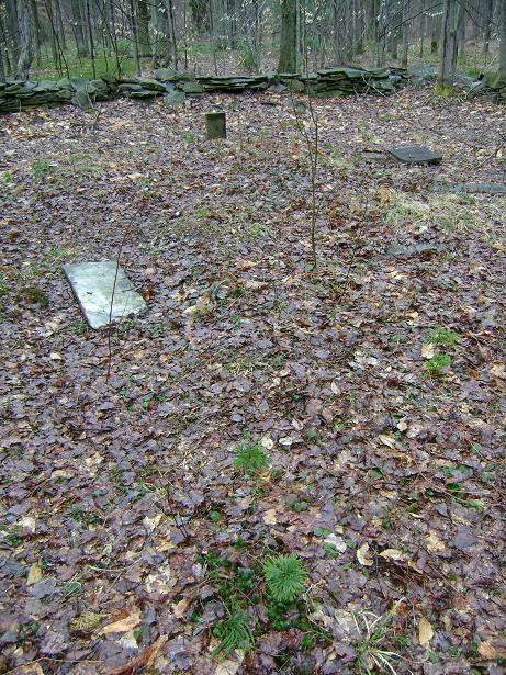
| Description | : | The Soper Cemetery is located in Pitcher on the South side of the Hakes-Calhoun-Davis Road, West of its intersection with Kostenko Sutton Road . It is a Cemetery of roughly rectangular shape, approximately 68x40 feet. The burial ground was in use between 1825 and 1844. |
frequently asked questions (FAQ):
-
Where is Soper Cemetery?
Soper Cemetery is located at Pitcher, Chenango County ,New York ,USA.
-
Soper Cemetery cemetery's updated grave count on graveviews.com?
0 memorials
-
Where are the coordinates of the Soper Cemetery?
Latitude: 42.5797005
Longitude: -75.8210983
Nearby Cemetories:
1. Lord Burial Plot
Pitcher, Chenango County, USA
Coordinate: 42.5674600, -75.8085800
2. Kenyon Cemetery
Pitcher, Chenango County, USA
Coordinate: 42.5608330, -75.8255560
3. Finch Burial Ground
Pitcher, Chenango County, USA
Coordinate: 42.5958300, -75.8408700
4. Hinman Cemetery
Pitcher, Chenango County, USA
Coordinate: 42.5875015, -75.8488998
5. Halsey Browning Farm Cemetery
Pitcher, Chenango County, USA
Coordinate: 42.5820100, -75.7873400
6. Lord Cemetery
Pharsalia, Chenango County, USA
Coordinate: 42.5765100, -75.7873200
7. Wayside Rest Cemetery
Pharsalia, Chenango County, USA
Coordinate: 42.5779000, -75.7842000
8. Brackel Church Cemetery
Pitcher, Chenango County, USA
Coordinate: 42.5552780, -75.8391670
9. Pitcher Congregational Church Cemetery
Pitcher, Chenango County, USA
Coordinate: 42.5805550, -75.8616660
10. Harvey Cemetery
Pitcher, Chenango County, USA
Coordinate: 42.5466460, -75.8176810
11. Crane Cemetery
Pharsalia, Chenango County, USA
Coordinate: 42.5846400, -75.7764200
12. North Pitcher Cemetery
Pitcher, Chenango County, USA
Coordinate: 42.6250000, -75.8189011
13. Neff Cemetery
Pharsalia, Chenango County, USA
Coordinate: 42.5739200, -75.7537000
14. Ufford Corners Cemetery
North Pitcher, Chenango County, USA
Coordinate: 42.6301100, -75.8087800
15. Pink Hill Cemetery
Pitcher, Chenango County, USA
Coordinate: 42.6237100, -75.8615000
16. Pharsalia Center Cemetery
Pharsalia, Chenango County, USA
Coordinate: 42.5993996, -75.7530975
17. Brown Cemetery
Pharsalia, Chenango County, USA
Coordinate: 42.5630560, -75.7502780
18. Taylor Rural Cemetery
Taylor, Cortland County, USA
Coordinate: 42.5647900, -75.8943700
19. Johnson Cemetery
Taylor, Cortland County, USA
Coordinate: 42.5913700, -75.9028400
20. Northwest Corners Cemetery
Pharsalia, Chenango County, USA
Coordinate: 42.6298660, -75.7728070
21. Cincinnatus Cemetery
Cincinnatus, Cortland County, USA
Coordinate: 42.5452770, -75.8969440
22. Union Valley Cemetery
Union Valley, Cortland County, USA
Coordinate: 42.6281000, -75.8854400
23. Valley View Cemetery
South Otselic, Chenango County, USA
Coordinate: 42.6450000, -75.7819440
24. Lower Cincinnatus Cemetery
Cincinnatus, Cortland County, USA
Coordinate: 42.5336110, -75.8952770


