
| Memorials | : | 0 |
| Location | : | Marion, Marion County, USA |
| Coordinate | : | 38.2908300, -97.1132400 |
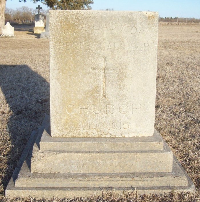
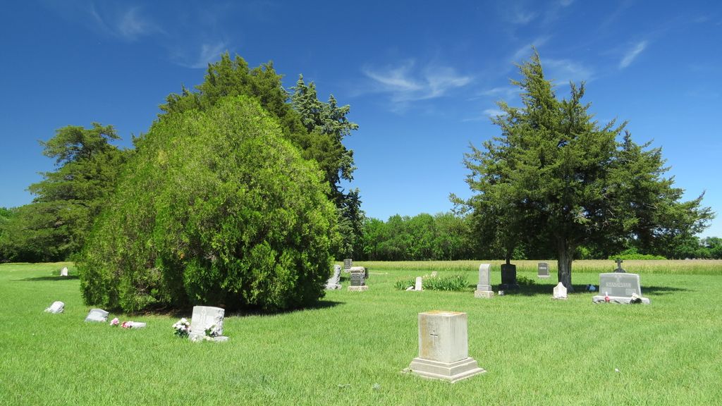
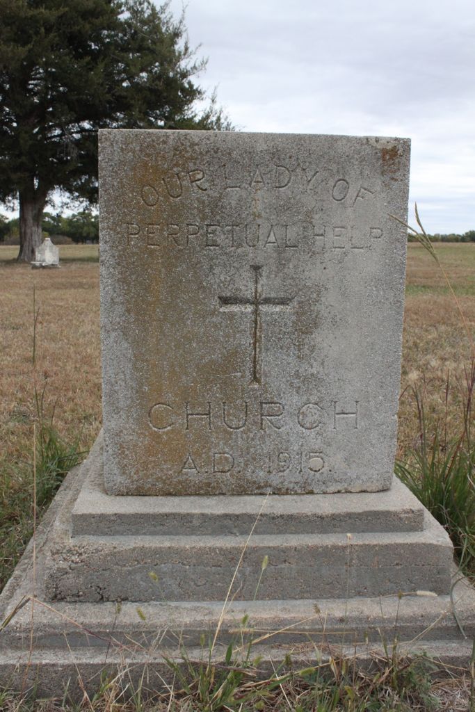
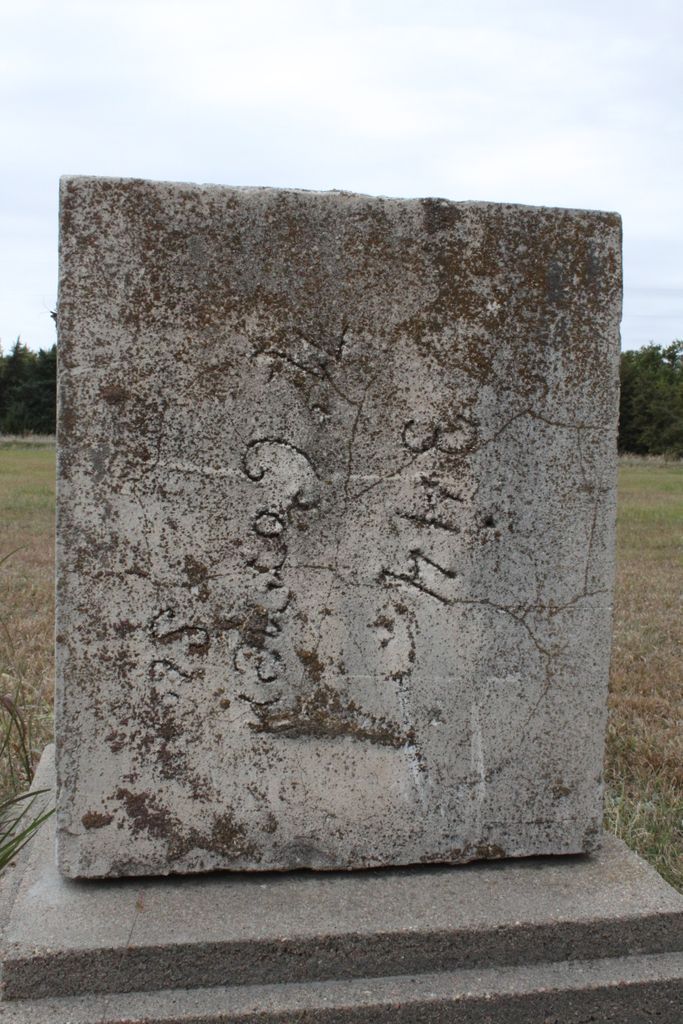
| Description | : | Spring Branch Catholic Cemetery was once part of the Our Lady of Perpetual Help Catholic Church near Aulne, KS. The cornerstone for the Catholic Church is there. Many of the stones are missing or broken and there is no name on or near the cemetery. These records were taken from the Marion County records. The records may be in the Wichita Diocese but are not held at the local Catholic church. This was one of the Catholic cemeteries that have been turned over to Marion county. Spring Branch is located in Wilson township, Section 21 on 150th and Nighthawk Rd. |
frequently asked questions (FAQ):
-
Where is Spring Branch Catholic Cemetery?
Spring Branch Catholic Cemetery is located at 150th and Nighthawk Road Marion, Marion County ,Kansas ,USA.
-
Spring Branch Catholic Cemetery cemetery's updated grave count on graveviews.com?
0 memorials
-
Where are the coordinates of the Spring Branch Catholic Cemetery?
Latitude: 38.2908300
Longitude: -97.1132400
Nearby Cemetories:
1. Marion County Poor Farm Cemetery
Aulne, Marion County, USA
Coordinate: 38.3095860, -97.0956100
2. Gard Cemetery
Peabody, Marion County, USA
Coordinate: 38.2902985, -97.1508026
3. Ebenfeld Mennonite Brethren Church Cemetery
Hillsboro, Marion County, USA
Coordinate: 38.2898450, -97.1679740
4. Claney Cemetery
Marion, Marion County, USA
Coordinate: 38.2905998, -97.0361023
5. Brunk Cemetery
Marion, Marion County, USA
Coordinate: 38.3481100, -97.1410800
6. Gnadenau Village Cemetery
Hillsboro, Marion County, USA
Coordinate: 38.3247200, -97.1802300
7. Salem Orphan's Home Cemetery
Marion County, USA
Coordinate: 38.3335440, -97.1756010
8. Catlin Community Cemetery
Marion County, USA
Coordinate: 38.2249985, -97.1339035
9. Canada Cemetery
Marion County, USA
Coordinate: 38.3628006, -97.1125031
10. Haven of Rest Cemetery
Hillsboro, Marion County, USA
Coordinate: 38.3478012, -97.1772003
11. Gnadenau Cemetery
Hillsboro, Marion County, USA
Coordinate: 38.3196200, -97.2062300
12. Dunkard Cemetery
Marion County, USA
Coordinate: 38.2256012, -97.1694031
13. Hillsboro Mennonite Brethren Church Cemetery
Hillsboro, Marion County, USA
Coordinate: 38.3479100, -97.2010000
14. Loewen Cemetery
Hillsboro, Marion County, USA
Coordinate: 38.3189100, -97.2244000
15. Zion Cemetery
Hillsboro, Marion County, USA
Coordinate: 38.3555984, -97.1971970
16. Alexanderfeld Mennonite Church Cemetery
Hillsboro, Marion County, USA
Coordinate: 38.3335820, -97.2242680
17. Marion Cemetery
Marion, Marion County, USA
Coordinate: 38.3514800, -97.0060900
18. Prairie Lawn Cemetery
Peabody, Marion County, USA
Coordinate: 38.1800003, -97.0943985
19. Strassburg Cemetery
Marion, Marion County, USA
Coordinate: 38.4059900, -97.0771300
20. Steinbach Community Cemetery
Hillsboro, Marion County, USA
Coordinate: 38.3045600, -97.2797200
21. French Creek Cemetery
Hillsboro, Marion County, USA
Coordinate: 38.3925018, -97.2193985
22. Doyle Valley Cemetery
Marion County, USA
Coordinate: 38.2043991, -97.2433014
23. Mount Calvary Cemetery
Florence, Marion County, USA
Coordinate: 38.2303009, -96.9589005
24. Johannestal Cemetery
Hillsboro, Marion County, USA
Coordinate: 38.4091988, -97.2247009