| Memorials | : | 0 |
| Location | : | Gum Springs, Winston County, USA |
| Coordinate | : | 33.2857320, -89.0675420 |
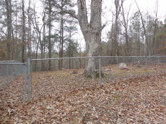
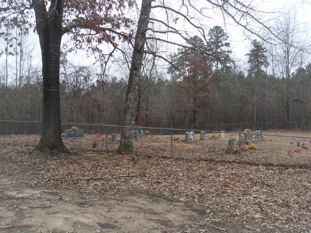
| Description | : | This cemetery is located just off Sharp Road down a little lane. Unless you know about it, you would never know it was there. There are actually two seperate fenced in cemeteries in this area just a few yards from each other. I have know idea why this is the case but they are very neatly kept and appear to be still used at this time. |
frequently asked questions (FAQ):
-
Where is Spring Hill Church Cemetery?
Spring Hill Church Cemetery is located at Sharp Road Gum Springs, Winston County ,Mississippi ,USA.
-
Spring Hill Church Cemetery cemetery's updated grave count on graveviews.com?
0 memorials
-
Where are the coordinates of the Spring Hill Church Cemetery?
Latitude: 33.2857320
Longitude: -89.0675420
Nearby Cemetories:
1. Spring Hill Cemetery
Louisville, Winston County, USA
Coordinate: 33.2851400, -89.0676100
2. Bethel Baptist Church Cemetery
Sturgis, Oktibbeha County, USA
Coordinate: 33.2881010, -89.0693970
3. Hyde Cemetery
Webster, Winston County, USA
Coordinate: 33.2786620, -89.0678330
4. Blackwood Cemetery
Webster, Winston County, USA
Coordinate: 33.2813988, -89.1063995
5. Woodard Family Cemetery
Sturgis, Oktibbeha County, USA
Coordinate: 33.3231500, -89.0672520
6. Boyd Chapel Cemetery
Morgantown, Oktibbeha County, USA
Coordinate: 33.3091698, -89.0322189
7. Davis Cemetery
Sturgis, Oktibbeha County, USA
Coordinate: 33.3208800, -89.0365500
8. Morrison Cemetery
Choctaw County, USA
Coordinate: 33.3225780, -89.1036820
9. Pleasant Hill Number One Cemetery
Winston County, USA
Coordinate: 33.2717018, -89.0102997
10. Wylie Cemetery
Louisville, Winston County, USA
Coordinate: 33.2354400, -89.0621330
11. Hendricks Vance Cemetery
Ackerman, Choctaw County, USA
Coordinate: 33.2683280, -89.1264020
12. Sturgis Cemetery
Sturgis, Oktibbeha County, USA
Coordinate: 33.3450012, -89.0505981
13. Roberts-Wylie Family Cemetery
Tollison, Choctaw County, USA
Coordinate: 33.2433900, -89.1205850
14. Morgan Chapel Cemetery
Oktibbeha County, USA
Coordinate: 33.3050003, -88.9969025
15. Catledge Cemetery
Ackerman, Choctaw County, USA
Coordinate: 33.2613983, -89.1361008
16. Shiloh Cemetery
Ackerman, Choctaw County, USA
Coordinate: 33.3369500, -89.1101600
17. Frazier Cemetery
Winston County, USA
Coordinate: 33.2330640, -89.0215870
18. Whitefield Cemetery
Sturgis, Oktibbeha County, USA
Coordinate: 33.3492430, -89.0425590
19. Mount Airy Cemetery
Sturgis, Oktibbeha County, USA
Coordinate: 33.3435140, -89.0174440
20. Little Rock Cemetery
Winston County, USA
Coordinate: 33.2182999, -89.0969009
21. Malone Family Cemetery
Sturgis, Oktibbeha County, USA
Coordinate: 33.3441350, -89.0163800
22. Mount Zion Cemetery
Sturgis, Oktibbeha County, USA
Coordinate: 33.3589096, -89.0567932
23. Tanksley Cemetery
Choctaw County, USA
Coordinate: 33.2181015, -89.1093979
24. Head Cemetery
Choctaw County, USA
Coordinate: 33.2682991, -89.1585999


