
| Memorials | : | 902 |
| Location | : | Blackburn, Blackburn with Darwen Unitary Authority, England |
| Website | : | www.stalbanandgoodshepherd.org.uk/ |
| Coordinate | : | 53.7530090, -2.4748540 |
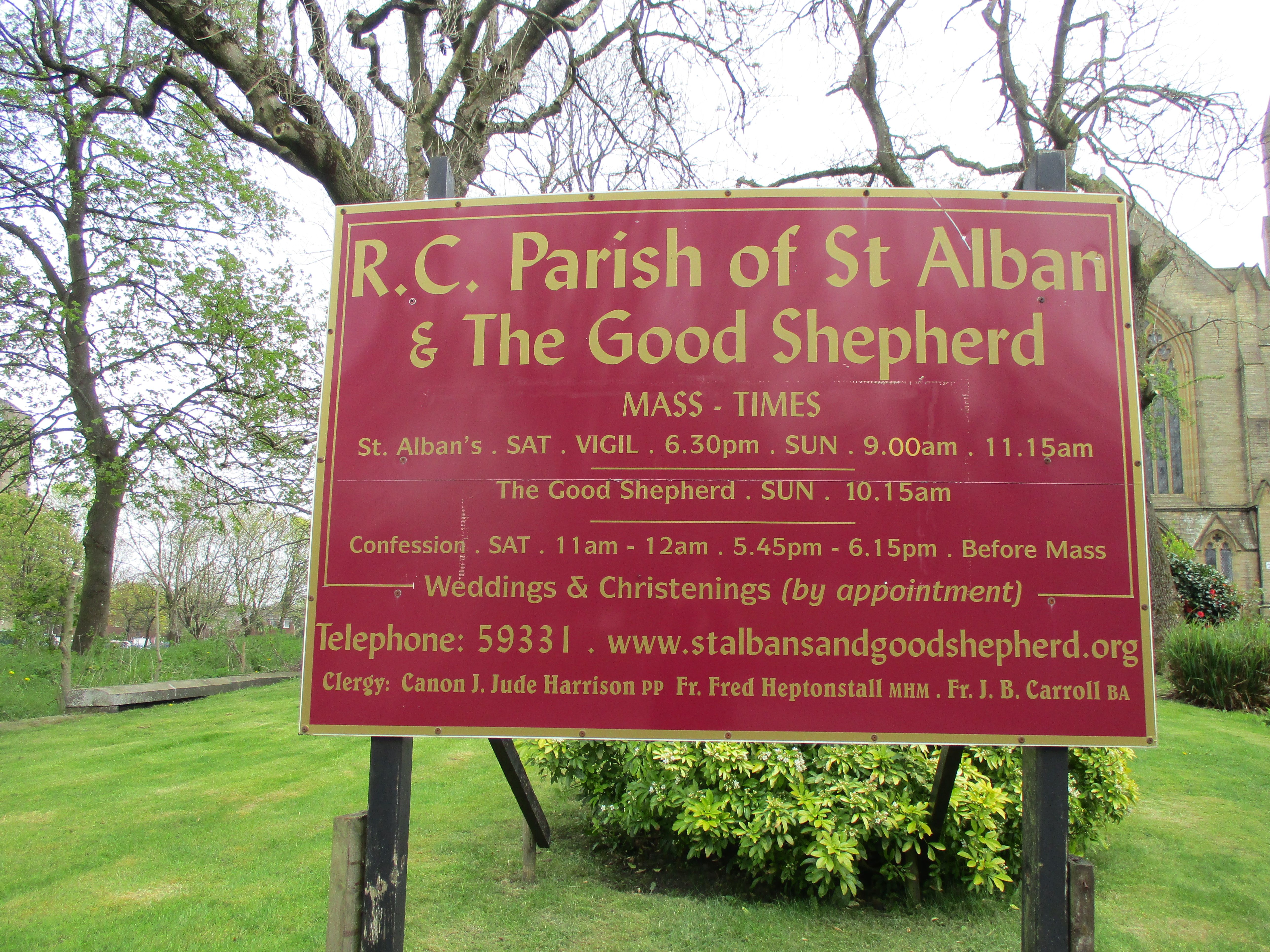
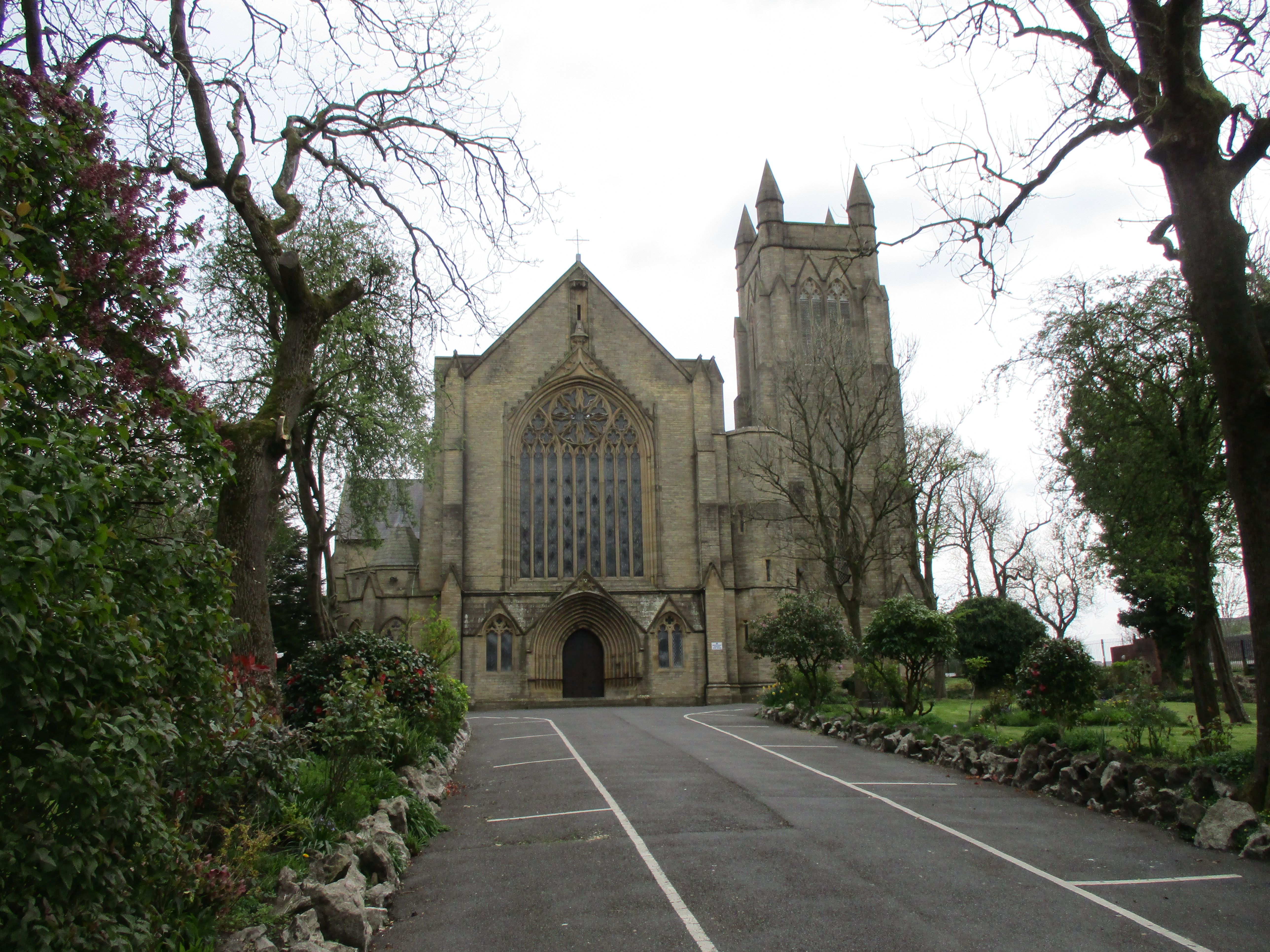
| Description | : | St Alban's Church congregation was first formed about 1773 by Bishop Petre and Father William Fisher. The first place of worship was located at King Street and Chapel Street. In 1824, a new church was built at St. Alban's Place located on Larkhill for £800. The new church seated about 700-800 people. The present day church was built in 1901 and still serves its parish well. The land round the church was used as a graveyard until 1854. |
frequently asked questions (FAQ):
-
Where is St Alban's Churchyard?
St Alban's Churchyard is located at Lark Hill Blackburn, Blackburn with Darwen Unitary Authority ,Lancashire ,England.
-
St Alban's Churchyard cemetery's updated grave count on graveviews.com?
902 memorials
-
Where are the coordinates of the St Alban's Churchyard?
Latitude: 53.7530090
Longitude: -2.4748540
Nearby Cemetories:
1. Holy Trinity Church
Blackburn with Darwen Unitary Authority, England
Coordinate: 53.7511727, -2.4747178
2. Mount St Presbyterian Chapelyard
Blackburn, Blackburn with Darwen Unitary Authority, England
Coordinate: 53.7478000, -2.4775000
3. Blackburn Cathedral
Blackburn, Blackburn with Darwen Unitary Authority, England
Coordinate: 53.7472960, -2.4820020
4. Wesleyan Methodist Chapel Chapelyard
Blackburn, Blackburn with Darwen Unitary Authority, England
Coordinate: 53.7464910, -2.4848380
5. St Paul's
Blackburn, Blackburn with Darwen Unitary Authority, England
Coordinate: 53.7491222, -2.4891266
6. Independent Chapel Churchyard
Blackburn, Blackburn with Darwen Unitary Authority, England
Coordinate: 53.7454960, -2.4864460
7. St. Peter's Churchyard
Blackburn, Blackburn with Darwen Unitary Authority, England
Coordinate: 53.7448110, -2.4865070
8. Blackburn Cemetery
Blackburn, Blackburn with Darwen Unitary Authority, England
Coordinate: 53.7662430, -2.4726050
9. St James Churchyard
Lower Darwen, Blackburn with Darwen Unitary Authority, England
Coordinate: 53.7245510, -2.4634700
10. New Row Methodist Church
Blackburn with Darwen Unitary Authority, England
Coordinate: 53.7208950, -2.5023720
11. Mellor Methodist Churchyard
Blackburn, Blackburn with Darwen Unitary Authority, England
Coordinate: 53.7742950, -2.5255060
12. St. Mary's Churchyard
Mellor, Ribble Valley Borough, England
Coordinate: 53.7728600, -2.5312400
13. St Peter Churchyard
Salesbury, Ribble Valley Borough, England
Coordinate: 53.7915000, -2.4859100
14. Pleasington Cemetery and Crematorium
Blackburn, Blackburn with Darwen Unitary Authority, England
Coordinate: 53.7388880, -2.5368710
15. New Lane Baptist Chapel Chapelyard
Oswaldwistle, Hyndburn Borough, England
Coordinate: 53.7381100, -2.4049500
16. Pleasington Priory
Pleasington, Blackburn with Darwen Unitary Authority, England
Coordinate: 53.7348590, -2.5433060
17. Immanuel Churchyard
Oswaldwistle, Hyndburn Borough, England
Coordinate: 53.7358300, -2.4056200
18. St Mary's R.C. Church Cemetery
Osbaldeston, Ribble Valley Borough, England
Coordinate: 53.7816970, -2.5350240
19. Great Harwood Cemetery
Great Harwood, Hyndburn Borough, England
Coordinate: 53.7796190, -2.4091680
20. St James Churchyard
Church, Hyndburn Borough, England
Coordinate: 53.7574640, -2.3942660
21. St Stephen Churchyard
Tockholes, Blackburn with Darwen Unitary Authority, England
Coordinate: 53.7058350, -2.5169320
22. Our Lady and Saint Hubert
Great Harwood, Hyndburn Borough, England
Coordinate: 53.7851070, -2.4009760
23. St. Bartholomew's Churchyard
Great Harwood, Hyndburn Borough, England
Coordinate: 53.7900670, -2.4055460
24. All Saints Churchyard
Clayton-le-Moors, Hyndburn Borough, England
Coordinate: 53.7738520, -2.3881690