
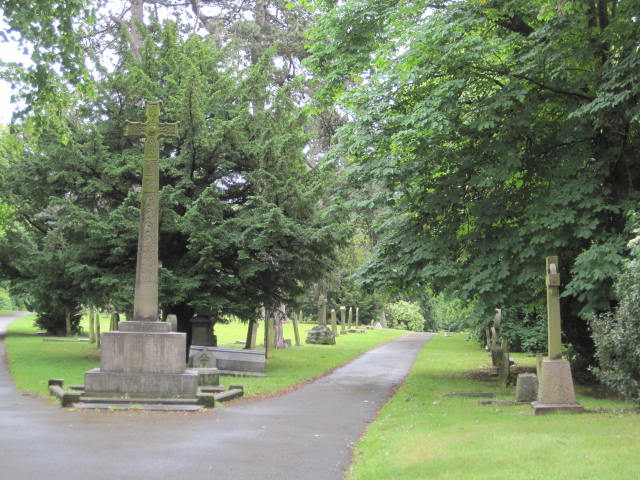
| Memorials | : | 1 |
| Location | : | Bishop Auckland, Durham Unitary Authority, England |
| Coordinate | : | 54.6508210, -1.6642140 |
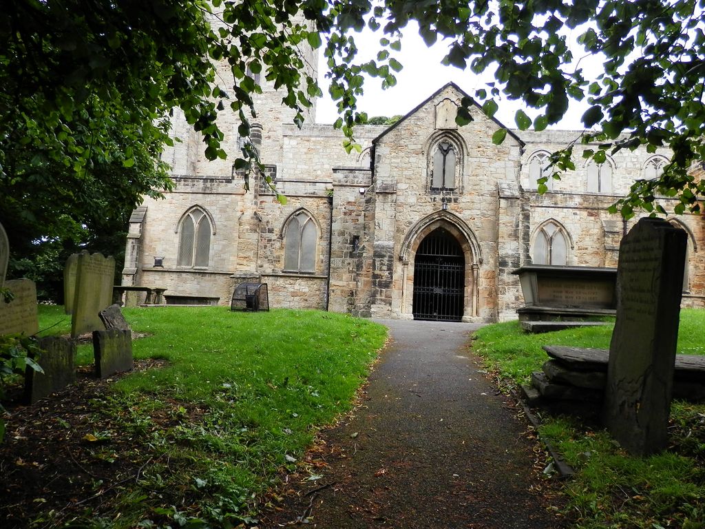
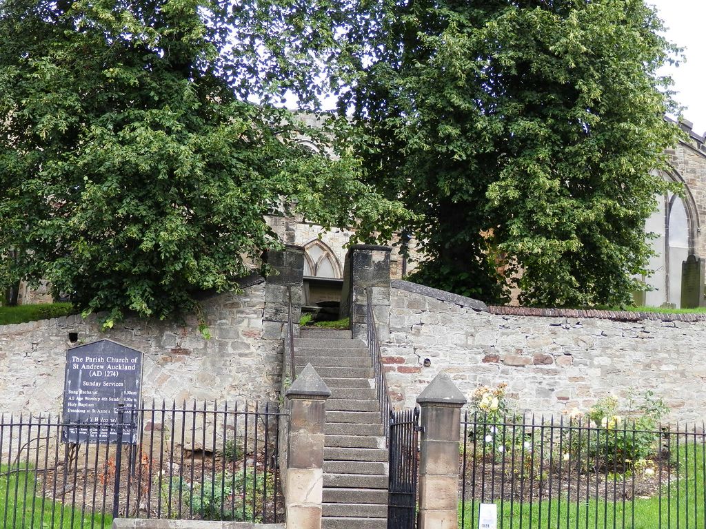
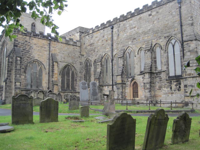
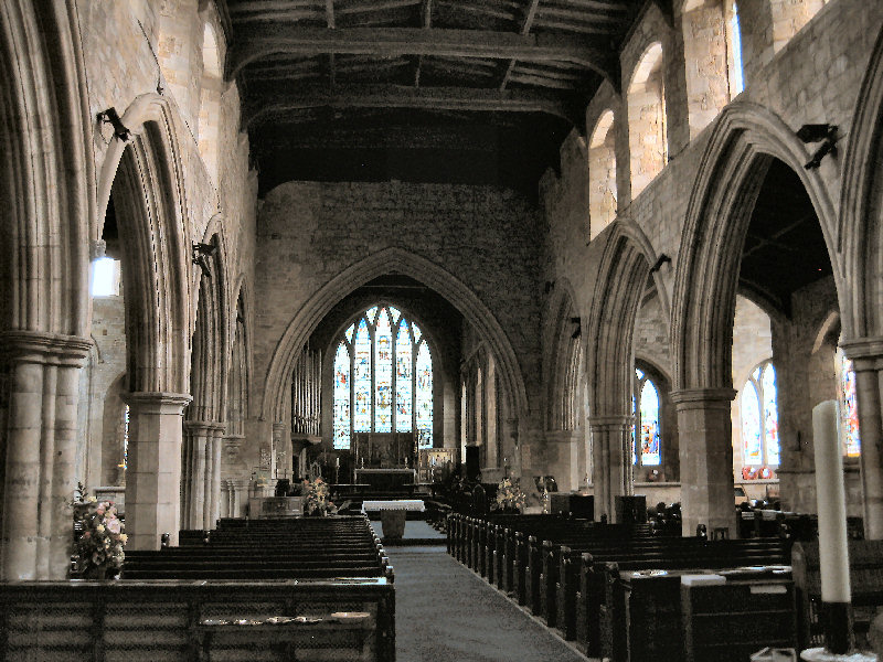
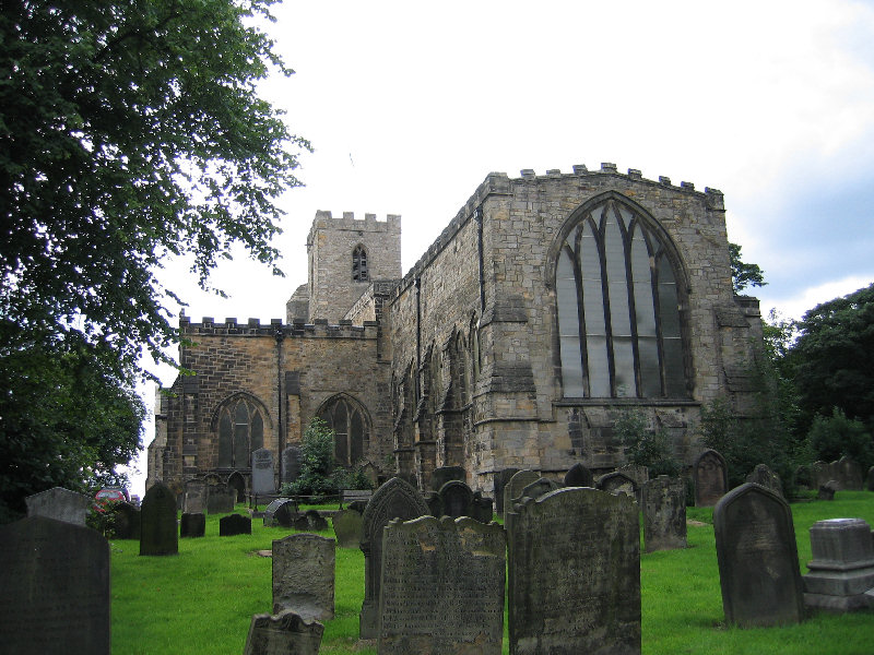
| Description | : | St Andrews is reputed to be the largest parish church in the Diocese of Durham. Internally it is grandly spacious, broad as well as long and lofty, reflecting its importance from the days when it became a college receiving some of the canons who had to leave Durham Cathedral when it was made monastic in 1083. It is almost all basically 13th century but with Perpendicular alterations which have given it low pitched roofs throughout with battlement or straight parapets. In plan it is cruciform with an aisled nave and west tower. The chancel is notably long with large north and... Read More |
frequently asked questions (FAQ):
-
Where is St. Andrew's Churchyard?
St. Andrew's Churchyard is located at South Church Bishop Auckland, Durham Unitary Authority ,County Durham , DL14 6SPEngland.
-
St. Andrew's Churchyard cemetery's updated grave count on graveviews.com?
1 memorials
-
Where are the coordinates of the St. Andrew's Churchyard?
Latitude: 54.6508210
Longitude: -1.6642140
Nearby Cemetories:
1. St. Andrew's Churchyard extension
Bishop Auckland, Durham Unitary Authority, England
Coordinate: 54.6507300, -1.6631300
2. South Church Cemetery
Bishop Auckland, Durham Unitary Authority, England
Coordinate: 54.6474340, -1.6584970
3. Town Cemetery
Bishop Auckland, Durham Unitary Authority, England
Coordinate: 54.6582400, -1.6671400
4. St. Mark Churchyard
Eldon, Durham Unitary Authority, England
Coordinate: 54.6440600, -1.6468600
5. Friends Burial Ground
Bishop Auckland, Durham Unitary Authority, England
Coordinate: 54.6629170, -1.6758117
6. Auckland Castle
Bishop Auckland, Durham Unitary Authority, England
Coordinate: 54.6668369, -1.6706450
7. Shildon Cemetery
Shildon, Durham Unitary Authority, England
Coordinate: 54.6312700, -1.6628600
8. St John's Churchyard
Shildon, Durham Unitary Authority, England
Coordinate: 54.6325180, -1.6471260
9. St. James's Churchyard
Coundon, Durham Unitary Authority, England
Coordinate: 54.6635200, -1.6353000
10. St Joseph’s Roman Catholic Cemetery
Coundon, Durham Unitary Authority, England
Coordinate: 54.6615400, -1.6276400
11. Escomb Cemetery
Escomb, Durham Unitary Authority, England
Coordinate: 54.6612500, -1.7121500
12. Escomb Churchyard
Escomb, Durham Unitary Authority, England
Coordinate: 54.6658090, -1.7084060
13. Wear Valley Crematorium
Coundon, Durham Unitary Authority, England
Coordinate: 54.6585820, -1.6129799
14. All Saints Churchyard
Shildon, Durham Unitary Authority, England
Coordinate: 54.6224700, -1.6412900
15. Binchester Cemetery
Binchester, Durham Unitary Authority, England
Coordinate: 54.6845944, -1.6463524
16. St Paul's Churchyard
Hunwick, Durham Unitary Authority, England
Coordinate: 54.6879240, -1.7048320
17. Hunwick Cemetery
Hunwick, Durham Unitary Authority, England
Coordinate: 54.6887060, -1.7027370
18. Etherley Cemetery
Etherley, Durham Unitary Authority, England
Coordinate: 54.6444410, -1.7431220
19. St. Cuthbert Churchyard
Etherley, Durham Unitary Authority, England
Coordinate: 54.6494200, -1.7450100
20. St Peter's Churchyard
Byers Green, Durham Unitary Authority, England
Coordinate: 54.6978180, -1.6513750
21. St. John the Evangelist Churchyard
Kirk Merrington, Durham Unitary Authority, England
Coordinate: 54.6771100, -1.5955800
22. Newfield Cemetery
Newfield, Durham Unitary Authority, England
Coordinate: 54.6982320, -1.6805670
23. Stephenson Way Cemetery
Newton Aycliffe, Durham Unitary Authority, England
Coordinate: 54.6234700, -1.5875600
24. West Cemetery
Newton Aycliffe, Durham Unitary Authority, England
Coordinate: 54.6095500, -1.5945500