
| Memorials | : | 3 |
| Location | : | Halstead, Braintree District, England |
| Coordinate | : | 51.9451350, 0.6396960 |
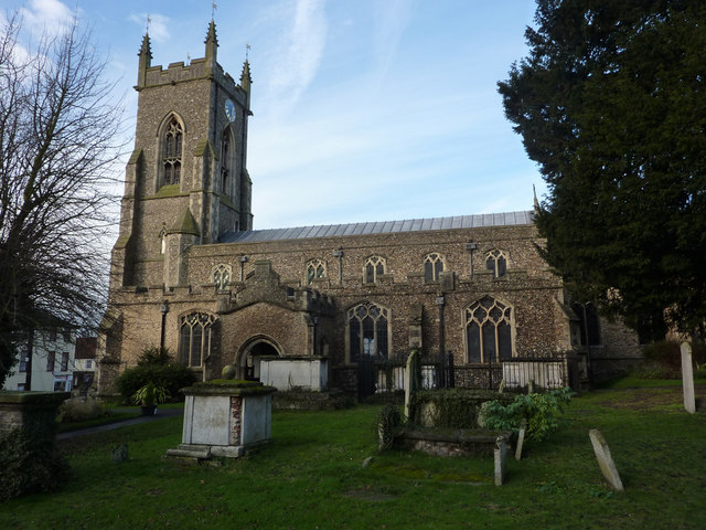
| Description | : | Halstead is a rural town located in Essex, England, near Colchester and Sudbury. The town is situated in the Colne Valley, and originally developed on the hill to the north of the river. The name Halstead is derived from the Old English hald (refuge, shelter, healthy) and stede (site, place or farm), meaning 'healthy farm' 'safe place' or 'place of refuge'.The benefice now includes Holy Trinity; that church is closed for worship and is in the care of The Churches Conservation Trust. |
frequently asked questions (FAQ):
-
Where is St Andrew Churchyard?
St Andrew Churchyard is located at Parsonage Street Halstead, Braintree District ,Essex , CO9 2LDEngland.
-
St Andrew Churchyard cemetery's updated grave count on graveviews.com?
3 memorials
-
Where are the coordinates of the St Andrew Churchyard?
Latitude: 51.9451350
Longitude: 0.6396960
Nearby Cemetories:
1. Halstead Cemetery
Halstead, Braintree District, England
Coordinate: 51.9439510, 0.6448570
2. Holy Trinity Churchyard
Halstead, Braintree District, England
Coordinate: 51.9434450, 0.6294390
3. St James the Great Churchyard
Greenstead Green, Braintree District, England
Coordinate: 51.9248430, 0.6486890
4. St John the Baptist Churchyard
Little Maplestead, Braintree District, England
Coordinate: 51.9744650, 0.6520560
5. St Katharine Churchyard
Gosfield, Braintree District, England
Coordinate: 51.9347640, 0.5846140
6. Baptist Chapel Churchyard
Earls Colne, Braintree District, England
Coordinate: 51.9300856, 0.7001074
7. St John the Baptist Churchyard
Pebmarsh, Braintree District, England
Coordinate: 51.9689130, 0.6971600
8. St Andrew Churchyard
Earls Colne, Braintree District, England
Coordinate: 51.9268480, 0.7046070
9. Colne Priory
Earls Colne, Braintree District, England
Coordinate: 51.9267220, 0.7103030
10. Castle Hedingham Cemetery
Castle Hedingham, Braintree District, England
Coordinate: 51.9856950, 0.5984890
11. St Peter Churchyard
Sible Hedingham, Braintree District, England
Coordinate: 51.9792950, 0.5840250
12. St Nicholas Churchyard
Castle Hedingham, Braintree District, England
Coordinate: 51.9902140, 0.5977370
13. All Saints
Stisted, Braintree District, England
Coordinate: 51.8908080, 0.6125730
14. St Andrew Churchyard
White Colne, Braintree District, England
Coordinate: 51.9362700, 0.7328930
15. All Saints Churchyard
Wickham St Paul, Braintree District, England
Coordinate: 52.0025650, 0.6604210
16. St. John the Evangelist Churchyard
Twinstead, Braintree District, England
Coordinate: 51.9974900, 0.7096940
17. St Mary the Virgin Churchyard
Bocking, Braintree District, England
Coordinate: 51.9018750, 0.5525520
18. St Mary the Virgin Church
Bocking, Braintree District, England
Coordinate: 51.9018600, 0.5524710
19. All Saints Churchyard
Wakes Colne, Colchester Borough, England
Coordinate: 51.9238500, 0.7467100
20. St Mary the Virgin Churchyard
Gestingthorpe, Braintree District, England
Coordinate: 52.0158970, 0.6393380
21. Bocking Cemetery
Braintree, Braintree District, England
Coordinate: 51.8974020, 0.5546570
22. Coggeshall Cemetery
Coggeshall, Braintree District, England
Coordinate: 51.8765110, 0.6899070
23. St Peter ad Vincula Churchyard
Coggeshall, Braintree District, England
Coordinate: 51.8748520, 0.6910450
24. Christ Church Churchyard
Coggeshall, Braintree District, England
Coordinate: 51.8725270, 0.6857280