
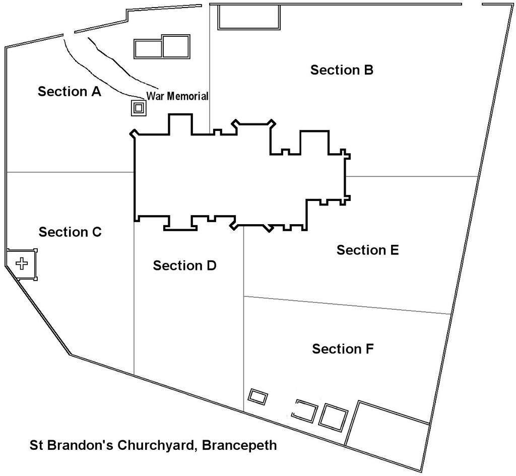
| Memorials | : | 0 |
| Location | : | Brancepeth, Durham Unitary Authority, England |
| Coordinate | : | 54.7337450, -1.6524470 |
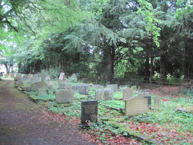
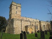
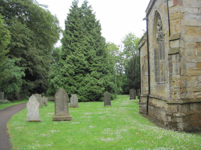
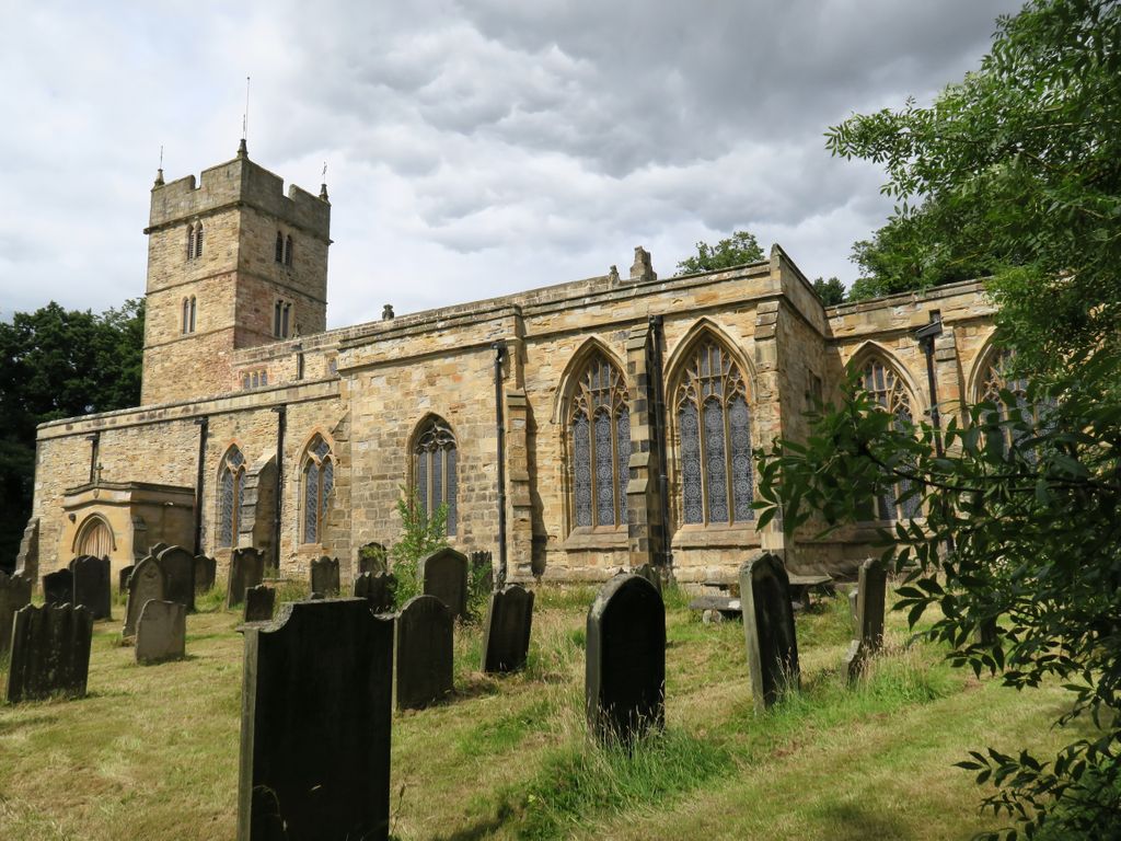
| Description | : | The Saxon Church, was possibly built as early as 700. Around 1180, the tower was added; the current study of the nave walls suggests that some form of transept of side chapel may have been added by this date. About 1200, the tower was heightened and an aisle added to the nave. In the early 14th century, the south transept was rebuilt, perhaps as a burial place for the Robert de Neville, ‘Peacock of the North’. The Nevilles enlarged the church by the late 1300s, and the chancel and aisles were rebuilt, and the tower given a new parapet (very... Read More |
frequently asked questions (FAQ):
-
Where is St Brandon Churchyard?
St Brandon Churchyard is located at Brancepeth, Durham Unitary Authority ,County Durham , DH7 8DFEngland.
-
St Brandon Churchyard cemetery's updated grave count on graveviews.com?
0 memorials
-
Where are the coordinates of the St Brandon Churchyard?
Latitude: 54.7337450
Longitude: -1.6524470
Nearby Cemetories:
1. Brandon Cemetery
Brandon, Durham Unitary Authority, England
Coordinate: 54.7554210, -1.6435610
2. Meadowfield Cemetery
Meadowfield, Durham Unitary Authority, England
Coordinate: 54.7532510, -1.6126190
3. St Peter's Churchyard
Byers Green, Durham Unitary Authority, England
Coordinate: 54.6978180, -1.6513750
4. Newfield Cemetery
Newfield, Durham Unitary Authority, England
Coordinate: 54.6982320, -1.6805670
5. Croxdale Cemetery
Croxdale, Durham Unitary Authority, England
Coordinate: 54.7233800, -1.5808800
6. Croxdale Hall Chapel
Croxdale, Durham Unitary Authority, England
Coordinate: 54.7358712, -1.5765290
7. Durham Crematorium
Durham, Durham Unitary Authority, England
Coordinate: 54.7584780, -1.5853720
8. South Road Cemetery
Durham, Durham Unitary Authority, England
Coordinate: 54.7577090, -1.5836350
9. Waterhouse Cemetery
Esh Winning, Durham Unitary Authority, England
Coordinate: 54.7685100, -1.7081310
10. Binchester Cemetery
Binchester, Durham Unitary Authority, England
Coordinate: 54.6845944, -1.6463524
11. Hett Cemetery
Hett, Durham Unitary Authority, England
Coordinate: 54.7258000, -1.5671200
12. Our Lady Queen Of Martyrs Churchyard
Esh Winning, Durham Unitary Authority, England
Coordinate: 54.7736930, -1.7061950
13. Crook Cemetery
Crook, Durham Unitary Authority, England
Coordinate: 54.7134780, -1.7328270
14. St Edmund Churchyard
Bearpark, Durham Unitary Authority, England
Coordinate: 54.7829380, -1.6294350
15. Parkwood Cemetery
Esh Winning, Durham Unitary Authority, England
Coordinate: 54.7662210, -1.7207360
16. Nevilles Cross
Durham Unitary Authority, England
Coordinate: 54.7724350, -1.5933540
17. Sublett Cemetery
Boom, Pickett County, USA
Coordinate: 54.7000580, -1.5847270
18. Bow Cemetery
Durham, Durham Unitary Authority, England
Coordinate: 54.7666927, -1.5811294
19. Hunwick Cemetery
Hunwick, Durham Unitary Authority, England
Coordinate: 54.6887060, -1.7027370
20. Our Lady Immaculate and St Cuthbert Roman Catholic Churchyard
Crook, Durham Unitary Authority, England
Coordinate: 54.7169050, -1.7410380
21. St Paul's Churchyard
Hunwick, Durham Unitary Authority, England
Coordinate: 54.6879240, -1.7048320
22. Redhills Roman Catholic Cemetery
Durham, Durham Unitary Authority, England
Coordinate: 54.7761820, -1.5914530
23. St Catherine's Churchyard
Crook, Durham Unitary Authority, England
Coordinate: 54.7153620, -1.7438540
24. St. Mary the Less Chapelyard
Durham, Durham Unitary Authority, England
Coordinate: 54.7718000, -1.5765000