
| Memorials | : | 6 |
| Location | : | Woodstock, Carleton County, Canada |
| Coordinate | : | 46.1448830, -67.5795080 |
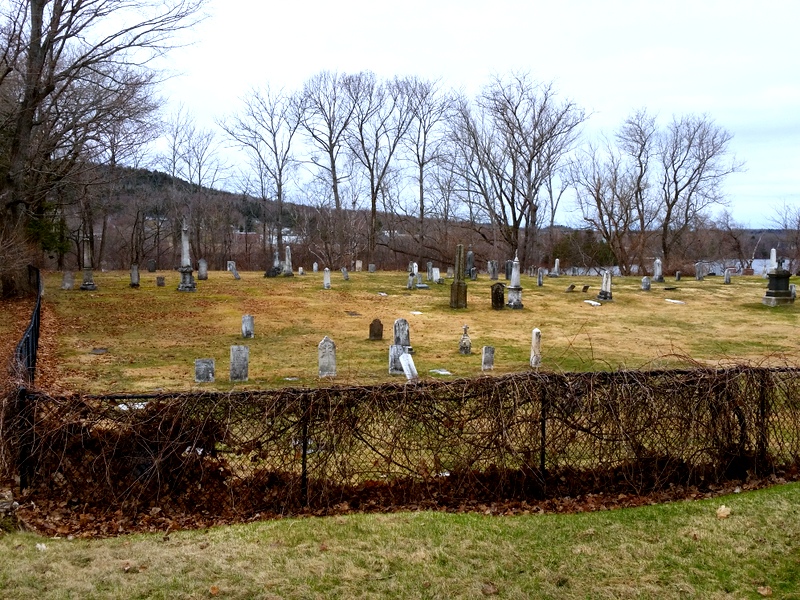
| Description | : | With the arrival of so many Irish immigrants in the early 1800's, the need for an established Roman Catholic church in Woodstock (then known as "The Creek") grew. In 1832, St. Malachy's Chapel was built on the current site of St. Gertrude's Roman Catholic Church. By 1842, St. Gertrude's Parish was established, the same time that the Maine/New Brunswick border was created. In 1849 Woodstock Parish encompassed Nackawic to Grand Falls, including Houlton, Maine. It was another 10 years before the first Mass was celebrated due to the local protestant/ Catholic strife, culminating in a riot... Read More |
frequently asked questions (FAQ):
-
Where is St. Gertrude's Roman Catholic Church Cemetery?
St. Gertrude's Roman Catholic Church Cemetery is located at Woodstock, Carleton County ,New Brunswick ,Canada.
-
St. Gertrude's Roman Catholic Church Cemetery cemetery's updated grave count on graveviews.com?
5 memorials
-
Where are the coordinates of the St. Gertrude's Roman Catholic Church Cemetery?
Latitude: 46.1448830
Longitude: -67.5795080
Nearby Cemetories:
1. Methodist Cemetery
Woodstock, Carleton County, Canada
Coordinate: 46.1457500, -67.5792500
2. Calvary Catholic Cemetery
Woodstock, Carleton County, Canada
Coordinate: 46.1507300, -67.5937700
3. Woodstock Rural Cemetery
Woodstock, Carleton County, Canada
Coordinate: 46.1493600, -67.5999500
4. Grafton Cemetery
Grafton, Carleton County, Canada
Coordinate: 46.1683697, -67.5627304
5. Upper Woodstock Cemetery
Upper Woodstock, Carleton County, Canada
Coordinate: 46.1716500, -67.5737900
6. Anglican Cemetery
Woodstock, Carleton County, Canada
Coordinate: 46.1086968, -67.5684877
7. Jacksonville Anglican Cemetery
Jacksonville, Carleton County, Canada
Coordinate: 46.1918800, -67.6055900
8. Bedell Settlement Cemetery
Bedell Settlement, Carleton County, Canada
Coordinate: 46.1331010, -67.6539630
9. Pembroke Cemetery
Pembroke, Carleton County, Canada
Coordinate: 46.1933710, -67.5344050
10. Jacksonville Community Cemetery
Jacksonville, Carleton County, Canada
Coordinate: 46.2024800, -67.6112400
11. Haynes Family Cemetery
Richmond Corner, Carleton County, Canada
Coordinate: 46.1504810, -67.6752390
12. Wakefield Community Cemetery
Wakefield, Carleton County, Canada
Coordinate: 46.2103590, -67.5287590
13. Pioneer Cemetery
Lower Wakefield, Carleton County, Canada
Coordinate: 46.2139200, -67.5247300
14. St. John's Anglican Cemetery
Richmond Corner, Carleton County, Canada
Coordinate: 46.1458400, -67.7014780
15. Richmond Corner United Church Cemetery
Richmond Corner, Carleton County, Canada
Coordinate: 46.1405890, -67.7079940
16. Lower Brighton Cemetery
Lower Brighton, Carleton County, Canada
Coordinate: 46.2198060, -67.5057780
17. Saint Joseph's Cemetery
Newburg, Carleton County, Canada
Coordinate: 46.1943700, -67.4666500
18. Northampton Kirk Cemetery
Woodstock, Carleton County, Canada
Coordinate: 46.0525000, -67.5535000
19. Saint John's United Church Cemetery
McKenzie Corner, Carleton County, Canada
Coordinate: 46.1016580, -67.7184300
20. Greenbank Cemetery
Wakefield, Carleton County, Canada
Coordinate: 46.2411630, -67.5112380
21. Jacksontown Cemetery
Jacksontown, Carleton County, Canada
Coordinate: 46.2490500, -67.6202300
22. McKenzie Corner Presbyterian Cemetery
McKenzie Corner, Carleton County, Canada
Coordinate: 46.1017400, -67.7236900
23. McKenzie Corner United Baptist Cemetery
McKenzie Corner, Carleton County, Canada
Coordinate: 46.1002730, -67.7256850
24. Lindsay United Baptist Church Cemetery
Lindsay, Carleton County, Canada
Coordinate: 46.2327740, -67.6785000