
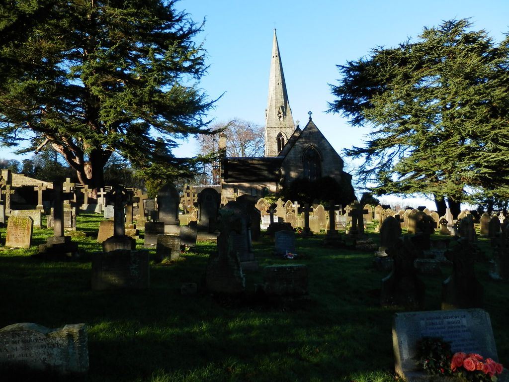
| Memorials | : | 78 |
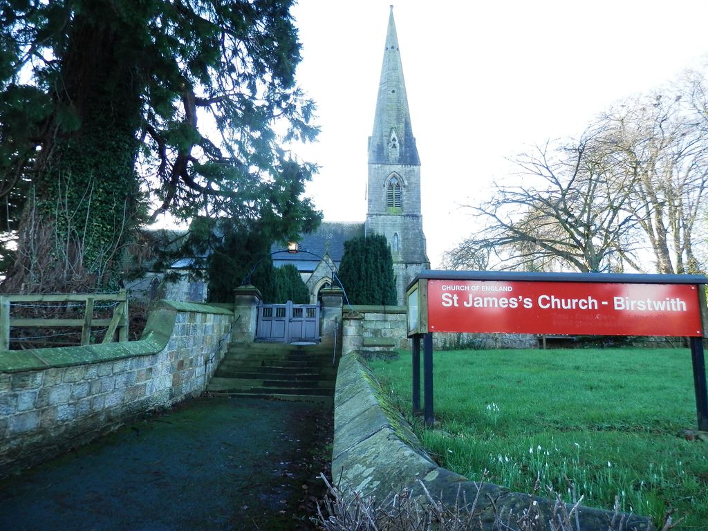
| Location | : | Birstwith, Harrogate Borough, England |
| Coordinate | : | 54.0307600, -1.6367800 |
| Description | : | Birstwith is a village and civil parish in the Harrogate district of North Yorkshire, England. It is part of Nidderdale, and is situated on the River Nidd. According to the 2001 census, the parish had a population of 756 increasing to 868 at the 2011 Census. In 1856-7 Frederick Greenwood built St James's church, after overriding the opposition of Thomas Shan, vicar of Hampsthwaite. The church was designed by M. Rhode Hawkins. He was the son-in-law of Frederick Greenwood and architect to the Privy Council Office. He used a 13th - 14th century Gothic style with a tall slender spire. Stone... Read More |
frequently asked questions (FAQ):
-
Where is St James Churchyard?
St James Churchyard is located at Birstwith, Harrogate Borough ,North Yorkshire ,England.
-
St James Churchyard cemetery's updated grave count on graveviews.com?
78 memorials
-
Where are the coordinates of the St James Churchyard?
Latitude: 54.0307600
Longitude: -1.6367800
Nearby Cemetories:
1. Quaker Burial Ground Hardcastle Garth
Hartwith-cum-Winsley, Harrogate Borough, England
Coordinate: 54.0390740, -1.6563110
2. St Andrew Churchyard
Burnt Yates, Harrogate Borough, England
Coordinate: 54.0457630, -1.6174990
3. St Thomas Becket Churchyard
Hampsthwaite, Harrogate Borough, England
Coordinate: 54.0267170, -1.6054560
4. Misson Church Churchyard
Felliscliffe, Harrogate Borough, England
Coordinate: 54.0100260, -1.6500610
5. St Jude Churchyard
Hartwith-cum-Winsley, Harrogate Borough, England
Coordinate: 54.0506810, -1.6713070
6. St Joseph Roman Catholic Churchyard
Bishop Thornton, Harrogate Borough, England
Coordinate: 54.0655250, -1.6023280
7. All Saints Churchyard
Ripley, Harrogate Borough, England
Coordinate: 54.0397200, -1.5687800
8. St Thomas the Apostle Churchyard
Killinghall, Harrogate Borough, England
Coordinate: 54.0206880, -1.5669210
9. St John the Evangelist Church of England
Bishop Thornton, Harrogate Borough, England
Coordinate: 54.0672100, -1.5991650
10. Providence United Reformed Churchyard
Dacre, Harrogate Borough, England
Coordinate: 54.0437240, -1.7074570
11. Holy Trinity Churchyard
Dacre, Harrogate Borough, England
Coordinate: 54.0563270, -1.6996410
12. Friends Burial Ground
Dacre, Harrogate Borough, England
Coordinate: 54.0412270, -1.7161800
13. St Paul and St Margaret Churchyard
Nidd, Harrogate Borough, England
Coordinate: 54.0423920, -1.5417480
14. St Saviour Churchyard
Thornthwaite, Harrogate Borough, England
Coordinate: 54.0288750, -1.7372950
15. Fewston Cemetery
Blubberhouses, Harrogate Borough, England
Coordinate: 53.9950600, -1.7176000
16. St Michael and St Lawrence Churchyard
Fewston, Harrogate Borough, England
Coordinate: 53.9827830, -1.7040760
17. St John the Evangelist Churchyard
Bilton, Harrogate Borough, England
Coordinate: 54.0080790, -1.5373560
18. Harlow Hill Cemetery
Harrogate, Harrogate Borough, England
Coordinate: 53.9803290, -1.5646610
19. St. Michael the Archangel Churchyard
Markington, Harrogate Borough, England
Coordinate: 54.0807600, -1.5636610
20. Grove Road Cemetery
Harrogate, Harrogate Borough, England
Coordinate: 53.9996400, -1.5356000
21. Harrogate War Memorial
Harrogate, Harrogate Borough, England
Coordinate: 53.9926370, -1.5419270
22. St Peter Church War Memorial
Harrogate, Harrogate Borough, England
Coordinate: 53.9931340, -1.5412160
23. St Wilfrid Churchyard
South Stainley, Harrogate Borough, England
Coordinate: 54.0636650, -1.5327810
24. St Andrew Churchyard
Blubberhouses, Harrogate Borough, England
Coordinate: 53.9932200, -1.7455200