
| Memorials | : | 0 |
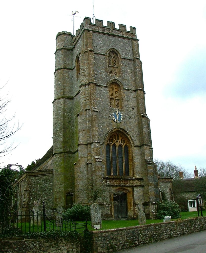
| Location | : | Hawkchurch, East Devon District, England |
| Coordinate | : | 50.7994590, -2.9335560 |
frequently asked questions (FAQ):
-
Where is St. John the Baptist Churchyard?
St. John the Baptist Churchyard is located at Hawkchurch Road Hawkchurch, East Devon District ,Devon , EX13 5XDEngland.
-
St. John the Baptist Churchyard cemetery's updated grave count on graveviews.com?
0 memorials
-
Where are the coordinates of the St. John the Baptist Churchyard?
Latitude: 50.7994590
Longitude: -2.9335560
Nearby Cemetories:
1. All Saints Churchyard
Axminster, East Devon District, England
Coordinate: 50.8054584, -2.9877668
2. St. Mary's Churchyard
Marshwood, West Dorset District, England
Coordinate: 50.7929400, -2.8775200
3. St Andrew's Churchyard
Monkton Wyld, West Dorset District, England
Coordinate: 50.7625200, -2.9419700
4. St Mary Roman Catholic Churchyard
Axminster, East Devon District, England
Coordinate: 50.7805380, -2.9924980
5. War Memorial Axminster
Axminster, East Devon District, England
Coordinate: 50.7819630, -2.9992970
6. Axminster Cemetery
Axminster, East Devon District, England
Coordinate: 50.7814963, -3.0001185
7. St Stephen Churchyard
Bettiscombe, West Dorset District, England
Coordinate: 50.7962210, -2.8540230
8. Holy Trinity Churchyard
Blackdown, West Dorset District, England
Coordinate: 50.8240600, -2.8582500
9. Charmouth Cemetery
Charmouth, West Dorset District, England
Coordinate: 50.7429500, -2.9175000
10. Newenham Abbey
Axminster, East Devon District, England
Coordinate: 50.7658620, -3.0090900
11. St Mary's Churchyard
Catherston Leweston, West Dorset District, England
Coordinate: 50.7456790, -2.8948410
12. St. John the Baptist Churchyard
Membury, East Devon District, England
Coordinate: 50.8219420, -3.0229970
13. United Reformed Church Cemetery
Charmouth, West Dorset District, England
Coordinate: 50.7391100, -2.8995100
14. St Andrew Churchyard
Charmouth, West Dorset District, England
Coordinate: 50.7384330, -2.9022810
15. St Mary Churchyard
Pilsdon, West Dorset District, England
Coordinate: 50.7925420, -2.8317720
16. Lyme Regis Cemetery
Lyme Regis, West Dorset District, England
Coordinate: 50.7304320, -2.9334380
17. Blessed Virgin Mary Churchyard
Chard, South Somerset District, England
Coordinate: 50.8693420, -2.9634360
18. St Michael the Archangel Churchyard
Lyme Regis, West Dorset District, England
Coordinate: 50.7257540, -2.9317900
19. St Andrew Churchyard
Burstock, West Dorset District, England
Coordinate: 50.8228330, -2.8216970
20. Cricket St Thomas Church
Cricket St Thomas, South Somerset District, England
Coordinate: 50.8733370, -2.8926326
21. Chard Cemetery
Chard, South Somerset District, England
Coordinate: 50.8759730, -2.9676070
22. Saint Michaels Church
Musbury, East Devon District, England
Coordinate: 50.7465179, -3.0290514
23. Stanton St. Gabriel Churchyard
Morcombelake, West Dorset District, England
Coordinate: 50.7407480, -2.8443460
24. Musbury Chapel
Musbury, East Devon District, England
Coordinate: 50.7480036, -3.0340822