| Memorials | : | 471 |
| Location | : | Rochester, Medway Unitary Authority, England |
| Coordinate | : | 51.3849380, 0.4993630 |
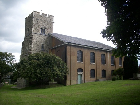
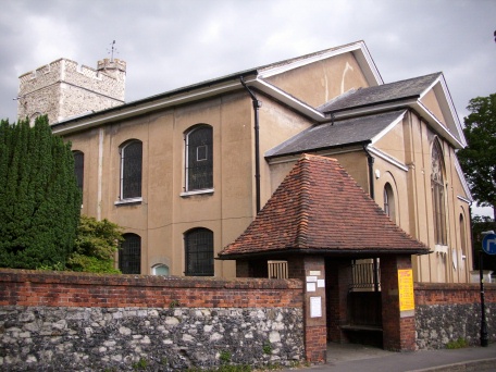
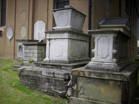
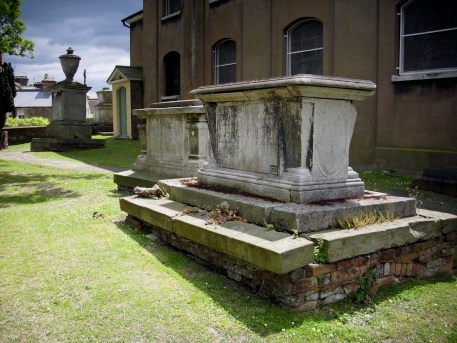
| Description | : | Although St Margaret's does not boast many celebrities in its history, there have been one or two. In the north gallery there is a memorial to Captain John Moore Mansfield who commanded HMS Minotaur, one of the Nelson's ships at Trafalgar, in which he distinguished himself by capturing an enemy ship. He owned land in the parish. One of Canon Thorndike's daughter's – Sybil, who taught in the Sunday School – made an international name for herself as an actress, and from the same talented family came Russell, famed for his books for children. Lastly we can make a small... Read More |
frequently asked questions (FAQ):
-
Where is St Margaret Churchyard?
St Margaret Churchyard is located at Rochester, Medway Unitary Authority ,Kent ,England.
-
St Margaret Churchyard cemetery's updated grave count on graveviews.com?
471 memorials
-
Where are the coordinates of the St Margaret Churchyard?
Latitude: 51.3849380
Longitude: 0.4993630
Nearby Cemetories:
1. Rochester Baptist Church
Rochester, Medway Unitary Authority, England
Coordinate: 51.3871570, 0.5052370
2. Rochester Cathedral
Rochester, Medway Unitary Authority, England
Coordinate: 51.3889750, 0.5031160
3. Rochester Castle Moat Burial Ground
Rochester, Medway Unitary Authority, England
Coordinate: 51.3894140, 0.5024580
4. St Nicholas Churchyard
Rochester, Medway Unitary Authority, England
Coordinate: 51.3894170, 0.5035320
5. St. Nicholas's Cemetery
Rochester, Medway Unitary Authority, England
Coordinate: 51.3780081, 0.5021076
6. St. Margaret's Cemetery
Rochester, Medway Unitary Authority, England
Coordinate: 51.3777000, 0.5011600
7. Strood Cemetery
Strood, Medway Unitary Authority, England
Coordinate: 51.3900220, 0.4838640
8. Fort Pitt Military Cemetery
Rochester, Medway Unitary Authority, England
Coordinate: 51.3769790, 0.5114570
9. St Nicholas with St Mary Churchyard
Strood, Medway Unitary Authority, England
Coordinate: 51.3959790, 0.4931350
10. Chatham Unitarian Church
Chatham, Medway Unitary Authority, England
Coordinate: 51.3826090, 0.5195850
11. St Matthew Churchyard
Borstal, Medway Unitary Authority, England
Coordinate: 51.3736150, 0.4868020
12. St Mary Churchyard
Chatham, Medway Unitary Authority, England
Coordinate: 51.3874550, 0.5244280
13. All Saints Churchyard
Frindsbury, Medway Unitary Authority, England
Coordinate: 51.4004440, 0.5058970
14. Chatham Burial Ground
Chatham, Medway Unitary Authority, England
Coordinate: 51.3849900, 0.5272600
15. Brompton War Memorial
Chatham, Medway Unitary Authority, England
Coordinate: 51.3932140, 0.5293660
16. Chatham Naval Memorial
Chatham, Medway Unitary Authority, England
Coordinate: 51.3836479, 0.5321670
17. Chatham Maidstone Road Cemetery
Chatham, Medway Unitary Authority, England
Coordinate: 51.3703300, 0.5227600
18. Chatham Palmerston Road Cemetery
Chatham, Medway Unitary Authority, England
Coordinate: 51.3678600, 0.5267300
19. St George Churchyard
Chatham, Medway Unitary Authority, England
Coordinate: 51.3974070, 0.5346770
20. St Philip and St James Churchyard
Upnor, Medway Unitary Authority, England
Coordinate: 51.4106250, 0.5250480
21. St. Michael and All Angels Churchyard
Cuxton, Medway Unitary Authority, England
Coordinate: 51.3714120, 0.4546760
22. St. Augustine's Church
Gillingham, Medway Unitary Authority, England
Coordinate: 51.3745050, 0.5474930
23. Christ Church Cemetery
Chatham, Medway Unitary Authority, England
Coordinate: 51.3716730, 0.5462690
24. St. Barnabas Church
Gillingham, Medway Unitary Authority, England
Coordinate: 51.3801400, 0.5505370


