
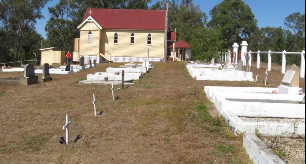
| Memorials | : | 88 |
| Location | : | Brooweena, Fraser Coast Region, Australia |
| Coordinate | : | -25.6155810, 152.2342900 |
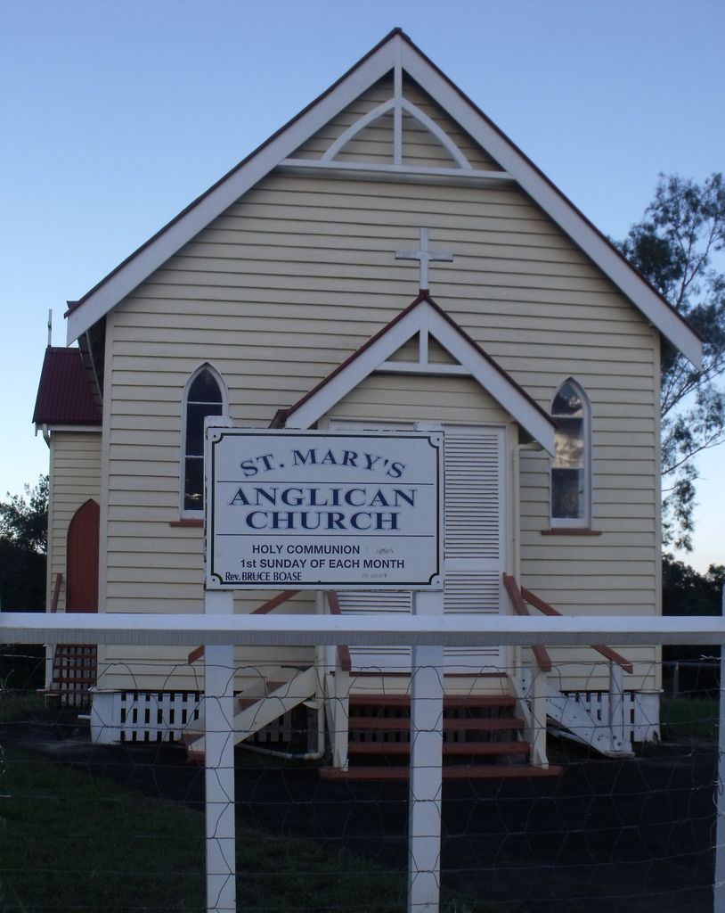
| Description | : | The Land for the church and Cemetery was donated by Elizabeth Thomas [Eaton] and was part of the property 'Clifton'. It is the resting place of 16 of her relatives including 5 of her children and her 2nd husband Thomas George Thomas. Elizabeth's headstone is only marked as ''Mother''. The opening service took place on the 2nd November 1919. the bell standing in the bell tower was donated by D.O.S Jones. It was originally used to call the Kanakas to dinner at ''Eatonvale'' sugar plantation in Tinana owned by Elizabeth's father and 2nd Mayor of Maryborough John Eaton. |
frequently asked questions (FAQ):
-
Where is St Mary's Anglican Churchyard?
St Mary's Anglican Churchyard is located at Maryborough Biggenden Rd Brooweena, Fraser Coast Region ,Queensland , 4620Australia.
-
St Mary's Anglican Churchyard cemetery's updated grave count on graveviews.com?
88 memorials
-
Where are the coordinates of the St Mary's Anglican Churchyard?
Latitude: -25.6155810
Longitude: 152.2342900
Nearby Cemetories:
1. Degilbo Cemetery
Degilbo, North Burnett Region, Australia
Coordinate: -25.4774440, 151.9982160
2. Deborah Cemetery
Netherby, Fraser Coast Region, Australia
Coordinate: -25.7827119, 152.4940048
3. Coalstoun Lakes Cemetery
Coalstoun Lakes, North Burnett Region, Australia
Coordinate: -25.6147010, 151.8871120
4. Chowey Cemetery
Chowey, North Burnett Region, Australia
Coordinate: -25.4513533, 151.9287490
5. Tiaro Cemetery
Tiaro, Fraser Coast Region, Australia
Coordinate: -25.7173650, 152.5856850
6. Agnes Vale Station Cemetery
Childers, Bundaberg Region, Australia
Coordinate: -25.2720660, 152.2496070
7. Munna Creek Cemetery
Gundiah, Fraser Coast Region, Australia
Coordinate: -25.8943010, 152.4806150
8. Apple Tree Creek Cemetery
Apple Tree Creek, Bundaberg Region, Australia
Coordinate: -25.2254030, 152.2386650
9. Childers Lawn Cemetery
Childers, Bundaberg Region, Australia
Coordinate: -25.2241618, 152.2642764
10. Maryborough Pioneer Cemetery
Maryborough, Fraser Coast Region, Australia
Coordinate: -25.5232830, 152.6746380
11. Maryborough Crematorium
Maryborough, Fraser Coast Region, Australia
Coordinate: -25.5116294, 152.6716756
12. Maryborough Cemetery
Maryborough, Fraser Coast Region, Australia
Coordinate: -25.5165460, 152.6735930
13. Maryborough Lawn Cemetery
Maryborough, Fraser Coast Region, Australia
Coordinate: -25.5126410, 152.6731850
14. Dickabram Cemetery
Miva, Gympie Region, Australia
Coordinate: -25.9604510, 152.4848260
15. Howard Remembrance Park
Howard, Fraser Coast Region, Australia
Coordinate: -25.3054360, 152.5470520
16. Elizabeth Park Rose Gardens
Maryborough, Fraser Coast Region, Australia
Coordinate: -25.5317100, 152.6952600
17. Commissioner Bidwill's Grave
Maryborough, Fraser Coast Region, Australia
Coordinate: -25.5631670, 152.7110000
18. Tansey Cemetery
Tansey, Gympie Region, Australia
Coordinate: -26.0286227, 152.0403891
19. Cordalba Cemetery
Cordalba, Bundaberg Region, Australia
Coordinate: -25.1562560, 152.2146830
20. Booyal Cemetery
Booyal, Bundaberg Region, Australia
Coordinate: -25.1758160, 152.0520170
21. Gunalda Cemetery
Gunalda, Gympie Region, Australia
Coordinate: -25.9877920, 152.5557680
22. Kilkivan Cemetery
Kilkivan, Gympie Region, Australia
Coordinate: -26.1072030, 152.2758930
23. Boonara Cemetery
Goomeri, Gympie Region, Australia
Coordinate: -26.0850320, 152.0540160
24. Barlows Farm Cemetery
Takura, Fraser Coast Region, Australia
Coordinate: -25.3330030, 152.7191200