
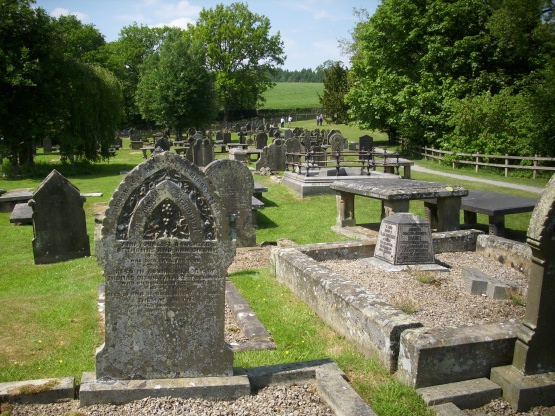
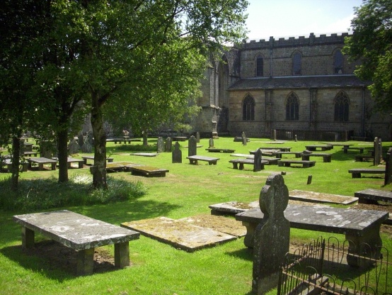
| Memorials | : | 31 |
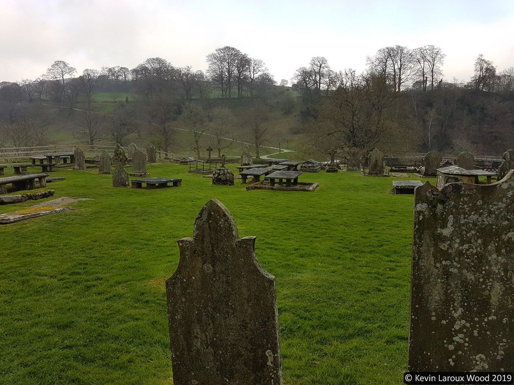
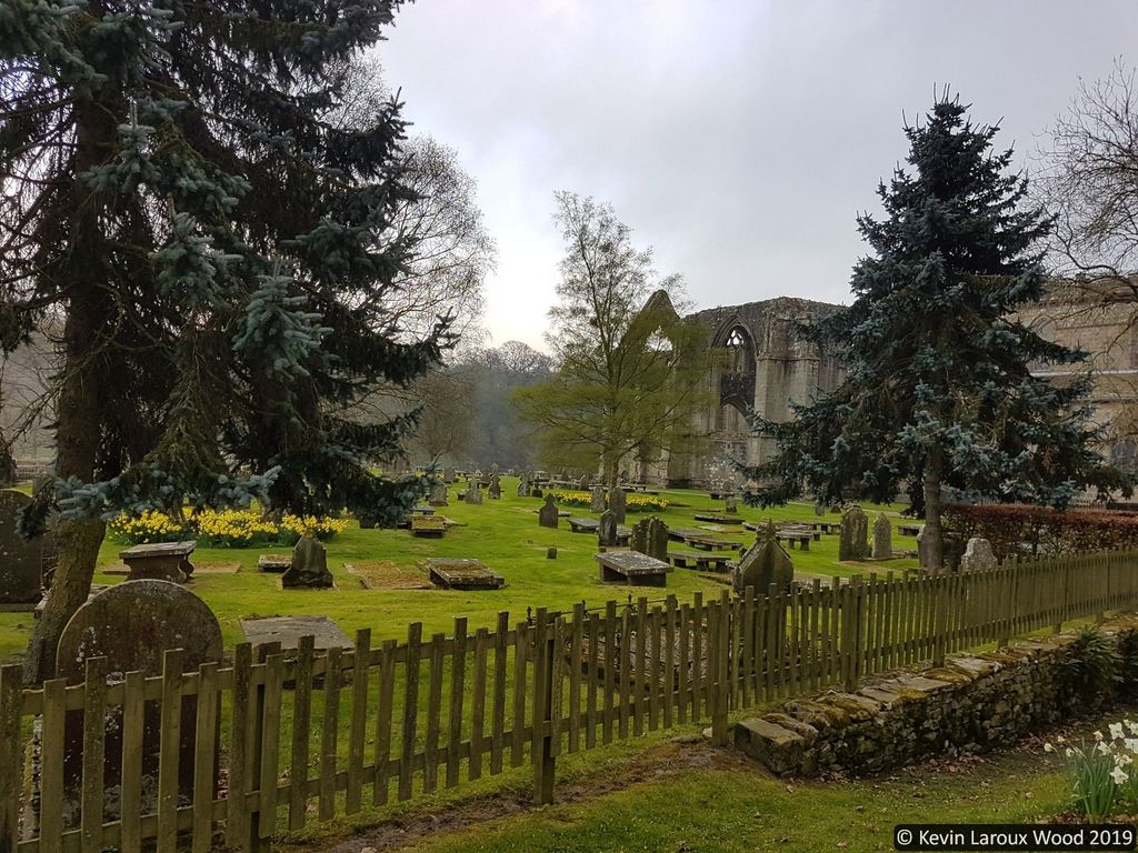
| Location | : | Bolton Abbey, Craven District, England |
| Coordinate | : | 53.9825000, -1.8872220 |
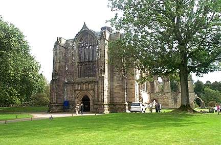
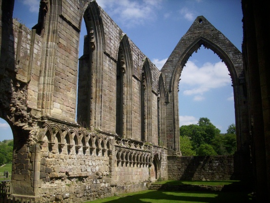
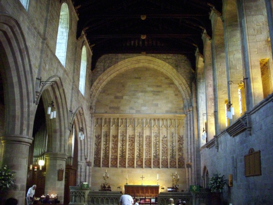
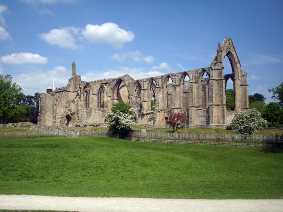
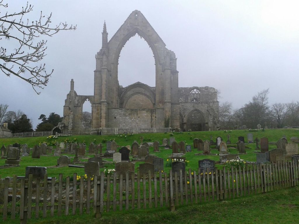
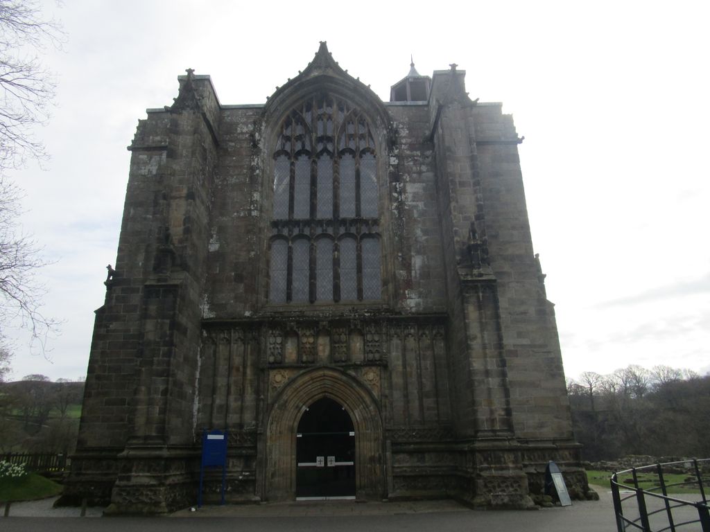
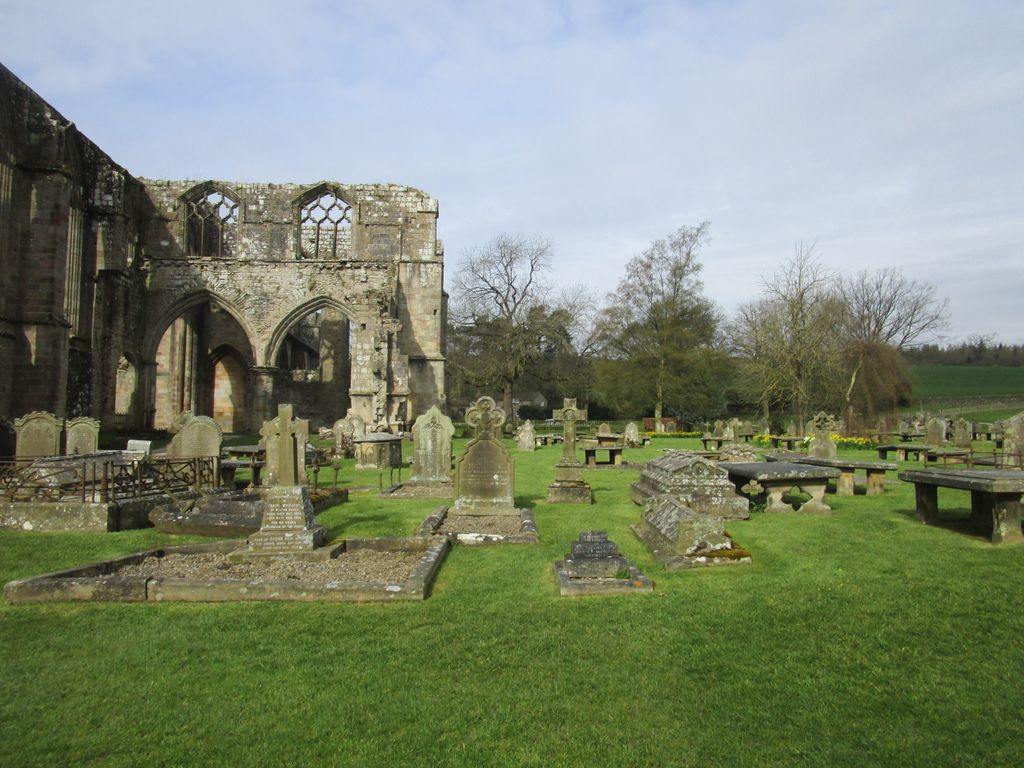
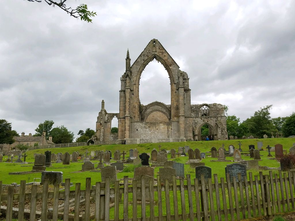
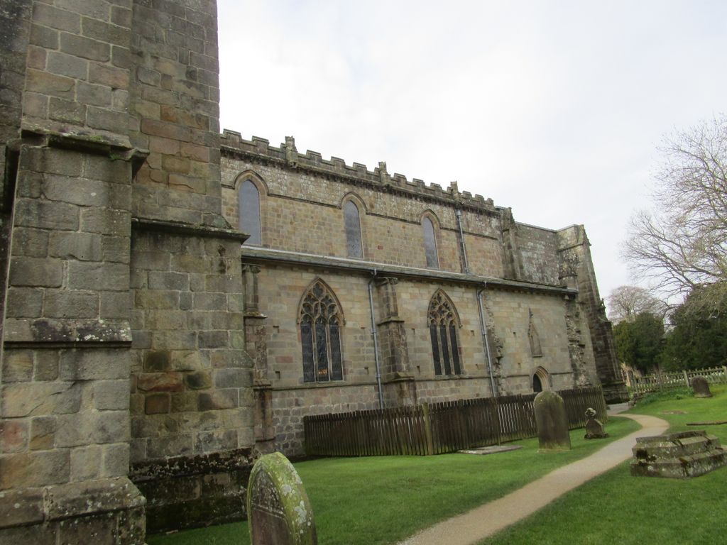
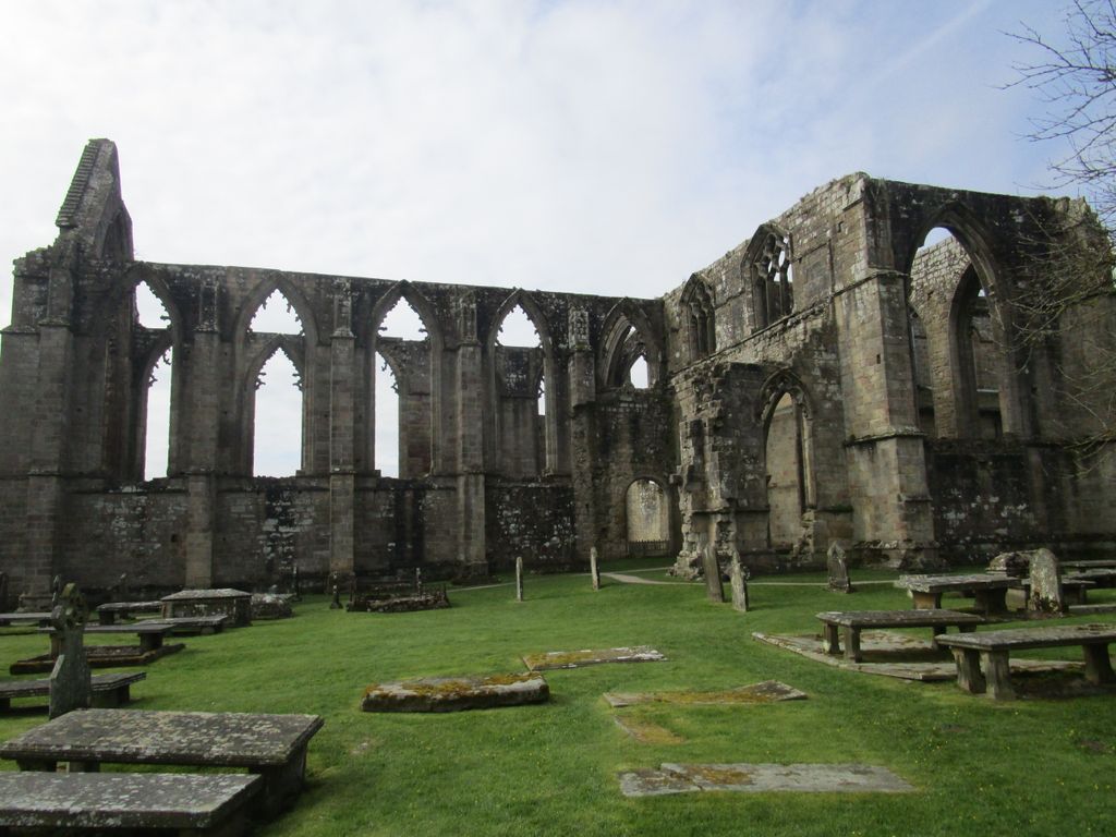
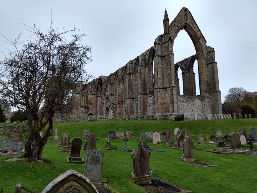
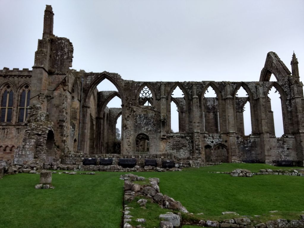
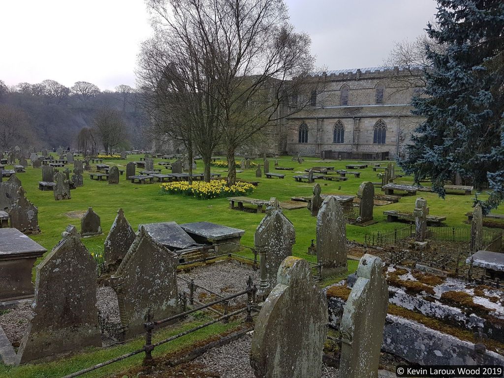
| Description | : | Founded in 1154 by the Augustinian order on the banks of the River Wharfe on land given to the order by Lady Alice de Romille of Skipton Castle. The monastery originated in 1120 at nearby Embsay. The priory was abandoned during the Dissolution of the Monasteries in 1539. The east end remains in ruins, and a tower, begun in 1520, was left half-standing, The restoration of the priory church located in the present village of Bolton Abbey began in the 19th century under the guidance of the Devonshire family. The restoration continued to the 1900's, and the ... Read More |
frequently asked questions (FAQ):
-
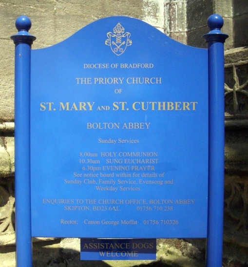
Where is St. Mary and St. Cuthbert Priory Churchyard?
St. Mary and St. Cuthbert Priory Churchyard is located at Route B6160 Bolton Abbey, Craven District ,North Yorkshire , BD23 6ALEngland.
-
St. Mary and St. Cuthbert Priory Churchyard cemetery's updated grave count on graveviews.com?
30 memorials
-
Where are the coordinates of the St. Mary and St. Cuthbert Priory Churchyard?
Latitude: 53.9825000
Longitude: -1.8872220

Nearby Cemetories:
1. St Peter Churchyard
Addingham, Metropolitan Borough of Bradford, England
Coordinate: 53.9433200, -1.8720200
2. St Mary Churchyard
Embsay, Craven District, England
Coordinate: 53.9829390, -1.9834030
3. All Saints Churchyard
Ilkley, Metropolitan Borough of Bradford, England
Coordinate: 53.9267050, -1.8241970
4. Ilkley War Memorial
Ilkley, Metropolitan Borough of Bradford, England
Coordinate: 53.9246070, -1.8288130
5. Ilkley Cemetery
Ilkley, Metropolitan Borough of Bradford, England
Coordinate: 53.9304820, -1.8133870
6. St Margaret Churchyard
Ilkley, Metropolitan Borough of Bradford, England
Coordinate: 53.9209950, -1.8269930
7. St James Churchyard
Silsden, Metropolitan Borough of Bradford, England
Coordinate: 53.9139070, -1.9390650
8. Silsden Cemetery
Silsden, Metropolitan Borough of Bradford, England
Coordinate: 53.9106500, -1.9267000
9. St Wilfrid Churchyard
Burnsall, Craven District, England
Coordinate: 54.0495000, -1.9520690
10. St. Andrew's Churchyard
Skipton, Craven District, England
Coordinate: 53.9609959, -2.0140994
11. St Helen Churchyard
Denton, Harrogate Borough, England
Coordinate: 53.9360940, -1.7808630
12. Holy Trinity Churchyard
Skipton, Craven District, England
Coordinate: 53.9633250, -2.0161180
13. Skipton War Memorial
Skipton, Craven District, England
Coordinate: 53.9627100, -2.0161680
14. Friends Burial Ground at Skipton
Skipton, Craven District, England
Coordinate: 53.9599220, -2.0148630
15. Bradley Cemetery
Bradleys Both, Craven District, England
Coordinate: 53.9306747, -1.9907120
16. Raikes Road Burial Ground
Skipton, Craven District, England
Coordinate: 53.9643822, -2.0196819
17. St Stephen Roman Catholic Churchyard
Skipton, Craven District, England
Coordinate: 53.9631760, -2.0210240
18. Christ Churchyard
Skipton, Craven District, England
Coordinate: 53.9581200, -2.0188910
19. Tarn Moor Memorial Woodland Burial Ground
Skipton, Craven District, England
Coordinate: 53.9759590, -2.0254260
20. St Andrew Churchyard
Blubberhouses, Harrogate Borough, England
Coordinate: 53.9932200, -1.7455200
21. Holy Trinity Cemetery
Thruscross, Harrogate Borough, England
Coordinate: 54.0259440, -1.7646110
22. Waltonwrays Cemetery and Skipton Crematorium
Skipton, Craven District, England
Coordinate: 53.9505500, -2.0272300
23. St Peter Churchyard
Hebden, Craven District, England
Coordinate: 54.0626500, -1.9618960
24. St Andrew Churchyard
Kildwick, Craven District, England
Coordinate: 53.9091560, -1.9839700