
| Memorials | : | 2 |
| Location | : | Chiselborough, South Somerset District, England |
| Coordinate | : | 50.9308340, -2.7589220 |
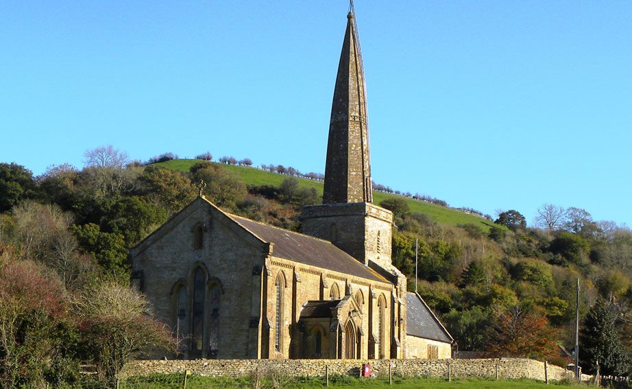
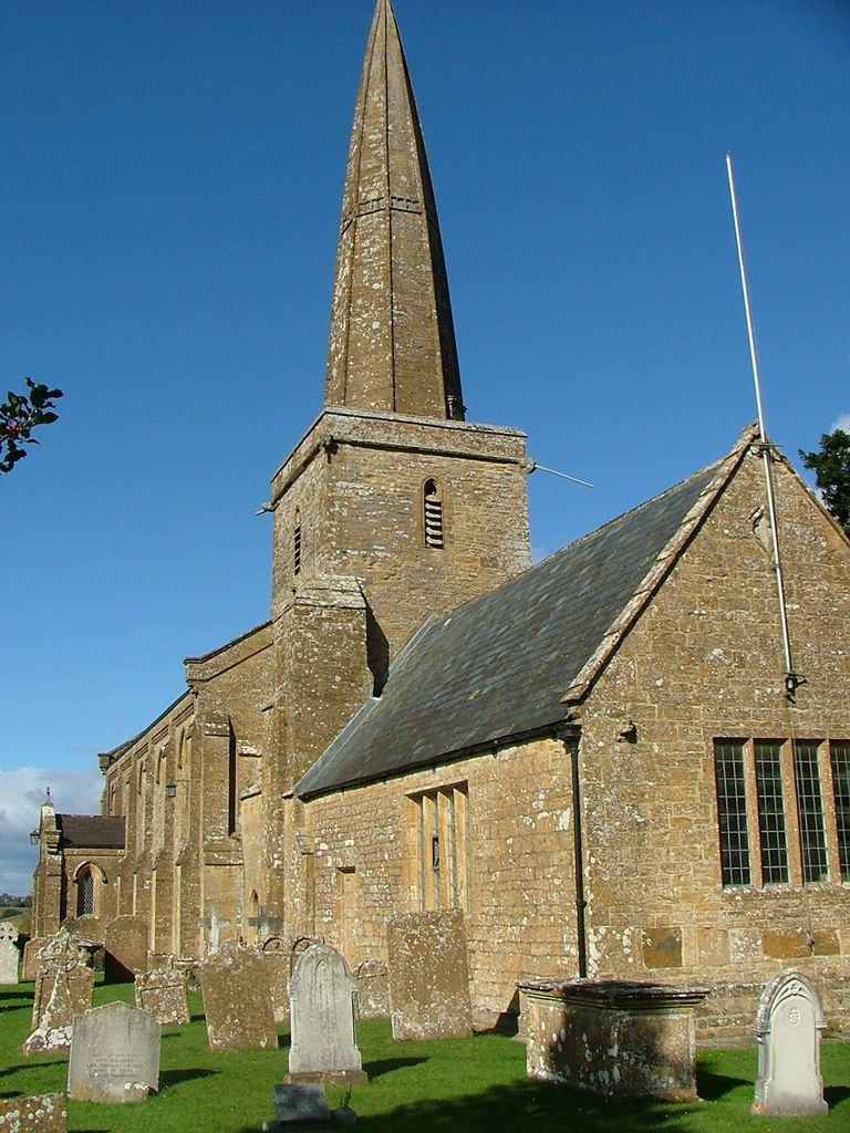
| Description | : | The 13th century parish church is well lit by tall windows and white walls. The original Norman church probably consisted of a low central tower with a chancel and short nave. The present church has been much restored in modern times, notably in 1842, in 1911/12 with an extension of the nave and in 1980/81 with the repair of the nave ceiling. Unusual features include the 13th century spire and the central position of the tower. The shields in the west window are those of the Strangways family (Earls of Ilchester) and of the Wyndhams, both of whom at... Read More |
frequently asked questions (FAQ):
-
Where is St. Peter and St. Paul's Churchyard?
St. Peter and St. Paul's Churchyard is located at Church Lane Chiselborough, Somerset, England Chiselborough, South Somerset District ,Somerset ,England.
-
St. Peter and St. Paul's Churchyard cemetery's updated grave count on graveviews.com?
2 memorials
-
Where are the coordinates of the St. Peter and St. Paul's Churchyard?
Latitude: 50.9308340
Longitude: -2.7589220
Nearby Cemetories:
1. Church of St. Mary the Virgin
Norton-sub-Hamdon, South Somerset District, England
Coordinate: 50.9404356, -2.7550615
2. St. Margaret's Churchyard
Middle Chinnock, South Somerset District, England
Coordinate: 50.9151370, -2.7522120
3. All Saints Churchyard
Merriott, South Somerset District, England
Coordinate: 50.9123410, -2.7941670
4. Montacute Priory
Montacute, South Somerset District, England
Coordinate: 50.9489820, -2.7183880
5. United Reform Churchyard
Martock, South Somerset District, England
Coordinate: 50.9609320, -2.7735020
6. St. Mary's Churchyard
East Chinnock, South Somerset District, England
Coordinate: 50.9164240, -2.7145142
7. St. Catherine's Churchyard
Montacute, South Somerset District, England
Coordinate: 50.9495420, -2.7178200
8. St. Michael and All Angels Churchyard
Haselbury Plucknett, South Somerset District, England
Coordinate: 50.8954140, -2.7531080
9. St. Peter and St. Paul's Churchyard
Odcombe, South Somerset District, England
Coordinate: 50.9365190, -2.7031239
10. All Saints Churchyard
Lopen, South Somerset District, England
Coordinate: 50.9270850, -2.8164620
11. All Saints Churchyard
Martock, South Somerset District, England
Coordinate: 50.9692420, -2.7687860
12. Lufton Anglican Churchyard
Lufton, South Somerset District, England
Coordinate: 50.9491080, -2.6917910
13. St Andrew's Churchyard
Brympton, South Somerset District, England
Coordinate: 50.9358500, -2.6855500
14. St James Churchyard
Kingsbury Episcopi, South Somerset District, England
Coordinate: 50.9646420, -2.8106370
15. St Marys Churchyard
Hardington Mandeville, South Somerset District, England
Coordinate: 50.9046300, -2.6954050
16. St Martin's Churchyard
North Perrott, South Somerset District, England
Coordinate: 50.8828270, -2.7518080
17. St George Churchyard
Hinton St George, South Somerset District, England
Coordinate: 50.9106520, -2.8285630
18. St Bartholomew Churchyard
Crewkerne, South Somerset District, England
Coordinate: 50.8851640, -2.7981790
19. Ash Parish Cemetery
Ash, South Somerset District, England
Coordinate: 50.9833540, -2.7538380
20. Holy Trinity Churchyard
Ash, South Somerset District, England
Coordinate: 50.9834250, -2.7528400
21. Townsend Cemetery
Crewkerne, South Somerset District, England
Coordinate: 50.8823800, -2.7952100
22. Saint Nicholas Churchyard
Dinnington, South Somerset District, England
Coordinate: 50.9111810, -2.8505240
23. St. James's Churchyard
Preston Plucknett, South Somerset District, England
Coordinate: 50.9437800, -2.6635960
24. Saint Leonards Churchyard
Misterton, South Somerset District, England
Coordinate: 50.8698905, -2.7795252