
| Memorials | : | 19 |
| Location | : | Woodlawn, Ottawa Municipality, Canada |
| Coordinate | : | 45.4538840, -76.0885620 |
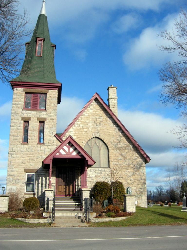
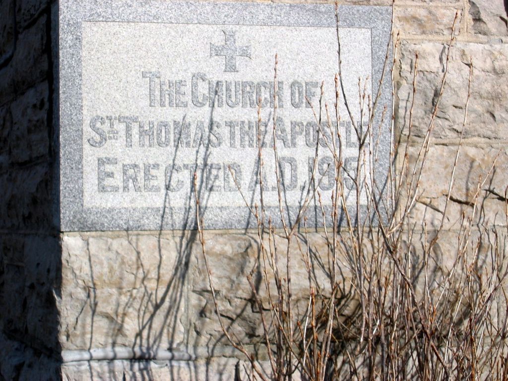
| Description | : | From http://www.archeion.ca/st-thomas-apostle-anglican-church-woodlawn-ont;isaar History-- A frame church was being used at Torbolton (later called Woodlawn) by 1874. St. Thomas the Apostle was consecrated on September 20, 1882 by Bishop J. Travers Lewis. In 1915, the present stone St. Thomas' Church was built to replace the old structure which was moved to the back of the lot and used until the new one was completed. The cornerstone of the new church was laid by Bishop John Charles Roper on July 1, 1915. The Bishop consecrated St. Thomas the Apostle, Woodlawn on December 14th of the same year. Land was donated in 1925 by Mr.... Read More |
frequently asked questions (FAQ):
-
Where is St. Thomas The Apostle Anglican Church?
St. Thomas The Apostle Anglican Church is located at 3794 Woodkilton Road Woodlawn, Ottawa Municipality ,Ontario ,Canada.
-
St. Thomas The Apostle Anglican Church cemetery's updated grave count on graveviews.com?
14 memorials
-
Where are the coordinates of the St. Thomas The Apostle Anglican Church?
Latitude: 45.4538840
Longitude: -76.0885620
Nearby Cemetories:
1. Epworth United Cemetery
Woodlawn, Ottawa Municipality, Canada
Coordinate: 45.4404780, -76.1193310
2. Torbolton Cemetery
Woodlawn, Ottawa Municipality, Canada
Coordinate: 45.4988900, -76.1218800
3. St. Paul's Anglican Cemetery
Dunrobin, Ottawa Municipality, Canada
Coordinate: 45.4218110, -76.0209880
4. Dunrobin United Church Cemetery
Dunrobin, Ottawa Municipality, Canada
Coordinate: 45.4199790, -76.0174570
5. Landon Cemetery
Ottawa, Ottawa Municipality, Canada
Coordinate: 45.4398550, -76.1796030
6. MacMillan Cemetery
West Carleton, Ottawa Municipality, Canada
Coordinate: 45.3968520, -76.1429700
7. Diamond Cemetery
Kinburn, Ottawa Municipality, Canada
Coordinate: 45.3874600, -76.1367100
8. Saint Paul's Anglican Cemetery
Ottawa Municipality, Canada
Coordinate: 45.3830900, -76.1304940
9. Saint Georges Anglican Cemetery
Fitzroy Harbour, Ottawa Municipality, Canada
Coordinate: 45.4770540, -76.2058400
10. Saint Michael's Roman Catholic Cemetery
Fitzroy Harbour, Ottawa Municipality, Canada
Coordinate: 45.4671380, -76.2135540
11. Zion United Church Cemetery
Eardley, Outaouais Region, Canada
Coordinate: 45.5474300, -76.0786300
12. Saint Lukes Anglican Cemetery
Eardley, Outaouais Region, Canada
Coordinate: 45.5486430, -76.0842190
13. Saint Dominique's Church
Luskville, Outaouais Region, Canada
Coordinate: 45.5343710, -76.0162750
14. Lowry Cemetery
Carp, Ottawa Municipality, Canada
Coordinate: 45.3603830, -76.1161900
15. Luskville Roman Catholic Cemetery
Luskville, Outaouais Region, Canada
Coordinate: 45.5347770, -76.0158130
16. Old Saint Marys Anglican Church Cemetery
Dunrobin, Ottawa Municipality, Canada
Coordinate: 45.4387500, -75.9521940
17. Centre Eardley Cemetery
Heyworth, Outaouais Region, Canada
Coordinate: 45.5014810, -75.9670270
18. Whyte's Cemetery
Fitzroy Harbour, Ottawa Municipality, Canada
Coordinate: 45.4908720, -76.2188010
19. Saint James Anglican Cemetery
Carp, Ottawa Municipality, Canada
Coordinate: 45.3467500, -76.0362700
20. Old Merrifield Cemetery
Breckenridge, Outaouais Region, Canada
Coordinate: 45.4507200, -75.9265200
21. Mohr Cemetery
Beech Grove, Outaouais Region, Canada
Coordinate: 45.5562720, -76.1692350
22. Saint John's Anglican Church Cemetery
Quyon, Outaouais Region, Canada
Coordinate: 45.5214480, -76.2315440
23. Galetta Hunt Cemetery
Kinburn, Ottawa Municipality, Canada
Coordinate: 45.3969440, -76.2427780
24. St. Mary's Catholic Cemetery - OLD
Pontiac Station, Outaouais Region, Canada
Coordinate: 45.4884864, -76.2617295