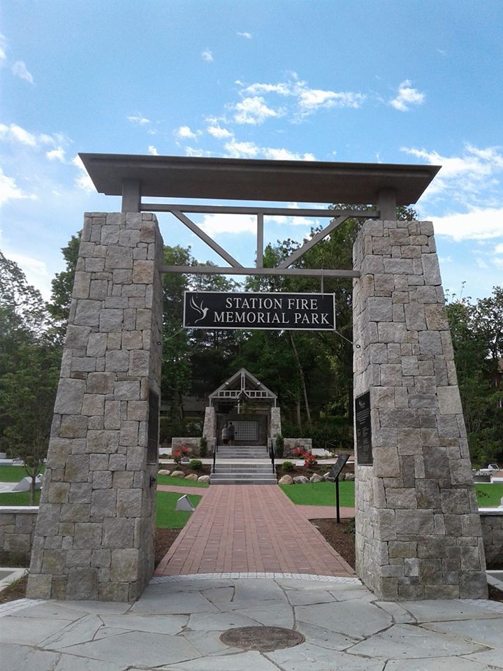
| Memorials | : | 0 |
| Location | : | West Warwick, Kent County, USA |
| Coordinate | : | 41.6843400, -71.5108700 |
| Description | : | Park and monument dedicated to The Station Nightclub fire disaster victims. No individual memorials are to be created within this listing. |
frequently asked questions (FAQ):
-
Where is Station Fire Memorial Park?
Station Fire Memorial Park is located at West Warwick, Kent County ,Rhode Island ,USA.
-
Station Fire Memorial Park cemetery's updated grave count on graveviews.com?
0 memorials
-
Where are the coordinates of the Station Fire Memorial Park?
Latitude: 41.6843400
Longitude: -71.5108700
Nearby Cemetories:
1. Waterman Lot
West Warwick, Kent County, USA
Coordinate: 41.6833800, -71.5099600
2. Brayton-Steadman Lot
West Warwick, Kent County, USA
Coordinate: 41.6859250, -71.5122400
3. Gideon Arnold Lot
West Warwick, Kent County, USA
Coordinate: 41.6871940, -71.5102220
4. Clapp-Greene Lot
West Warwick, Kent County, USA
Coordinate: 41.6834908, -71.5192032
5. Arnold Lot
West Warwick, Kent County, USA
Coordinate: 41.6836500, -71.5200500
6. Saint Mary Cemetery
West Warwick, Kent County, USA
Coordinate: 41.6861305, -71.5199585
7. Old Baptist Cemetery
West Warwick, Kent County, USA
Coordinate: 41.6848946, -71.5203018
8. Anthony Arnold Lot
West Warwick, Kent County, USA
Coordinate: 41.6917900, -71.5145400
9. Emanuel Lutheran Cemetery
West Warwick, Kent County, USA
Coordinate: 41.6887054, -71.5203781
10. Saint Philips Episcopal Cemetery
West Warwick, Kent County, USA
Coordinate: 41.6889610, -71.5204239
11. Arnold-Budlong Lot
West Warwick, Kent County, USA
Coordinate: 41.6915000, -71.5040830
12. Rhode Island Historical Cemetery West Warwick #522
West Warwick, Kent County, USA
Coordinate: 41.6933980, -71.5091830
13. Frederick Hamilton Lot
West Warwick, Kent County, USA
Coordinate: 41.6908120, -71.5201390
14. John Tew Lot
West Warwick, Kent County, USA
Coordinate: 41.6818300, -71.5240900
15. Gorton-Wing Lot
Warwick, Kent County, USA
Coordinate: 41.6841300, -71.4971200
16. Arnold Lot
West Warwick, Kent County, USA
Coordinate: 41.6947130, -71.5091330
17. John Stanton Lot
West Warwick, Kent County, USA
Coordinate: 41.6731730, -71.5110430
18. Nason-Sweet-Spink Lot
West Warwick, Kent County, USA
Coordinate: 41.6798058, -71.5251083
19. Rice Lot
West Warwick, Kent County, USA
Coordinate: 41.6820770, -71.5261530
20. Centerville Methodist Cemetery
West Warwick, Kent County, USA
Coordinate: 41.6936455, -71.5209732
21. Wightman-Sweet Lot
West Warwick, Kent County, USA
Coordinate: 41.6739006, -71.5012360
22. Greene-Anthony Lot
West Warwick, Kent County, USA
Coordinate: 41.6938095, -71.5221863
23. Reverend Stephen Allin Lot
West Warwick, Kent County, USA
Coordinate: 41.6717220, -71.5064720
24. Thomas Tiffany Lot
West Warwick, Kent County, USA
Coordinate: 41.6737700, -71.5222900

