
| Memorials | : | 1 |
| Location | : | Franklin County, USA |
| Coordinate | : | 38.2954400, -84.8778700 |
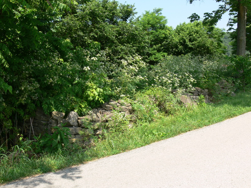
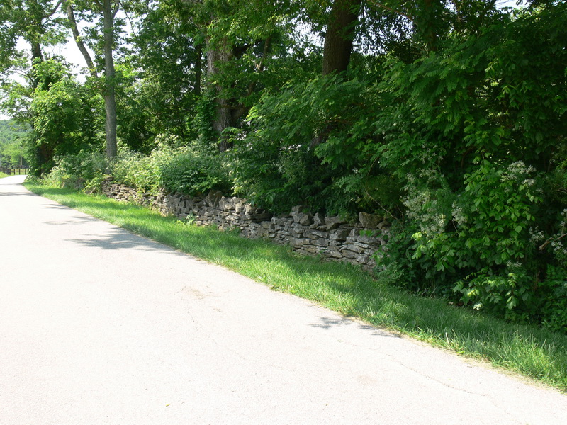
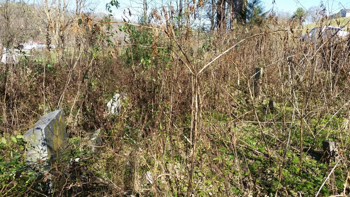
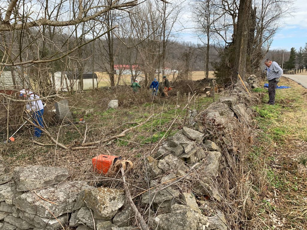
| Description | : | The cemetery is located on Steele Branch Road behind 1003 Port Collins Road. It is so overgrown that it is nearly impossible to enter. |
frequently asked questions (FAQ):
-
Where is Steele-Hawkins-O'Nan Cemetery?
Steele-Hawkins-O'Nan Cemetery is located at Franklin County ,Kentucky ,USA.
-
Steele-Hawkins-O'Nan Cemetery cemetery's updated grave count on graveviews.com?
1 memorials
-
Where are the coordinates of the Steele-Hawkins-O'Nan Cemetery?
Latitude: 38.2954400
Longitude: -84.8778700
Nearby Cemetories:
1. Girtley Graveyard
Franklin County, USA
Coordinate: 38.2952700, -84.8965500
2. Duvall Family Cemetery
Franklin County, USA
Coordinate: 38.2790640, -84.8729090
3. Harrod Cemetery #1
Franklin County, USA
Coordinate: 38.2778500, -84.8862100
4. Pleasant Ridge Baptist Church Cemetery
Frankfort, Franklin County, USA
Coordinate: 38.2786600, -84.9063000
5. O'Nan-Waits-Quarles Graveyard
Franklin County, USA
Coordinate: 38.3161100, -84.9024800
6. Waits Cemetery
Franklin County, USA
Coordinate: 38.3208008, -84.8966980
7. Harrod Cemetery #2
Polsgrove, Franklin County, USA
Coordinate: 38.3250700, -84.9003400
8. Harvieland Methodist Church Cemetery
Franklin County, USA
Coordinate: 38.2743800, -84.9156800
9. Hutcherson Cemetery
Franklin County, USA
Coordinate: 38.2743800, -84.9156800
10. Bethel Baptist Church Cemetery
Frankfort, Franklin County, USA
Coordinate: 38.2653500, -84.8486300
11. Moore Cemetery
Franklin County, USA
Coordinate: 38.3321991, -84.8925018
12. Bruer Graveyard
Franklin County, USA
Coordinate: 38.3322600, -84.8928100
13. Tracy-McDonald Cemetery
Franklin County, USA
Coordinate: 38.2600400, -84.8524900
14. Harrod Family Cemetery
Polsgrove, Franklin County, USA
Coordinate: 38.3359500, -84.8871000
15. Penn Graveyard
Franklin County, USA
Coordinate: 38.2551600, -84.8896000
16. Lewis Graveyard
Franklin County, USA
Coordinate: 38.2538340, -84.8846150
17. Dobson Graveyard
Franklin County, USA
Coordinate: 38.3287200, -84.9124700
18. Mount Carmel Baptist Church Cemetery
Polsgrove, Franklin County, USA
Coordinate: 38.3413200, -84.8859300
19. Dillon Guthrie Gravesite
Franklin County, USA
Coordinate: 38.3433400, -84.8862500
20. Polsgrove Cemetery
Franklin County, USA
Coordinate: 38.3444100, -84.8929000
21. Graham Cemetery
Franklin County, USA
Coordinate: 38.3251000, -84.8244500
22. Slattery Graveyard
Franklin County, USA
Coordinate: 38.3109700, -84.9411100
23. Peaks Mill Christian Church Cemetery
Franklin County, USA
Coordinate: 38.3016570, -84.8111910
24. Hutchison Graveyard
Franklin County, USA
Coordinate: 38.3522900, -84.8990200