
| Memorials | : | 0 |
| Location | : | Topeka, LaGrange County, USA |
| Coordinate | : | 41.5300700, -85.5005540 |
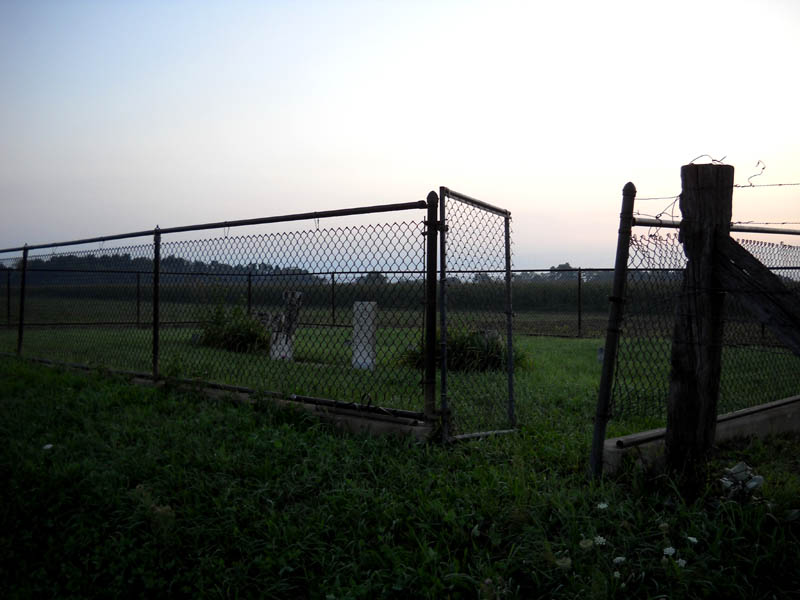
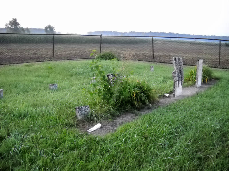
| Description | : | The cemetery is located on the east side of S County Road 400 W about 0.7 miles south of its intersection with W County Road 700 S. The cemetery is listed in the Cemetery and Burial Grounds Registry of the Indiana Department of Natural Resources (DNR) and in the State Historical Architectural and Archaeological Research Database (SHAARD) under survey CR-44-18 (Steinberger Family). The U.S. Geological Survey (USGS) Geographic Names Information System (GNIS) feature ID for the cemetery is 444118 (Steinberg Cemetery). |
frequently asked questions (FAQ):
-
Where is Steinberg Cemetery?
Steinberg Cemetery is located at S County Road 400 W Topeka, LaGrange County ,Indiana , 46767USA.
-
Steinberg Cemetery cemetery's updated grave count on graveviews.com?
0 memorials
-
Where are the coordinates of the Steinberg Cemetery?
Latitude: 41.5300700
Longitude: -85.5005540
Nearby Cemetories:
1. Clearspring Cemetery
Topeka, LaGrange County, USA
Coordinate: 41.5317001, -85.4807968
2. Lower Cemetery
Noble County, USA
Coordinate: 41.5145900, -85.4890200
3. Beulah Cemetery
Topeka, LaGrange County, USA
Coordinate: 41.5540780, -85.4857300
4. Rice Brothwell Cemetery
Noble County, USA
Coordinate: 41.5163269, -85.4526825
5. Rogers Orphan Home Cemetery
Valentine, LaGrange County, USA
Coordinate: 41.5622830, -85.4693760
6. Sloan Cemetery
LaGrange County, USA
Coordinate: 41.5655680, -85.4618900
7. Hawpatch Cemetery
Topeka, LaGrange County, USA
Coordinate: 41.5466490, -85.5582940
8. Eden Cemetery
Topeka, LaGrange County, USA
Coordinate: 41.5393982, -85.5667038
9. Gerber Cemetery
Topeka, LaGrange County, USA
Coordinate: 41.5388800, -85.5679880
10. Cosperville Cemetery
Wawaka, Noble County, USA
Coordinate: 41.4804840, -85.4724731
11. Maple Grove Cemetery
Topeka, LaGrange County, USA
Coordinate: 41.5247002, -85.5736008
12. Lakeside Cemetery
LaGrange County, USA
Coordinate: 41.5402985, -85.4225006
13. Salem Cemetery
Ligonier, Noble County, USA
Coordinate: 41.5101662, -85.5765152
14. Miller Amish Cemetery
LaGrange, LaGrange County, USA
Coordinate: 41.5889015, -85.4822006
15. Osborn Cemetery
LaGrange, LaGrange County, USA
Coordinate: 41.5978012, -85.4586029
16. Jordon Cemetery
LaGrange, LaGrange County, USA
Coordinate: 41.5974998, -85.4432983
17. Christner Family Cemetery
Honeyville, LaGrange County, USA
Coordinate: 41.5750010, -85.5932430
18. Christner Cemetery
Honeyville, LaGrange County, USA
Coordinate: 41.5754930, -85.5983560
19. Woodruff Cemetery
Witmer Manor, LaGrange County, USA
Coordinate: 41.5389500, -85.3756500
20. Pierce-Witmer Cemetery
Witmer Manor, LaGrange County, USA
Coordinate: 41.5388985, -85.3756027
21. Honeyville Cemetery
Eden Township, LaGrange County, USA
Coordinate: 41.5818810, -85.6068420
22. Woodland Cemetery
Wolcottville, LaGrange County, USA
Coordinate: 41.5300210, -85.3712530
23. Saint Gaspars Catholic Cemetery
Rome City, Noble County, USA
Coordinate: 41.5060997, -85.3743973
24. Oak Park Cemetery
Ligonier, Noble County, USA
Coordinate: 41.4538994, -85.5852966