
| Memorials | : | 0 |
| Location | : | Simmern, Rhein-Hunsrück-Kreis, Germany |
| Coordinate | : | 49.9849200, 7.5230200 |
| Description | : | All sarcophagi in the two vaults, except for those of Ludwig Heinrich and Maria of Oranje-Nassau, were destroyed. |
frequently asked questions (FAQ):
-
Where is Stephanskirche?
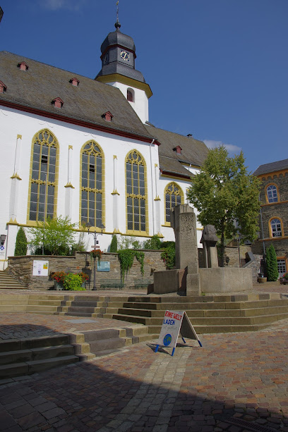
Stephanskirche is located at Simmern, Rhein-Hunsrück-Kreis ,Rheinland-Pfalz ,Germany.
-
Stephanskirche cemetery's updated grave count on graveviews.com?
0 memorials
-
Where are the coordinates of the Stephanskirche?
Latitude: 49.9849200
Longitude: 7.5230200
Nearby Cemetories:
1. Friedhof Simmern
Simmern, Rhein-Hunsrück-Kreis, Germany
Coordinate: 49.9805385, 7.5120901
2. Kloster Ravengiersburg
Ravengiersburg, Rhein-Hunsrück-Kreis, Germany
Coordinate: 49.9356660, 7.4768000
3. Gemünden Cemetery
Gemünden, Rhein-Hunsrück-Kreis, Germany
Coordinate: 49.8982539, 7.4793254
4. Dickenshied Village Cemetery
Dickenschied, Rhein-Hunsrück-Kreis, Germany
Coordinate: 49.9047222, 7.4158796
5. Gehlweiler Cemetery
Gehlweiler, Rhein-Hunsrück-Kreis, Germany
Coordinate: 49.8855600, 7.4616700
6. Henau Cemetery
Rhein-Hunsrück-Kreis, Germany
Coordinate: 49.8718603, 7.5029377
7. Friedhof Schlierschied
Schlierschied, Rhein-Hunsrück-Kreis, Germany
Coordinate: 49.8765255, 7.4448120
8. Kellenbach Cemetery
Kellenbach, Landkreis Bad Kreuznach, Germany
Coordinate: 49.8455600, 7.4925000
9. Wurrich Friedhof
Wurrich, Rhein-Hunsrück-Kreis, Germany
Coordinate: 49.9790076, 7.3017156
10. Friedhof Winterburg
Winterburg, Landkreis Bad Kreuznach, Germany
Coordinate: 49.8636380, 7.6440956
11. Friedhof Sohren
Sohren, Rhein-Hunsrück-Kreis, Germany
Coordinate: 49.9320129, 7.3130949
12. Friedhof Allenfeld
Allenfeld, Landkreis Bad Kreuznach, Germany
Coordinate: 49.8675105, 7.6724797
13. Hahn-Hunsrück
Hahn, Rhein-Hunsrück-Kreis, Germany
Coordinate: 49.9638100, 7.2712330
14. Friedhof
Schwall, Rhein-Hunsrück-Kreis, Germany
Coordinate: 50.1487203, 7.5567384
15. Bruschied Cemetery
Bruschied, Landkreis Bad Kreuznach, Germany
Coordinate: 49.8358581, 7.4087656
16. Dorweiler Dommershausen Cemetery
Dorweiler, Rhein-Hunsrück-Kreis, Germany
Coordinate: 50.1394803, 7.4226174
17. Jüdischer Friedhof
Oberwesel, Rhein-Hunsrück-Kreis, Germany
Coordinate: 50.1062118, 7.7144869
18. Friedhof Bacharach
Bacharach, Landkreis Mainz-Bingen, Germany
Coordinate: 50.0455956, 7.7819442
19. Friedhof St. Martins Kirche
Oberwesel, Rhein-Hunsrück-Kreis, Germany
Coordinate: 50.1096901, 7.7191267
20. Friedhof Liebfrauen Kirche
Oberwesel, Rhein-Hunsrück-Kreis, Germany
Coordinate: 50.1042237, 7.7296524
21. Liebfrauenkirche
Sankt Goar, Rhein-Hunsrück-Kreis, Germany
Coordinate: 50.1111110, 7.7213890
22. Pfarrkirche Liebfrauen
Sankt Goar, Rhein-Hunsrück-Kreis, Germany
Coordinate: 50.1111110, 7.7213890
23. Pfarrkirche St. Martin
Rheingau-Taunus-Kreis, Germany
Coordinate: 50.0441670, 7.8033330
24. Friedhof Lorch
Lorch, Rheingau-Taunus-Kreis, Germany
Coordinate: 50.0438553, 7.8065637